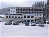
Šport hotel - Planina Zajavornik
Starting point: Šport hotel (1280 m)
| Latitude/Longitude: | 46,33820°N 13,96160°E |
| |
Walking time: 40 min
Difficulty: easy marked way
Elevation gain: 12 m
Elevation difference along the route: 50 m
Map: TNP 1 : 50.000
Recommended equipment (summer):
Recommended equipment (winter):
Views: 30.583
 | 2 people like this post |
Access to starting point:
From the highway Ljubljana - Jesenice, we take the Lesce exit and follow the road in the direction of Bled; there, at the traffic-light crossroads, signs for Pokljuka direct us to the right. We follow this road, which in the lower part runs through some villages and later starts ascending more steeply, to the Šport Hotel on Pokljuka. We park at an appropriate place by the road or near the hotel. Parking in front of the hotel is allowed only for guests.
Route description:
From the Šport Hotel, we return along the road to the junction with the main road, then continue the ascent in the direction of Rudno polje. After approximately 100 m of walking along the main road, a forest road branches off to the right, which quickly leads us into the spruce forest. We follow the mentioned road, which gently ascends and along which we notice some blazes, all the way to its end at a larger turning area. At the end of the road, we notice a wide marked cart track, along which we continue in a moderate ascent. The cart track flattens after a short ascent, then gradually starts to descend. After a few minutes of descent, we step out of the forest onto the expansive Planina Zajavornik mountain pasture.
Photos:
 1
1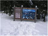 2
2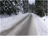 3
3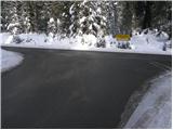 4
4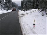 5
5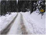 6
6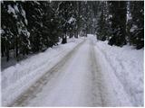 7
7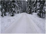 8
8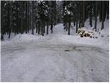 9
9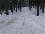 10
10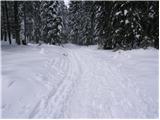 11
11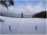 12
12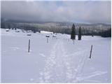 13
13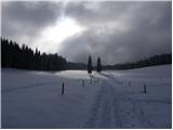 14
14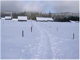 15
15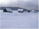 16
16
Discussion about the trip Šport hotel - Planina Zajavornik
|
| Gost23. 11. 2007 |
On Pokljuka they have a competition. Currently the road is leading, the hotel follows, in third place is the Zatrnik ski slope.
|
|
|
|
| Gost26. 11. 2007 |
This is a trip suitable for a Sunday walk. Short, non-strenuous tour with a nice view of the peaks above the Pokljuka forests. This is also paradise for cross-country skiing enthusiasts.
|
|
|
|
| mukica20. 01. 2013 |
Peter as always... leeeeepo, this planina still hasn't seen me, even though it's been on the plan for a long time, but obviously something always takes precedence
|
|
|
|
| peter220. 01. 2013 |
Thanks! Sure, in summer we usually skip right past it for some higher goal, in winter if there's enough snow it's definitely worth taking a couple hours to visit the planina  
|
|
|
|
| Pohodnica5625. 01. 2013 |
And continue to Lipance, super.
|
|
|
|
| bumbi15. 03. 2018 |
Wonderful. This year we really have proper winter. A few more Fridays and some year, I'll come during the week to enjoy it too.
|
|
|
To post a comment you must log in:
If you do not yet have a username, you must first
register.