Sporthotel Maltatal - Jägersteighütte
Starting point: Sporthotel Maltatal (1933 m)
| Latitude/Longitude: | 47,07890°N 13,34390°E |
| |
Walking time: 45 min
Difficulty: easy marked way
Elevation gain: 48 m
Elevation difference along the route: 48 m
Map:
Recommended equipment (summer):
Recommended equipment (winter):
Views: 5.219
 | 2 people like this post |
Access to starting point:
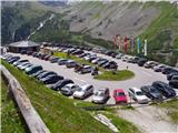
From the Beljak/Villach - Salzburg highway, we take the Gmünd exit and follow the road towards the Maltatal valley. A well-marked road brings us to the settlement Malta after a few kilometers, and a little further to the place where toll is collected. The steep and occasionally narrow road, with the help of tunnels and traffic lights, brings us to a large parking lot by the artificial lake (the dam at the end of the lake is 165m high). While driving, we can observe numerous waterfalls, which, because of a lack of parking spaces, we can view only from the car.
Route description:
From the large asphalt parking lot we continue on a macadam road in the direction of Osnabrücker Hütte. After 5 minutes of easy walking by the lake we get to the next parking lot at the mountain hut Kölnbreinstüberl. We still continue on the road in the direction of the mountain hut Osnabrücker Hütte. The gentle road, which all the time runs by the lake, offers a nice view of the surrounding peaks and waterfalls of surrounding streams. After a good half an hour of walking, we come to a crossing, where we continue sharply right in the direction of Arlscharte. From here on, the path starts ascending and after another 5 minutes of ascent brings us to the next crossing. We continue right and on a gently sloping path in 5 minutes we arrive at the mountain hut Jägersteighütte (straight ahead Arlhöhe).
Photos:
 1
1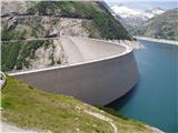 2
2 3
3 4
4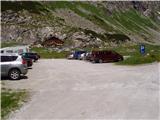 5
5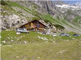 6
6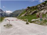 7
7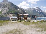 8
8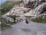 9
9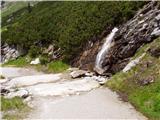 10
10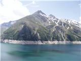 11
11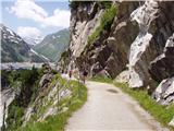 12
12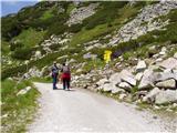 13
13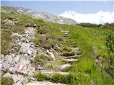 14
14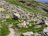 15
15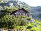 16
16
Discussion about the trip Sporthotel Maltatal - Jägersteighütte
To post a comment you must log in:
If you do not yet have a username, you must first
register.