Sporthotel Maltatal - Pfringersee
Starting point: Sporthotel Maltatal (1933 m)
| Latitude/Longitude: | 47,07890°N 13,34390°E |
| |
Walking time: 1 h 40 min
Difficulty: easy marked way
Elevation gain: 297 m
Elevation difference along the route: 297 m
Map:
Recommended equipment (summer):
Recommended equipment (winter): ice axe, crampons
Views: 6.662
 | 1 person like this post |
Access to starting point:
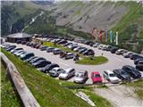
From the highway Beljak/Villach - Salzburg, we take the exit Gmünd and follow the road ahead towards the Maltatal valley. A well-marked road brings us after a few kilometers to the settlement Malta, and only a little further to the spot where toll is collected. The steep and occasionally narrow road, with the help of tunnels and traffic lights, brings us to a large parking lot by the artificial lake (the dam at the end of the lake is 165m high). While driving, we can observe numerous waterfalls, which, because of a lack of parking spaces, we can view only from the car.
Route description:
From the large asphalt parking lot we continue on a macadam road in the direction of Osnabrücker Hütte. After 5 minutes of easy walking by the lake we get to the next parking lot at the mountain hut Kölnbreinstüberl. We still continue on the road in the direction of the mountain hut Osnabrücker Hütte. The gentle road, which all the time runs by the lake, offers a nice view of the surrounding peaks and waterfalls of surrounding streams. After a good half an hour of walking, we come to a junction, where we continue sharply right in the direction of Arlscharte. From here on, the path starts ascending and after additional 5 minutes of ascent it brings us to the next junction.
Right: mountain hut 5 minutes, and we continue straight on an increasingly steep and panoramic path, which higher brings us to a poorly marked junction. We continue slightly left in the direction of Arlscharte on the path which is getting closer to the indistinct summit on our left side. When the path gets completely close to the cliffs on our left, it turns slightly to the right and after further ascent brings us to the saddle Arlscharte (2252m). On the saddle, we notice a cross and signposts. We continue straight in the direction of the lake Pfringersee. After less than 5 minutes of descent on granite slabs we get to the mentioned lake.

Photos:
 1
1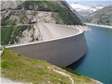 2
2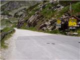 3
3 4
4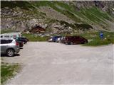 5
5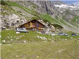 6
6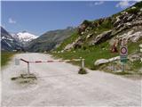 7
7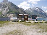 8
8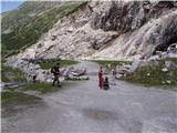 9
9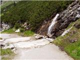 10
10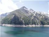 11
11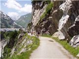 12
12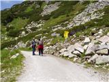 13
13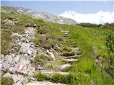 14
14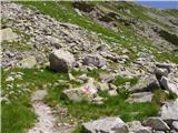 15
15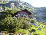 16
16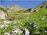 17
17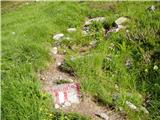 18
18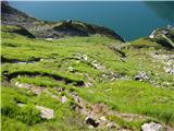 19
19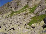 20
20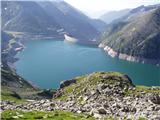 21
21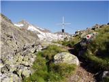 22
22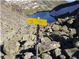 23
23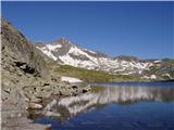 24
24
Discussion about the trip Sporthotel Maltatal - Pfringersee
|
| slavi090226. 03. 2011 |
it's very nice, now when the little roses start blooming, it will surely be fantastic....I have one question....is it possible to avoid the highway
|
|
|
|
| čemšeničan26. 03. 2011 |
Slavi, to avoid the highway through Tržič border crossing Ljubelj to Ferlach then to Villach, Spittal to Gmünd approx. 210km one way, it's nice there, we were there last year with TD Čemšenik.
Nice regards and good luck!
|
|
|
To post a comment you must log in:
If you do not yet have a username, you must first
register.