Srednja vas - Mali Draški vrh (Za Ribnico)
Starting point: Srednja vas (583 m)
| Latitude/Longitude: | 46,29750°N 13,92310°E |
| |
Route name: Za Ribnico
Walking time: 4 h 50 min
Difficulty: difficult unmarked way
Elevation gain: 1549 m
Elevation difference along the route: 1600 m
Map: TNP 1:50.000
Recommended equipment (summer): helmet
Recommended equipment (winter): helmet, ice axe, crampons
Views: 744
 | 2 people like this post |
Access to starting point:
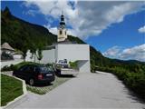
From the Ljubljana - Jesenice motorway, take the Lesce exit and follow the road towards Bled and further towards Bohinjska Bistrica. Just before Bohinjska Bistrica, at the settlement of Bitnje, continue sharply right towards Pokljuka. After a short ascent, the road levels out and quickly brings us to the Upper Bohinj Valley. Here at the intersection, continue left (right Pokljuka) and follow the road further to Srednja vas. Here in the second part of the village, notice the signs for the church of St. Martin, which direct us right onto a narrower and quite steep road, along which we quickly arrive at the church and primary school. Park at a suitable place by the school or church.
Route description:
From the parking lot at the church, we descend a few steps to the primary school, from there continue towards the viewpoint at Kres. The path further leads along a narrower asphalt road, along which we quickly reach a larger water tank, where we notice signs for Uskovnica. We continue along the cart track, which enters the forest, at the right bend we temporarily exit the forest and a nice view opens up to Rudnica and part of the Upper Bohinj Valley. We continue along the cart track, which leads us through a somewhat narrower passage, then in a traverse ascent to the place where we reach the road leading to Uskovnica. We reach the road exactly at the nicely arranged viewpoint at Kres, from which a view opens towards Srednja vas, Upper Bohinj Valley and the Lower Bohinj Mountains in the background, now called Bohinjsko-Tolminske gore. We continue along the road for a short time, then at the end of a gentle left bend, signs for Uskovnica direct us right onto a cart track that leads us through forest, a belt of shrubs, higher up again through forest. A few minutes higher we reach the gravel road again, but this time we leave it immediately, as we continue in the direction of the hiking path to Uskovnica. The cart track soon forks, we continue on the left, where we notice a mark on the electricity pole. For some time we continue along the power line and follow the marks. Soon a path branches left leading to Uskovnica via Lom, we continue on the path that turns slightly right and leads to the steep slopes of the area called Za Ribnico (Ribnica is a stream deep below us). Higher we reach a newer cart track or logging trail and follow it right. The newer logging trail ends after a few minutes, the path continues traversing the slopes to the right. A bit further, at a small junction, we continue on the upper left path, next to which there are signs for Uskovnica and which is visibly better trodden. Further on, we ascend somewhat more steeply along the path, from which a bit higher an unmarked path towards Lom branches off (the sign says "sir, skuta, milk and more").
We continue towards Uskovnica again, then in a few minutes we reach the gravel road (we reach the road where it is already closed to public traffic), which we follow right. When we step onto the road, we join the path from Stara Fužina, the path from Srednja vas via Lom and the path from the starting point or parking lot Lom. The gentle gravel road quickly brings us to the weekend houses at Uskovnica, then we leave it a little after the water trough and continue left onto the cart track towards Koča na Uskovnici. After about 50 meters of ascent along the cart track, we reach Koča na Uskovnici.
From the hut, we continue towards Tosca, Draški vrh, Viševnik, Vodnikov dom, Rudno polje and Praprotnica along the path that first crosses a pasture fence, then quickly joins the gravel road, which we follow right. The road then leads us between hummocky meadows, then after crossing the next fence we quickly arrive at the intersection or junction by the chapel of Mary Queen of Peace at Uskovnica.
At the chapel, the path towards Vodnikov dom continues left, right leads the path towards Pokljuka, we continue straight towards planina Konjščica (also one of the paths by which we can reach Velo polje or Vodnikov dom). We continue the path between fenced pastures, along a relatively steep cart track, from which a nice view opens to the surrounding mountains. Higher the path, which also leads past a few weekend houses, levels out and we join a wider cart track coming from Pokljuka or from near the bridge over Ribnica (in descriptions starting point Uskovnica (Junction) towards planina Konjščica).
A bit further, a nice view opens towards Viševnik, the cart track then ascends transversely for some time, mostly through forest. Higher we cross a pasture fence and the path brings us to the southwestern edge of planina Konjščica. Here the path, which was occasionally somewhat steeper again, completely levels out and leads us transversely across the planina. During the crossing we step over a few small streams, then behind a small cross we cross a somewhat larger stream, behind it in a few steps we reach the cheese dairy at planina Konjščica, where during the grazing season it is possible to buy some dairy product.
In front of the cheese dairy, we continue slightly left towards Triglav and Vodnikov dom at Velo polje, along the path that gently ascends towards the northern part of the planina. When the planina ends, the path passes through dwarf pines surrounded by individual trees and begins to ascend moderately. With views of the surrounding mountains, we quickly reach a marked junction, where a marked path from Rudno polje joins from the right.
We continue slightly left towards Studorski preval and ascend somewhat more steeply for a few minutes. Higher the valley along which we walk narrows, then along the torrent we reach the grassy flat at Jezerca, where the next marked junction is.
Here the path towards Triglav turns left, we continue right, past a bench towards Viševnik and Srenjski preval. The clearly visible but unmarked path to Srenjski preval ascends gently at first to the nearby stream, crosses it, then ascends to the source of the mentioned stream. Behind the source the path becomes steeper and forks into two parts. Higher both paths merge, we with nice views of the nearby towers and peaks surrounding Jezerca reach Srenjski preval in a few more minutes of ascent, where we notice marks again.
From Srenjski preval we continue left along an unmarked and less visible path that begins to ascend ever more steeply along and beside an indistinct gully (sharply left Studorski preval). The path in the lower part ascends somewhat right of the gully, then briefly crosses to its left (direction of ascent) side. Higher the gully steepens further, the path starts to disappear. Further we ascend directly up the gully steeply (careful due to great scree) and along the "path" we will notice some very old and completely faded marks. After about 20 minutes of ascent, we step onto a precipitous ridge, from which a nice view opens to the Krma valley and the peaks surrounding it.
From here we can climb to the nearby eastern summit, which is a few meters of easier climbing along the exposed ridge, or to the somewhat more distant but a few meters higher western summit. To it we must first descend a bit, then along the quite exposed ridge in a few dozen steps we ascend to the panoramic summit.
Srednja vas - Koča na Uskovnici 1:40, Koča na Uskovnici - kapelica na Uskovnici 0:05, kapelica na Uskovnici - planina Konjščica 1:05, Planina Konjščica - Klanci 0:40, Klanci - Jezerce 0:05, Jezerce - Srenjski preval 0:35, Srenjski preval - Mali Draški vrh 0:40.

Photos:
 1
1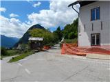 2
2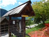 3
3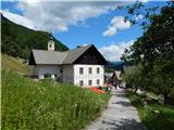 4
4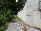 5
5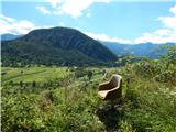 6
6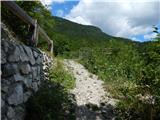 7
7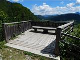 8
8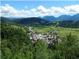 9
9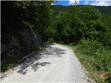 10
10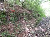 11
11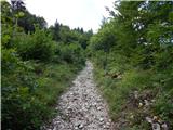 12
12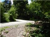 13
13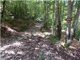 14
14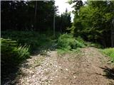 15
15 16
16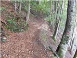 17
17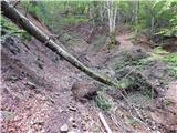 18
18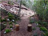 19
19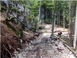 20
20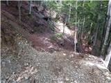 21
21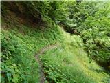 22
22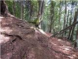 23
23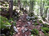 24
24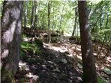 25
25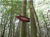 26
26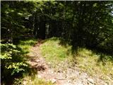 27
27 28
28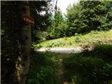 29
29 30
30 31
31 32
32 33
33 34
34 35
35 36
36 37
37 38
38 39
39 40
40 41
41 42
42 43
43 44
44 45
45 46
46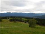 47
47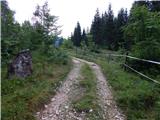 48
48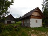 49
49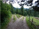 50
50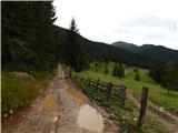 51
51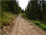 52
52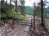 53
53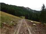 54
54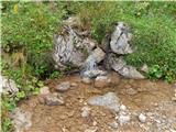 55
55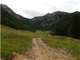 56
56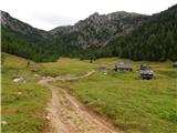 57
57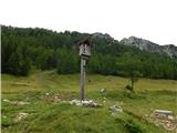 58
58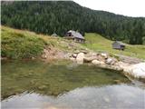 59
59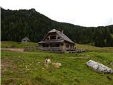 60
60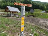 61
61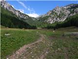 62
62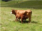 63
63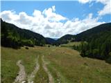 64
64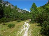 65
65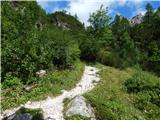 66
66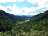 67
67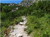 68
68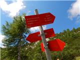 69
69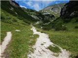 70
70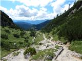 71
71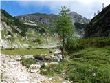 72
72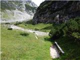 73
73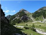 74
74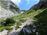 75
75 76
76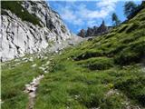 77
77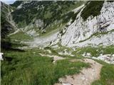 78
78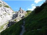 79
79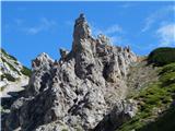 80
80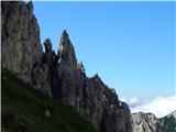 81
81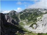 82
82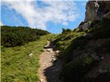 83
83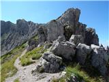 84
84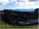 85
85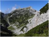 86
86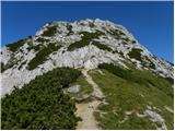 87
87 88
88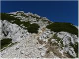 89
89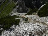 90
90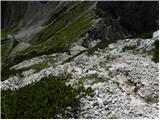 91
91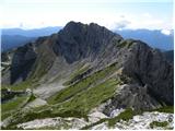 92
92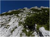 93
93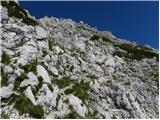 94
94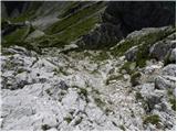 95
95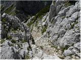 96
96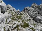 97
97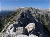 98
98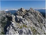 99
99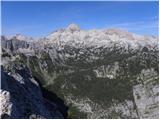 100
100
Discussion about the trip Srednja vas - Mali Draški vrh (Za Ribnico)
To post a comment you must log in:
If you do not yet have a username, you must first
register.