Starting point: Srednja vas (583 m)
| Latitude/Longitude: | 46,29750°N 13,92310°E |
| |
Walking time: 1 h 30 min
Difficulty: easy unmarked way, easy pathless terrain
Elevation gain: 419 m
Elevation difference along the route: 440 m
Map: TNP 1:50.000
Recommended equipment (summer):
Recommended equipment (winter): ice axe, crampons
Views: 3.970
 | 2 people like this post |
Access to starting point:
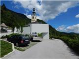
From the Ljubljana - Jesenice motorway, take the Lesce exit and follow the road towards Bled and further towards Bohinjska Bistrica. Just before Bohinjska Bistrica, at the settlement of Bitnje, turn sharply right towards Pokljuka. After a short ascent, the road levels out and quickly brings us into the Upper Bohinj Valley. At the intersection here, continue left (right to Pokljuka) and follow the road further to Srednja vas. Here in the second part of the village, notice the signs for the church of St. Martin, which direct us right onto a narrower and quite steep road, along which we quickly arrive at the church and primary school. Park at a suitable spot by the school or church; the arranged public parking lot is located about 15 minutes away at the foot of the Senožeta ski slope.
Route description:
From the parking lot at the church, descend a few steps to the primary school, from there continue towards the viewpoint at Kres. The path ahead leads along a narrow asphalt road, along which we quickly reach a larger water tank, where we notice signs for Uskovnica. Continue along the gravel road, which enters the forest; at the right bend, we temporarily exit the forest and a nice view opens to Rudnica and part of the Upper Bohinj Valley. Continue along the gravel road, which leads us through a somewhat narrower passage, then in a traverse ascent to the point where we reach the road to Uskovnica. We reach the road exactly at the nicely arranged viewpoint at Kres, from which a view opens towards Srednja vas, Upper Bohinj Valley, and Lower Bohinj Mountains in the background. Continue along the road for a short time, then at the end of a gentle left bend, the signs for Uskovnica direct us right onto a gravel road that leads through the forest, a belt of shrubs, higher up again through the forest. A few minutes higher, we reach the macadam road again, but this time we stay on it longer and leave the marked path that continues along the gravel road. A longer traverse ascent to the left follows, where we occasionally get some views, otherwise mostly ascending through the forest. Higher on the left, we already see the first huts on Blatce pasture, but we ascend the road for a few more minutes; from the road, go left when a poorer road branches slightly left leading to the nearby hut.
From the hut, continue along the poorer gravel road, ascending to the upper part of the pasture, where there is another hut. At the mentioned hut, go slightly left and ascend across the meadow to the edge of the forest, where we find a gravel road that ascends traverse through the forest to the right. The gravel road ascends in a few hairpins and quickly turns into a forest path, which higher up is somewhat harder to follow due to leaves. The path soon levels out and brings us to the southern side of the ridge, where in a few dozen steps we arrive at the Studor take-off site.
From the take-off site, where there are a few benches and from which a wonderful view opens, continue slightly left, returning to the forest, and continue walking along easier pathless terrain. A few shorter ascents and descents follow, until we reach the summit marked with a metal rod, which is about 15 minutes from the take-off site.
Srednja vas - planina Blatce 0:55, planina Blatce - Studor 0:35.
The description refers to the condition in February 2020, the photos are from various periods.

Photos:
 1
1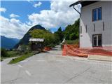 2
2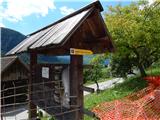 3
3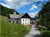 4
4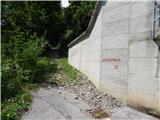 5
5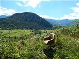 6
6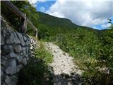 7
7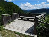 8
8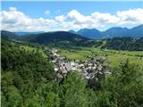 9
9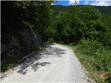 10
10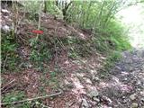 11
11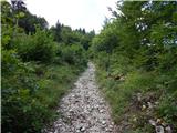 12
12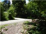 13
13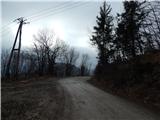 14
14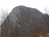 15
15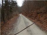 16
16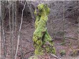 17
17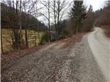 18
18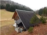 19
19 20
20 21
21 22
22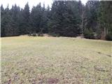 23
23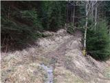 24
24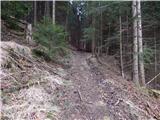 25
25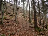 26
26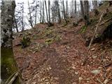 27
27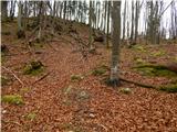 28
28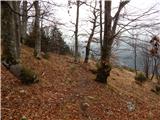 29
29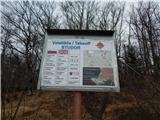 30
30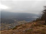 31
31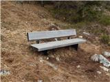 32
32 33
33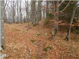 34
34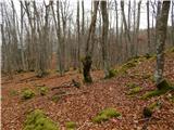 35
35 36
36 37
37 38
38 39
39 40
40 41
41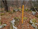 42
42
Discussion about the trip Srednja vas - Studor
To post a comment you must log in:
If you do not yet have a username, you must first
register.