Srednja vas - Triglav (Za Ribnico and via Triglavska škrbina)
Starting point: Srednja vas (583 m)
| Latitude/Longitude: | 46,29750°N 13,92310°E |
| |
Route name: Za Ribnico and via Triglavska škrbina
Walking time: 8 h 5 min
Difficulty: very difficult marked way
Elevation gain: 2281 m
Elevation difference along the route: 2485 m
Map: TNP 1:50.000
Recommended equipment (summer): helmet, self belay set
Recommended equipment (winter): helmet, self belay set, ice axe, crampons
Views: 3.830
 | 1 person like this post |
Access to starting point:
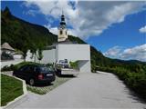
From the Ljubljana-Jesenice motorway, take the Lesce exit and follow the road towards Bled and further to Bohinjska Bistrica. Just before Bohinjska Bistrica, at the settlement of Bitnje, continue sharply right towards Pokljuka. After a short ascent, the road flattens and quickly brings us to the Upper Bohinj Valley. At the intersection, continue left (right to Pokljuka) and follow the road further to Srednja vas. In the second part of the village, notice the signs for St. Martin's Church, which direct us right onto a narrower and quite steep road, along which we quickly reach the church and elementary school. Park in a suitable place by the school or church.
Route description:
From the parking lot by the church, we descend a few steps to the elementary school, then continue towards the viewpoint at Kres. The path leads along a narrower asphalt road, quickly reaching a large water tank where we see signs for Uskovnica. We continue along the track that enters the forest; at the right bend, we temporarily exit the forest and enjoy a nice view of Rudnica and part of the Upper Bohinj Valley. We continue on the track through a slightly narrower passage, then in a traverse ascent to the point where we reach the road to Uskovnica. We reach the road exactly at the nicely arranged viewpoint at Kres, from which we have a view towards Srednja vas, Upper Bohinj Valley, and the Lower Bohinj Mountains in the background, now called Bohinj-Tolmin Mountains. We briefly continue along the road, then at the end of a gentle left bend, signs for Uskovnica direct us right onto a track leading through forest, a strip of bushes, and higher again through forest. A few minutes higher, we reach the gravel road again but immediately leave it, continuing along the hiking path to Uskovnica. The track soon forks; we take the left one, where we spot a marker on the power line pole. We continue along the power line for a while, following the markers. Soon a path branches left to Uskovnica via Lom; we continue on the path that turns slightly right and leads to the steep slopes of the area called Za Ribnico (Ribnica is a stream deep below us). Higher up, we reach a newer track and follow it right. The newer track ends after a few minutes, and the path continues traversing the slopes to the right. A bit further, at a small junction, we take the upper left path, marked for Uskovnica and clearly better trodden. We ascend somewhat more steeply; higher up, an unmarked path to Lom branches off (sign says "cheese, cottage cheese, milk and more").
We continue towards Uskovnica again, then in a few minutes reach the gravel road (we join it where it is already closed to public traffic), which we follow right. Upon reaching the road, we join the path from Stara Fužina, the path from Srednja vas via Lom, and the path from the Lom starting point/parking. The easy gravel road quickly takes us to the weekend houses at Uskovnica, then we leave it just after the water trough and continue left on a track towards Koča na Uskovnici. After about 50 meters of ascent on the track, we reach Koča na Uskovnici.
From the hut, we continue towards Tosca, Draški vrh, Viševnik, Vodnikov dom, Rudno polje, and Praprotnica on a path that first crosses a pasture fence, then quickly joins a gravel road, which we follow right. The road leads between hummocky meadows, then after crossing the next fence, we quickly reach a junction by the chapel of Mary Queen of Peace at Uskovnica.
Past the chapel, continue left (straight to planina Konjščica, right to Rudno polje) along the flat road that leads across extensive meadows of Uskovnica, then the path brings us to the edge of the forest, where it starts turning into a initially wide track. The track, which begins to moderately ascend, has a few junctions; we follow it towards Vodnikov dom at Velem polju and Triglav. Higher up, the track, mostly through forest, turns into a footpath, which quickly brings us to a pleasant spring below Mesnova glava called Štapce. At the spring, continue straight (right hunters' hut) and continue the ascent on an easy path that soon brings us to steep slopes. Soon after reaching the steep slopes, fixed protection helps us cross a steep gully. The path continues along relatively steep slopes, especially slippery when wet. During the traverse, the path steeply ascends briefly several times and then descends again. In the last part, we cross several very steep gullies over a path that is locally completely ruined (high risk of slipping). The traverse ends at a larger torrent (usually a spring), after which we enter softer grassy terrain.
A few minutes of easy walking follow, and the path takes us to the abandoned planina Spodnji Tosc. The path ahead begins to moderately ascend and soon brings us to a small junction, where we turn sharply right (straight old, partly abandoned path) along a well-followed path. The path ahead steepens and quickly takes us from a strip of sparse forest into dwarf pines, where it begins turning more to the left. The path soon flattens and leads us from the dwarf pines onto grassy slopes, across which in a few minutes we ascend to the Pokljuka-Triglav path, turning left.
The path ahead traverses the southern slopes of Tosca, then in a slight descent crosses a short strip of sparse forest, after which we reach the steep slopes of Tosca. A bit further, the path along an artificially made wide ledge in a slight descent traverses the precipitous slopes of the same mountain. Since the path is quite wide, it poses no problems (but beware of falling rocks, rockfall in 2008). The path then rises slightly again and brings us to a junction, where we continue right towards Vodnikov dom (sharply left Voje and Stara Fužina, slightly left Velo polje). Another about ten minutes of walking without major ascents or descents brings us to Vodnikov dom at Velem polju, where there is the next junction.
Here too, continue straight towards Triglav; the path begins traversing the slopes of Vernar, becoming technically demanding higher up. Some traversing follows, aided by a wire cable; higher up, we reach a steep step, where numerous pegs and a wire cable help us ascend rocky steps.
The path ahead flattens, the slope becomes less steep, and near Konjsko sedlo also somewhat more grassy.
We easily descend to Konjsko sedlo; from the marked junction at the saddle, head left towards Dom Planika pod Triglavom (straight Kredarica and Dom Valentina Staniča, right Krma) and begin a fairly steep ascent to the west. For a while, we approach Mokra skala (2266 m), then the path turns right and leads onto an indistinct ridge, where it temporarily flattens. The marked path higher up bypasses a small cirque on the right, then begins turning left. Another about ten minutes of ascent with nice views of the Triglav massif and surrounding mountains brings us to Dom Planika pod Triglavom.
At the hut, head onto the path towards Triglav via Triglav Notch, also called Gorjanska pot. The path ahead initially almost horizontally traverses the high-mountain cirque Triglavski kot, where snow persists most of the year. On the other side of the cirque, the path ascends scree to the start of the climbing section. The path steeply ascends with pegs and wire cables. The well-protected path is exposed to falling rocks, so a helmet is mandatory! The last meters below Triglav Notch, or Bovška škrbina, are less steep but no less dangerous. Ascending loose sand requires great caution to avoid slipping. At the notch, where the path from Dolič and Plemenice joins, continue right upwards along a steep but well-protected path. After a few minutes, the steepness eases, and only a few minutes of ascent along the summit slope remain to the top.
Srednja vas - Koča na Uskovnici 1:40, Koča na Uskovnici - kapelica na Uskovnici 0:05, kapelica na Uskovnici - Štapce 0:50, Štapce - Planina Spodnji Tosc 1:15, Planina Spodnji Tosc - Planina Zgornji Tosc 0:30, Planina Zgornji Tosc - Na Zagonu 0:20, Na Zagonu - Vodnikov dom 0:20, Vodnikov dom - Konjsko sedlo 0:30, Konjsko sedlo - Planika 1:00, Planika - Triglavska škrbina 0:50, Triglavska škrbina - Triglav 0:35.

Along the route: Razgledišče na Kresu (619m),
Koča na Uskovnici (1154m), Kapela Kraljice miru na Uskovnici (1177m), Izvir Štapce (1452m), Planina Spodnji Tosc (1663m), Planina Zgornji Tosc (1849m), Na Zagonu (1819m),
Vodnikov dom (1817m), Konjsko sedlo (2020m),
Dom Planika (2401m), Triglavska škrbina (2659m)
Photos:
 1
1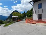 2
2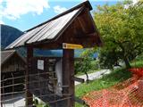 3
3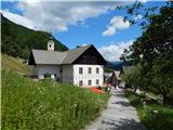 4
4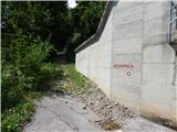 5
5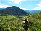 6
6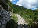 7
7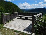 8
8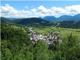 9
9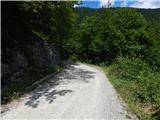 10
10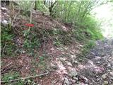 11
11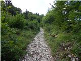 12
12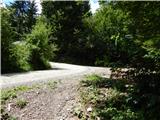 13
13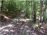 14
14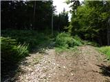 15
15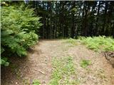 16
16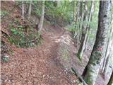 17
17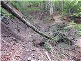 18
18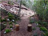 19
19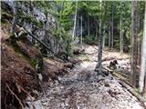 20
20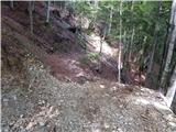 21
21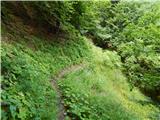 22
22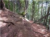 23
23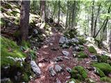 24
24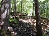 25
25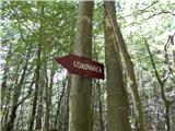 26
26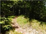 27
27 28
28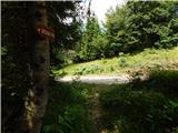 29
29 30
30 31
31 32
32 33
33 34
34 35
35 36
36 37
37 38
38 39
39 40
40 41
41 42
42 43
43 44
44 45
45 46
46 47
47 48
48 49
49 50
50 51
51 52
52 53
53 54
54 55
55 56
56 57
57 58
58 59
59 60
60 61
61 62
62 63
63 64
64 65
65 66
66 67
67 68
68 69
69 70
70 71
71 72
72 73
73 74
74 75
75 76
76 77
77 78
78 79
79 80
80 81
81 82
82 83
83 84
84 85
85 86
86 87
87 88
88 89
89 90
90 91
91 92
92 93
93 94
94 95
95 96
96 97
97 98
98 99
99 100
100 101
101 102
102 103
103 104
104 105
105 106
106 107
107 108
108 109
109 110
110 111
111 112
112 113
113 114
114 115
115 116
116 117
117 118
118 119
119 120
120 121
121 122
122 123
123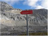 124
124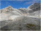 125
125 126
126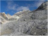 127
127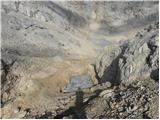 128
128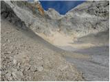 129
129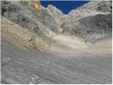 130
130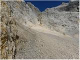 131
131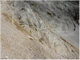 132
132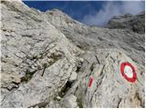 133
133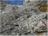 134
134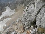 135
135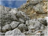 136
136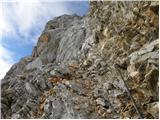 137
137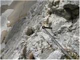 138
138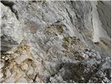 139
139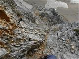 140
140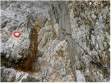 141
141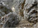 142
142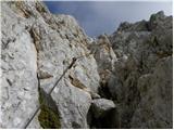 143
143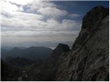 144
144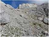 145
145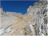 146
146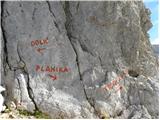 147
147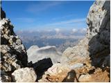 148
148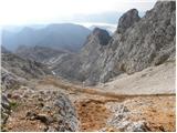 149
149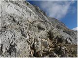 150
150 151
151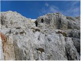 152
152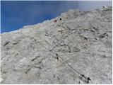 153
153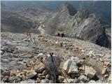 154
154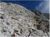 155
155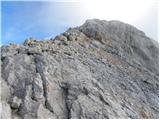 156
156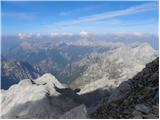 157
157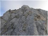 158
158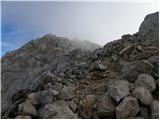 159
159 160
160
Discussion about the trip Srednja vas - Triglav (Za Ribnico and via Triglavska škrbina)
To post a comment you must log in:
If you do not yet have a username, you must first
register.