Srednji Vrh - Bele peči (Lepi vrh) (via valley of stream Žlebnica)
Starting point: Srednji Vrh (980 m)
| Latitude/Longitude: | 46,48940°N 13,83710°E |
| |
Route name: via valley of stream Žlebnica
Walking time: 2 h 45 min
Difficulty: easy unmarked way
Elevation gain: 946 m
Elevation difference along the route: 966 m
Map: Kranjska Gora 1:30.000
Recommended equipment (summer):
Recommended equipment (winter): ice axe, crampons
Views: 3.420
 | 1 person like this post |
Access to starting point:
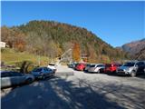
A) From the highway Ljubljana - Jesenice we take the exit Jesenice - west (Hrušica) and continue driving in the direction of Kranjska Gora. When we arrive in Gozd-Martuljek we turn right in the direction of Srednji Vrh and drive on a narrow and steep road to the mentioned settlement. When the road flattens a little, we will come to a crossroads of several roads and a turning area. We park on the marked parking lot next to the turning area.
B) We drive to Kranjska Gora, then continue driving in the direction of Jesenice. When we arrive in Gozd-Martuljek, first we cross the Sava Dolinka river over the bridge, then we pay attention to the left turn-offs, as the road to Srednji Vrh soon branches off to the left. We continue on the mentioned road, which leads us past a few more houses, then it starts to ascend steeply on a relatively narrow road that leads us past the waterfalls of the Jerman stream. When the road flattens higher up we arrive at Srednji Vrh, where we park on the marked parking lot next to the turning area.
Route description:
From the starting point, we continue on the left road, which immediately splits, and we choose the lower right road, which is closed to public traffic with a traffic sign. The road first leads us past a few houses, then the asphalt ends. A little further, we notice a notice that we are entering a bear area, and we continue the path on a macadam road, which ascends transversely on the slopes above the right bank of the Hladnik stream, which we occasionally hear, and we also cross several relatively picturesque right tributaries of it. During the ascent, a nice view of the Julian Alps occasionally opens up to us, then after a good hour of walking we arrive at the hunting hut Za Lepim vrhom, where there is a junction of several paths.
Behind the hut we continue on the leftmost cart track, which continues somewhat above the bed of the Žlebnica stream. We continue through the forest, at the first junction we go straight. Behind the junction the cart track ends, then we continue the ascent on the right side of the pleasantly trickling stream. Higher the steady stream ends, and we continue along the torrent, temporarily briefly on the left side. When from the valley, along which we walk, the torrent turns left into the slope, we continue straight ahead, further along the valley, where a nicely traceable path also guides us further. Higher the path rises above the valley, then it brings us to a larger clearing, where the path somewhat disappears. On the other side of the larger clearing, where the path returns to the larch forest, the path becomes clearer again, slowly it starts to turn more to the left, where it gradually passes to the eastern slopes. A few more minutes of ascent follow along an indistinct valley, then we climb over the grassy slope to a better-trodden path, which leads across the Grajšca mountain pasture.
When we reach the mentioned path we follow it to the left, but we leave it before the junction at the saddle between Bele peči on the left and Trupejevo poldne on the right. We leave the path at the point where we cross the old wire fence, so we continue left along the edge of the dwarf pines (that is, we continue left a few steps before the saddle).
The nice passage towards the summit soon stops us with a belt of dwarf pines through which we must break. After 15 to 20 meters of breaking through the dwarf pines we suddenly step onto a nice clearing, which leads us mostly straight upwards on a fairly steep slope. Higher the path makes some smaller turns and we are already on the very panoramic summit.
Description and pictures refer to the condition in 2015 (November).

Along the route: Lovska koča za Lepim vrhom (1280m)
Photos:
 1
1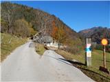 2
2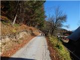 3
3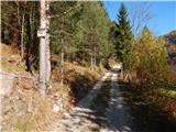 4
4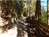 5
5 6
6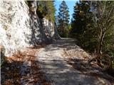 7
7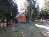 8
8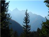 9
9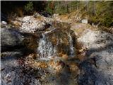 10
10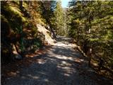 11
11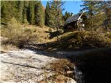 12
12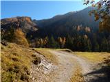 13
13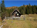 14
14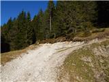 15
15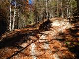 16
16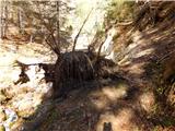 17
17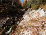 18
18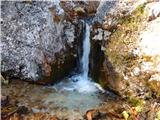 19
19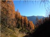 20
20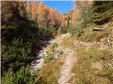 21
21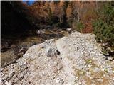 22
22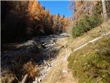 23
23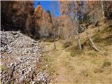 24
24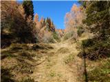 25
25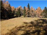 26
26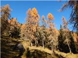 27
27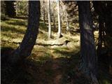 28
28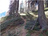 29
29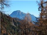 30
30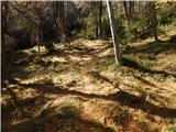 31
31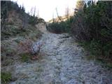 32
32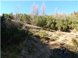 33
33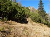 34
34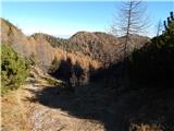 35
35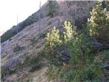 36
36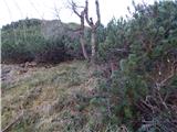 37
37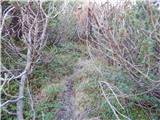 38
38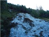 39
39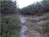 40
40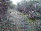 41
41 42
42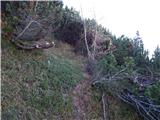 43
43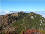 44
44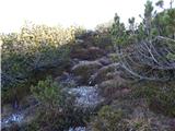 45
45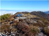 46
46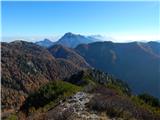 47
47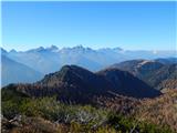 48
48 49
49
Discussion about the trip Srednji Vrh - Bele peči (Lepi vrh) (via valley of stream Žlebnica)
To post a comment you must log in:
If you do not yet have a username, you must first
register.