Srednji Vrh - Blekova planina
Starting point: Srednji Vrh (960 m)
| Latitude/Longitude: | 46,48940°N 13,83710°E |
| |
Walking time: 1 h 50 min
Difficulty: easy unmarked way
Elevation gain: 669 m
Elevation difference along the route: 669 m
Map: Kranjska Gora 1:30.000
Recommended equipment (summer):
Recommended equipment (winter): ice axe, crampons
Views: 10.203
 | 1 person like this post |
Access to starting point:
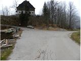
From the highway Ljubljana - Jesenice, we take the exit Jesenice - west (Hrušica) and continue driving towards Kranjska Gora. When we arrive in Gozd-Martuljek, we turn right towards Srednji Vrh and drive on a narrow and steep road to the mentioned place. When the road flattens a little, we will come to a crossroads of several roads and a turning area. Here we park in a suitable spot at the crossroads.
Route description:
From the crossroads, we continue on the left ascending road along which we notice signs "Trupijevo poldne". For some time we continue on the mentioned road, then the next sign for the same peak directs us right onto an ascending grassy cart track. The cart track soon turns sharply to the right and ascends diagonally for a short time, then it brings us to an unmarked junction, where we continue on the lower right cart track, which after a few minutes of traversing comes very close to the Jerman stream. Further on, we ascend moderately along the stream, and the cart track on which we walk crosses the mentioned stream several times over bridges. Higher up, the path leads past some abandoned huts at Hudi hlevi, then it flattens and in a few minutes of further walking brings us to a wider forest road (area named Železnica).
When we step onto the road, we follow it to the left and follow it in a gentle ascent to the first crossroads. Here we continue sharply right, where in a few minutes of further walking we step out of the forest onto the lower southern edge of Blekova planina. The road continues along the right edge of the mountain pasture, then, when it turns left, we leave it and continue the path along the edge of the forest across increasingly panoramic slopes. In less than 5 minutes of walking from the spot where we left the road, we arrive at the wooden Austrian hut (Blekova Hütte).

Along the route: Železnica (1500m)
Photos:
 1
1 2
2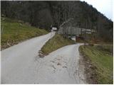 3
3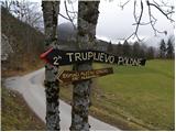 4
4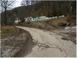 5
5 6
6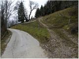 7
7 8
8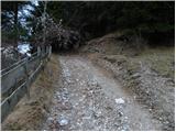 9
9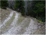 10
10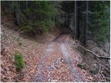 11
11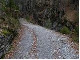 12
12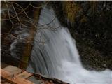 13
13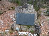 14
14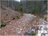 15
15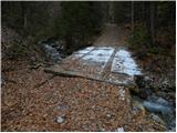 16
16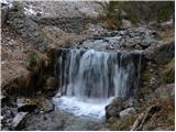 17
17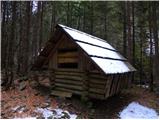 18
18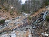 19
19 20
20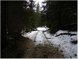 21
21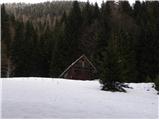 22
22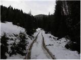 23
23 24
24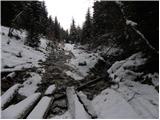 25
25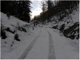 26
26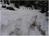 27
27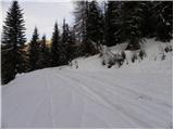 28
28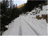 29
29 30
30 31
31 32
32 33
33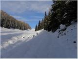 34
34 35
35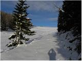 36
36 37
37 38
38 39
39 40
40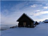 41
41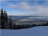 42
42
Discussion about the trip Srednji Vrh - Blekova planina
|
| poizon16. 08. 2018 |
Does anyone know how to contact the owner of the hut on Blekova planina if I wanted to overnight there?
|
|
|
|
| Fulcrum12. 11. 2018 |
On 10.11.2018 I went along this path to Blekova planina and further along the ridge to Vošca. There are some fallen trees on the path, but easy to avoid. The sign "Trupijevo poldne" (picture 4) is no longer there.
|
|
|
|
| Majdag17. 05. 2022 11:00:39 |
Blekova planina from Srednji Vrh, back past Jureževa planina, circular ramble. The forest road is soon after the turn-off for Blekova planina thickly covered with trimmed spruces. About five meters. Otherwise doesn't look bad from that direction. From Hlebanje to Jureževa homestead the road is closed, laying something. Views beautiful as always.
https://jelenkamenmajdag.blogspot.com/2022/05/blekova-planina-jurezeva-planina.html
|
|
|
To post a comment you must log in:
If you do not yet have a username, you must first
register.