Srednji Vrh - Techantinger Mittagskogel (Trupejevo poldne) (via Blekova planina)
Starting point: Srednji Vrh (960 m)
| Latitude/Longitude: | 46,4894°N 13,8371°E |
| |
Route name: via Blekova planina
Walking time: 3 h 10 min
Difficulty: difficult unmarked way
Elevation gain: 971 m
Elevation difference along the route: 1020 m
Map: Kranjska Gora 1:30.000
Recommended equipment (summer):
Recommended equipment (winter):
Views: 12.450
 | 2 people like this post |
Access to starting point:
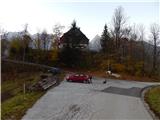
A) From the highway Ljubljana - Jesenice we take the exit Jesenice - west (Hrušica) and continue driving in the direction of Kranjska Gora. When we arrive in Gozd-Martuljek we turn right in the direction of Srednji Vrh and drive on a narrow and steep road to the mentioned place. When the road flattens a little, we will come to an intersection of several roads and a turning area. We park on the marked parking lot by the turning area.
B) We drive to Kranjska Gora, then continue driving in the direction of Jesenice. When we arrive in Gozd-Martuljek, first we cross the Sava Dolinka river over the bridge, then we pay attention to the left branches, as the road to Srednji Vrh branches off to the left soon. We continue on the mentioned road, which leads us past a few more houses, then it begins to ascend steeply on a relatively narrow road, which leads us past the waterfalls of the Jerman stream. When the road flattens higher up we arrive at Srednji Vrh, where we park on the marked parking lot by the turning area.
Route description:
From the starting point we continue on the left road, which immediately splits. We choose the left road (the right road leads above the Hladnik stream towards the hunting cottage Za Lepim vrhom), which takes us past the Hlebanja farm (at the mentioned farm it is possible to buy dairy products) and the chapel to the place where the signs for Trupejevo poldne (on the sign Trupijevo poldne) direct us right onto the cart track, which first crosses the electric fence of the shepherd. The cart track, from which a nice view opens up on the Martuljek mountain group, soon turns right, then before entering the forest it splits into two parts. We continue on the lower cart track, beside which we notice signs for Alpe Adria Trail, and the cart track after a shorter crossing brings us to the Jerman stream, along which we then ascend. Further on we ascend for quite some time along the mentioned stream, which we cross several times with the help of a wider wooden footbridge. Higher up the forest starts to thin, so that a nice view opens up towards Špik when looking back, and the path also leads us past two huts, which we notice on the left side of the path. During the ascent the path together with the valley of the Jerman stream turns more and more to the right and becomes gentler. When the path flattens even more, we quickly reach the macadam road which leads from Korensko sedlo, and we follow it to the left (right Trupejevo poldne normal path).
On the mentioned road we walk for a few minutes, then we notice a footpath which branches off slightly to the right from the road. We can continue on the mentioned footpath, which ascends diagonally across the occasionally panoramic slope, or on the road. In case we continue on the road, at the first intersection we continue right, and when we arrive from the forest both paths join.
From the place where the paths join we continue on the road to the place where it turns left, and at the mentioned bend we continue slightly right onto the footpath, which ascends along the edge of Blekova planina. Higher up the path flattens and in a few steps we arrive at the shepherd hut.
Behind the hut the path goes into the forest and continues along the border ridge. Initially the path leads us through spruce forest, occasionally partly also larch forest. After approximately 30 minutes of gentle to moderate ascent, with a few shorter descents, the path brings us to the only technically more demanding part of the path, where we have to climb over a short step. With a little help from our hands we quickly ascend about 10 meters of elevation. After the step, which can be bypassed on the Slovenian side, the path flattens, then continues along an increasingly panoramic ridge, where the increasingly sparse forest is slowly replaced by dwarf pines. With views of Austria, Slovenia, and when looking back also Italy, we approach Trupejevo poldne more and more, whose summit we already see nicely in front of us. A few more minutes of ascent follow, then the dwarf pines also disappear, replaced by grasses. A little below the summit the path leads us past the mouth of a torrent gully, where on the Austrian side the path is somewhat exposed, otherwise technically undemanding. From the gully to the summit only a few dozen somewhat steeper steps separate us.
Starting point - Blekova planina 1:50, Blekova planina - Trupejevo poldne 1:20.
Description and pictures refer to the condition in the year 2015 (November).

Photos:
 1
1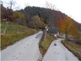 2
2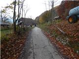 3
3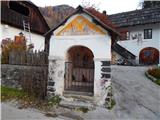 4
4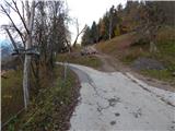 5
5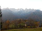 6
6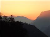 7
7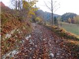 8
8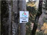 9
9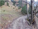 10
10 11
11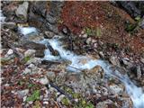 12
12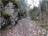 13
13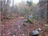 14
14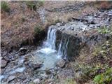 15
15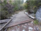 16
16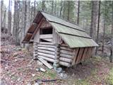 17
17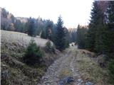 18
18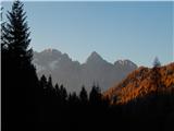 19
19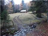 20
20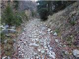 21
21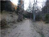 22
22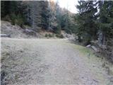 23
23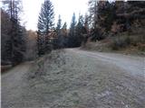 24
24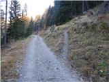 25
25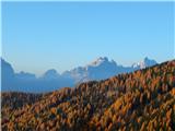 26
26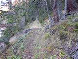 27
27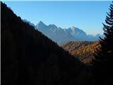 28
28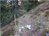 29
29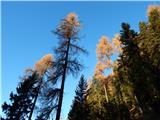 30
30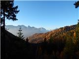 31
31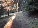 32
32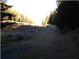 33
33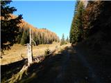 34
34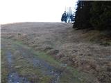 35
35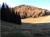 36
36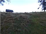 37
37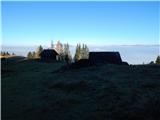 38
38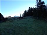 39
39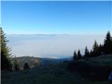 40
40 41
41 42
42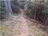 43
43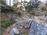 44
44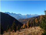 45
45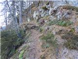 46
46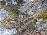 47
47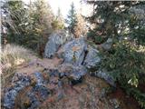 48
48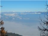 49
49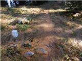 50
50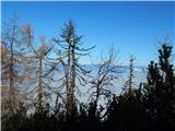 51
51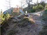 52
52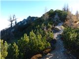 53
53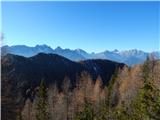 54
54 55
55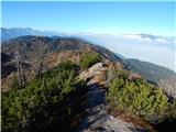 56
56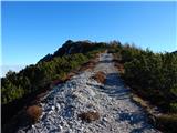 57
57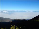 58
58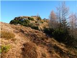 59
59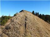 60
60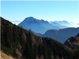 61
61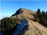 62
62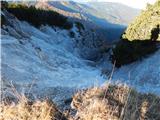 63
63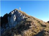 64
64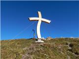 65
65 66
66
Discussion about the trip Srednji Vrh - Techantinger Mittagskogel (Trupejevo poldne) (via Blekova planina)
|
| tango3. 10. 2023 16:21:36 |
Wonderful day for a circular tour in the Karavanks. Beautiful path, perhaps the difficulty is slightly exaggerated in the description, as the path is really easy. From Trupej we extended to Maloško poldne and then via Grajšce back to Srednji Vrh. Of course, a marmot curiously watched us on the upper part of Grajšce, which has the alpine pasture riddled with holes.
Otherwise, on the whole path, 19 km and 1200 m ascent, we didn't meet a soul.
|
|
|
To post a comment you must log in:
If you do not yet have a username, you must first
register.