St. Anna am Lavantegg - Waldheimhütte
Starting point: St. Anna am Lavantegg (1291 m)
| Latitude/Longitude: | 47,03905°N 14,68902°E |
| |
Walking time: 1 h 25 min
Difficulty: easy marked way
Elevation gain: 323 m
Elevation difference along the route: 350 m
Map: WK 212 (Seetaler & Seckauer Alpen 1:50.000)
Recommended equipment (summer):
Recommended equipment (winter): ice axe, crampons
Views: 106
 | 1 person like this post |
Access to starting point:
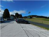
We leave the highway from Klagenfurt am Wörthersee to Graz at the exit Bad St. Leonhard im Lavanttal, and then we follow the signs for Zeltweg and Reichenfels. After the settlement Reichenfels we reach the state border between Austrian Carinthia / Kärnten and Styria / Steiermark, and a little further we arrive at the Obdacher Sattel pass, where we turn left towards the settlement St. Anna am Lavantegg. Next follows a steeper ascent to the mentioned settlement, where we park on the designated parking area in the center of the settlement.
Route description:
From the parking lot, we continue on the main road through the settlement, where the path also leads past the church of St. Anna; at the upper part of the settlement we leave the road and turn right onto the educational trail Erlebnisweg, where we follow the signs for the mentioned trail and the educational information boards. Higher up, we join the marked path that starts in the settlement Obdach, but we continue straight ahead in the direction of the mountain hut Waldheimhütte (here the educational trail continues sharply to the right). The path ahead leads us for some time along a pasture, then returns into the forest and descends to an asphalt road (it is also possible to reach this point by road), which leads towards the mountain hut Waldheimhütte.
We continue on the road for a few minutes, then turn slightly right onto a footpath that enters the forest. Further on, the path leads us past a few more holiday cottages, all of which we bypass on the right side. After the last holiday cottages we temporarily ascend a little more steeply; higher up we mostly ascend gently to moderately, and even higher the path completely flattens out; at junctions we follow the blazes. In the final section there is also an easy descent and we arrive at the mountain hut Waldheimhütte.
The description and photographs reflect conditions in October 2025.

Photos:
 1
1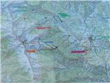 2
2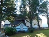 3
3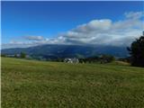 4
4 5
5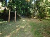 6
6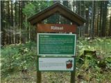 7
7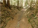 8
8 9
9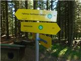 10
10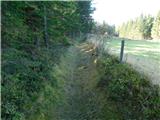 11
11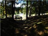 12
12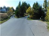 13
13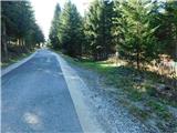 14
14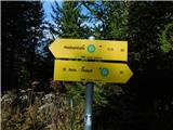 15
15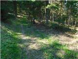 16
16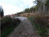 17
17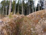 18
18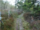 19
19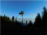 20
20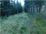 21
21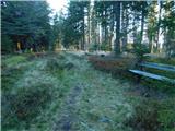 22
22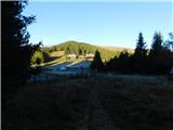 23
23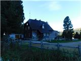 24
24
Discussion about the trip St. Anna am Lavantegg - Waldheimhütte
To post a comment you must log in:
If you do not yet have a username, you must first
register.