St. Vinzenz (St. Vinzenz) - Großer Speikkogel (Koralpe)
Starting point: St. Vinzenz (St. Vinzenz) (1083 m)
| Latitude/Longitude: | 46,69614°N 15,01308°E |
| |
Walking time: 5 h 40 min
Difficulty: easy marked way
Elevation gain: 1057 m
Elevation difference along the route: 1210 m
Map:
Recommended equipment (summer):
Recommended equipment (winter): ice axe, crampons
Views: 256
 | 1 person like this post |
Access to starting point:
a) We drive to Dravograd, then through the Vič border crossing into Austria to the settlement Labot / Lavamünd, where we turn right towards Graz and Ivnik / Eibiswald. Next follows an ascent to mountain pass Soboški prelaz / Koglereck, followed by a descent to lake Sobote / Stausee Soboth, where, on the southeastern side of the lake, we turn left towards the settlement St. Vinzenz. When we reach the church in the mentioned settlement, we continue straight to the nearby parking lot.
b) We drive to Zgornja Kungota, then through the Jurij border crossing by Pesnica into Austria, from where we follow signs for the settlement Lučane / Leutschach, and then signs for Ivnik / Aibiswald. After Ivnik, we arrive in Aibl, where we exit the roundabout at the Spar store towards the settlement Labot / Lavamünd. Next follows a relatively short ascent, and when the road flattens, we also pass by the settlement Sobota / Soboth, then drive to lake Sobote / Stausee Soboth, where we turn right towards the settlement St. Vinzenz. When we reach the church in the mentioned settlement, we continue straight to the nearby parking lot.
c) We drive to Radlje ob Dravi, then through the mountain pass Radeljski prelaz into Austria, from where we follow signs for the settlement Ivnik / Aibiswald. Before the mentioned settlement, in Aibl, we exit the roundabout at the Spar store towards the settlement Labot / Lavamünd. Next follows a relatively short ascent, and when the road flattens, we also pass by the settlement Sobota / Soboth, then drive to lake Sobote / Stausee Soboth, where we turn right towards the settlement St. Vinzenz. When we reach the church in the mentioned settlement, we continue straight to the nearby parking lot.
Route description:
From the parking lot, we return to the church, and then we head on the path toward the cottage Dreieckhütte, initially passing by houses. After the first houses, the asphalt ends, and beyond the last house, the road transitions into the forest. We continue the ascent along the stream Schwarzenbach, at a few crossroads continuing straight or following the trail markers.
When we reach a slightly larger crossroad, where a marked path from the right joins, leading past the cottage Glashütte, we proceed on the middle road. Higher up, at a few smaller crossroads, we follow the trail markers, and when the road levels out, we quickly reach the saddle, where we notice a chapel on the right and, on the left eastern side of the saddle, by the edge of the mountain pasture Dreieckalm, also the cottage Dreieckhütte.
Behind the cottage, we go left upwards towards the cottage Koralpenhaus and the peak Gr. Speikkogel, and after a few dozen strides, we reach a rougher road, which we follow to the left. We ascend slightly along the road, then quickly turn right onto a footpath that continues between the forest and a grazing fence. A little higher, we cross the grazing fence, then traverse a grassy area to reach the cross on Dreieckkogel. The highest point of the peak lies a bit further, where the path crosses the grazing fence again.
On the other side of the grazing fence, we begin a gentle to moderate descent, and when the path flattens, it continues with a few shorter ascents and descents. We continue to follow the blazes, and the path leads us to the route of the high-pressure gas line, along which we proceed for some time. When we reach the road a little further, we go left; the road then turns right and leads us into the area of wind turbines. A little further from the warning sign, we veer slightly left off the road and continue along a footpath, which leads us past an older trough and through blueberry bushes.
Further on, a path branches off to the left towards the Steinbergerhütte cottage, but we continue straight. When we leave the forest at the wind turbine, the blazes and path are lost due to the turbine's construction, but we maintain a straight direction and notice the continuation of the marked path at the edge of the forest. Next follows an ascent towards the summit of Kleinschneiderkogel, bypassing its highest point on the left side. From here, a close view opens up on the slopes of the Kleinalpl peak, and we descend through a sparse forest to the saddle between the two just-mentioned peaks, where there is a marked crossing.
Here, a path from the left joins, leading past the Steinbergerhütte cottage, but we continue slightly to the right towards the Koralpenhaus cottage and the highest peak of Golica. Next follows a shorter, muddier section, after which we cross a cart track and continue the ascent on an increasingly grassy slope. Next follows the traversing of the northeastern slopes of the Kleinalpl peak, where the path leads us through lush blueberry bushes. When we eventually reach the indistinct northern ridge of the just-mentioned summit, an unmarked path branches off to the left towards the Kleinalpl summit, but we continue straight, following the marked path, which begins to moderately descend towards a crossing a few minutes away, where we join the path from the mountain pass Soboški prelaz / Koglereck.
Here, we continue right along the road and arrive at the Jauksattel saddle in a few minutes.
Here we leave the macadam road and go on grassy slopes following the signs Gr. Speikkogel. A grassy cart track at first leads up the slope, then turns left and for a short time runs through the forest. By the path, we will notice interesting boulders, which are characteristic for this area. The cart track then crosses the fence and brings us onto ample pastures.
Here, we continue on a footpath that begins to ascend more steeply up the slope. The path then crosses a mountain stream and soon after that also the high voltage power line. The path continues to ascend steadily along scenic grassy slopes, crossing grazing fences a few times in the process. Later, the path turns to the left, and a view opens up on the radars at the top, which aid us in orientation. Soon a view opens up on the western side and the path brings us to a marked crossing. We continue straight, following the signs »Gr. Speikkogel 15 min« (slightly left to Koralpenhaus, sharply right to Kramerin and Oberfresen), and begin ascending a grassy slope towards the ridge on the right side of the peak. On the ridge, we continue left and only a short ascent follows to the top.
St. Vinzenz - Dreieckhütte 1:20, Dreieckhütte - Dreieckkogel 0:15, Dreieckkogel - Jauksattel 2:05, Jauksattel - Gr. Speikkogel 2:00.

Photos:
 1
1 2
2 3
3 4
4 5
5 6
6 7
7 8
8 9
9 10
10 11
11 12
12 13
13 14
14 15
15 16
16 17
17 18
18 19
19 20
20 21
21 22
22 23
23 24
24 25
25 26
26 27
27 28
28 29
29 30
30 31
31 32
32 33
33 34
34 35
35 36
36 37
37 38
38 39
39 40
40 41
41 42
42 43
43 44
44 45
45 46
46 47
47 48
48 49
49 50
50 51
51 52
52 53
53 54
54 55
55 56
56 57
57 58
58 59
59 60
60 61
61 62
62 63
63 64
64 65
65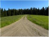 66
66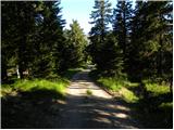 67
67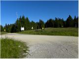 68
68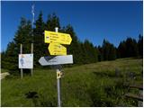 69
69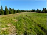 70
70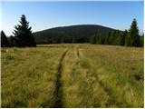 71
71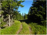 72
72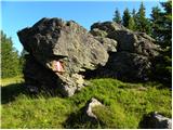 73
73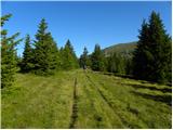 74
74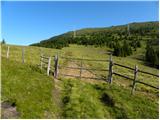 75
75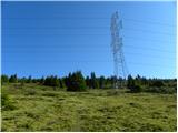 76
76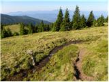 77
77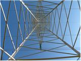 78
78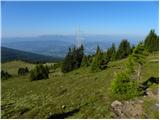 79
79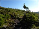 80
80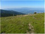 81
81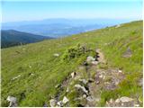 82
82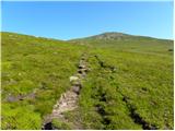 83
83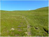 84
84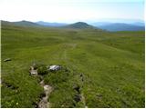 85
85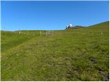 86
86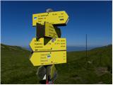 87
87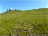 88
88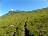 89
89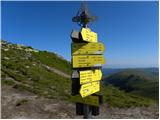 90
90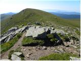 91
91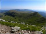 92
92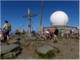 93
93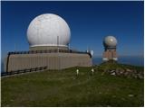 94
94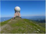 95
95
Discussion about the trip St. Vinzenz (St. Vinzenz) - Großer Speikkogel (Koralpe)
To post a comment you must log in:
If you do not yet have a username, you must first
register.