Starting point: Stara Fužina (573 m)
| Latitude/Longitude: | 46,29030°N 13,88680°E |
| |
Walking time: 5 h 20 min
Difficulty: easy unmarked way
Elevation gain: 1514 m
Elevation difference along the route: 1620 m
Map: TNP 1:50.000
Recommended equipment (summer):
Recommended equipment (winter): ice axe, crampons
Views: 3.530
 | 1 person like this post |
Access to starting point:
From the Ljubljana - Jesenice motorway, take the Lesce exit and follow the road towards Bled and further towards Bohinjska Bistrica. Continue driving towards Lake Bohinj (Ribčev laz), where we reach a junction and continue right towards Stara Fužina. In Stara Fužina, at the junction by the chapel, turn sharply left onto the ascending road towards Planina Blato, Planina Vogar and Voje Valley. Follow this road to the parking lot where toll and parking fees are collected.
Route description:
At the beginning of the parking lot, signs for the Mostnica gorges and waterfall direct us right onto a wide path, along which we arrive at the Devil's Bridge in a few minutes. Continue straight (right across the Uskovnica bridge via Planina Blatce and Stara Fužina), a little further, at the information board for the Mostnica gorges, go slightly right. At the next junction, go slightly right again (left Vogar, also possible to Voje), then arrive at the place where they collect the fee for maintaining the path through the Mostnica gorges (adult entrance fee was 3 eur in June 2018).
At the mentioned place, the path splits, and we choose the left or right path. Both paths further run near the gorges (there is a branch off the right path to see the elephant, a natural feature), later they merge into one path, along which we ascend to the gravel road. Follow the road to the right, past the NOB monument we quickly arrive at the Mountain Hut at Vojah.
A few dozen metres before the Hut at Vojah, at the monument, leave the road and continue the path left towards the west along a gentle cart track, which quickly brings us to a small junction, where we continue on the left marked path. Continue the ascent along a moderately steep path, which after a short ascent brings us to the forest-covered ridge of Ravno brdo. Here the path turns right and temporarily flattens. A little further, we will notice a small cross along the path, and from here the path becomes increasingly steep.
Further on, we ascend steeply through dense forest for quite some time. At an altitude of about 1300 m, the path flattens, and a few metres higher it brings us to the place where we cross the unmarked path from Planina Blato to Planina Zgornja Grintovica. Crossing the mentioned path is almost imperceptible, as there is a lot of fallen timber here covering both paths.
Here continue in the same direction and soon step onto a well-traceable but poorly marked path again. The path ahead ascends through dense forest for a while longer, then gradually approaches the nearby Planina Krstenica. Higher up, the forest becomes sparser, and the path less steep. A little further, we finally exit the forest, where the open terrain of Planina Krstenica opens before us. The again poorly visible trail turns slightly left here and first brings us in a moderate ascent, then in a slight descent to the shepherds' huts on Planina Krstenica.
On Planina Krstenica, we also reach the unmarked path from Planina Blato to Planina Krstenica, but we follow the marked path towards Lazovski and Jezerski pass to the western part of the alpine pasture, where we notice signs for Planina v Lazu. Continue in the direction of the mentioned alpine pasture and first begin descending towards the valley that separates Ogradi from the Stogov ridge. When the descent ends, the path leads through occasionally denser forest, crossing first the valley, then the slopes at the foot of Ogradi towards the east. A little further, the path begins to ascend more noticeably and turns right. The ascent does not last long, as the path soon flattens. A few minutes of walking with slight ascents and descents follow, then we arrive at a junction where a cairn usually stands.
Here continue sharply right (straight to Planina v Lazu) onto the unmarked path leading towards the summit of Ogradi.
The well-visible but unmarked path ascends steeply ahead and brings us in a few minutes to the ruins of the abandoned alpine pasture on the southern slopes of Ogradi. Here the path turns left, and the steepness gradually eases. Further, we ascend along an occasionally somewhat less visible trail that climbs the grassy slope of the mountain. The increasingly scenic path then ascends somewhat more steeply again and brings us to the summit in a few more minutes of walking.
Stara Fužina - Koča na Vojah 0:45, Koča na Vojah - razpotje Na vrhu 1:45, razpotje Na vrhu - planina Krstenica 0:50, Planina Krstenica - odcep za Ograde 0:45, Odcep za Ograde - Ogradi 1:15.

Photos:
 1
1 2
2 3
3 4
4 5
5 6
6 7
7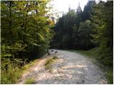 8
8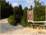 9
9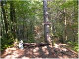 10
10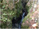 11
11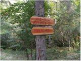 12
12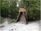 13
13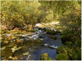 14
14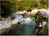 15
15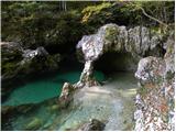 16
16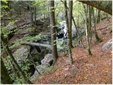 17
17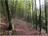 18
18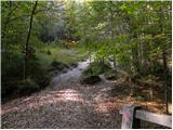 19
19 20
20 21
21 22
22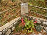 23
23 24
24 25
25 26
26 27
27 28
28 29
29 30
30 31
31 32
32 33
33 34
34 35
35 36
36 37
37 38
38 39
39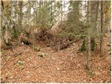 40
40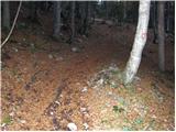 41
41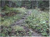 42
42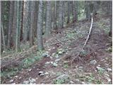 43
43 44
44 45
45 46
46 47
47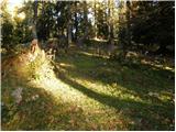 48
48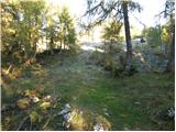 49
49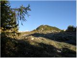 50
50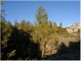 51
51 52
52 53
53 54
54 55
55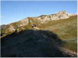 56
56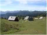 57
57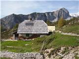 58
58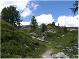 59
59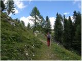 60
60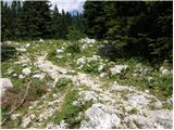 61
61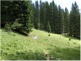 62
62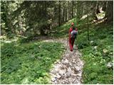 63
63 64
64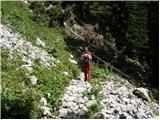 65
65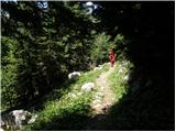 66
66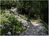 67
67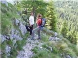 68
68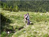 69
69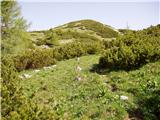 70
70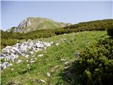 71
71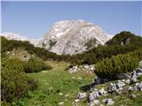 72
72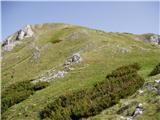 73
73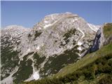 74
74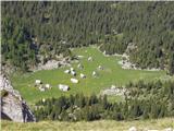 75
75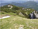 76
76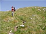 77
77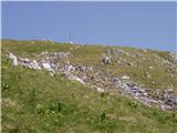 78
78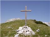 79
79 80
80
Discussion about the trip Stara Fužina - Ogradi
To post a comment you must log in:
If you do not yet have a username, you must first
register.