Stara Fužina - Planina Krstenica
Starting point: Stara Fužina (573 m)
| Latitude/Longitude: | 46,29030°N 13,88680°E |
| |
Walking time: 3 h 20 min
Difficulty: easy marked way
Elevation gain: 1097 m
Elevation difference along the route: 1130 m
Map: Triglav 1:25.000
Recommended equipment (summer):
Recommended equipment (winter): ice axe, crampons
Views: 23.054
 | 2 people like this post |
Access to starting point:
From the Ljubljana-Jesenice motorway, take the Lesce exit and follow the road towards Bled and further towards Bohinjska Bistrica. Continue driving towards Lake Bohinj (Ribčev laz), where we reach a junction and continue right towards Stara Fužina. In Stara Fužina, at the junction by the chapel, turn sharply left onto the ascending road towards planina Blato, planina Vogar and dolina Voje. Follow this road to the parking lot where road toll and parking fees are collected.
Route description:
At the beginning of the parking lot, signs for the gorges and Mostnica waterfall direct us right onto a wide path, along which we reach Hudičev most in a few minutes. Continue straight (right over the Uskovnica bridge via planina Blatce and Stara Fužina), a little further at the information board for Mostnica gorges go slightly right. At the next junction go slightly right again (left Vogar, also possible to Voje), then we arrive at the place where they collect the fee for maintaining the path through Mostnica gorges (adult entrance fee was 3 euros in June 2018).
At the mentioned spot the path splits, and we choose the left or right path. Both paths continue near the gorges (off the right path there is a branch to see the slonček, a natural feature), later they merge into one path along which we ascend to a gravel road. Follow the road right, past the NOB monument we quickly reach the Mountain Hut at Voje.
A few tens of meters before the Hut at Voje, at the monument leave the road and continue left westwards along a gentle cart track, which quickly brings us to a small junction where we continue on the left marked path. Continue ascent on a moderately steep path which after a short climb brings us to the forest-covered ridge Ravno brdo. Here the path turns right and temporarily flattens. A little further we notice a small cross by the path, and from here the path becomes steeper.
Further on we steeply ascend through dense forest for some time. At about 1300 m elevation the path flattens, and a few elevation meters higher it brings us to the place where we cross the unmarked path planina Blato - planina Zgornja Grintovica. Crossing the mentioned path is almost unnoticeable as there is a lot of fallen timber exactly there covering both paths.
Here continue in the same direction and soon step again onto a nicely traceable but poorly marked path. The path ahead climbs through dense forest for a while longer, then slowly approaches the nearby planina Krstenica. Higher the forest becomes sparser, the path less steep. A little further we exit the forest where the open world of planina Krstenica opens before us. The again poorly visible trail turns slightly left here and first in moderate ascent then in slight descent brings us to the shepherds' huts on planina Krstenica.
Stara Fužina - Koča na Vojah 0:45, Koča na Vojah - razpotje Na vrhu 1:45, razpotje Na vrhu - planina Krstenica 0:50.

The trip can be extended to the following destinations: Planina Jezerce ( 30 min),
Krsteniški Stog ( 45 min),
Jezerski Stog,
Prevalski Stog (1 h 50 min),
Ogradi (1 h 45 min),
Škednjovec,
Vrh Hribaric,
Vršaki (Vrh za Koritami),
Vršaki (Srednji vrh),
Vršaki (South peak),
Vršaki (Vzhodni vrh),
Teme (Hribarice),
Poprovec,
Kanjavec,
Kanjavec (West peak)
Photos:
 1
1 2
2 3
3 4
4 5
5 6
6 7
7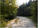 8
8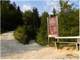 9
9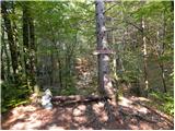 10
10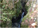 11
11 12
12 13
13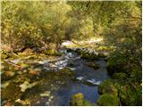 14
14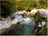 15
15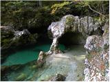 16
16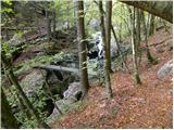 17
17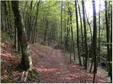 18
18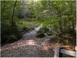 19
19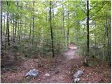 20
20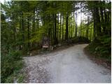 21
21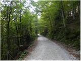 22
22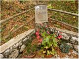 23
23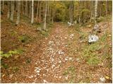 24
24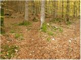 25
25 26
26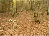 27
27 28
28 29
29 30
30 31
31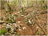 32
32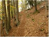 33
33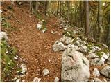 34
34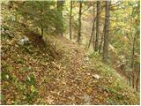 35
35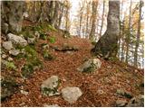 36
36 37
37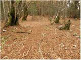 38
38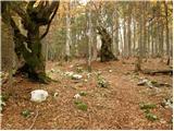 39
39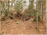 40
40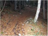 41
41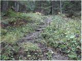 42
42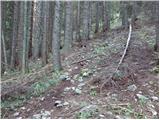 43
43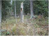 44
44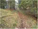 45
45 46
46 47
47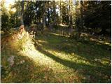 48
48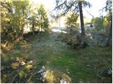 49
49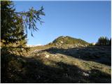 50
50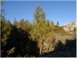 51
51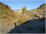 52
52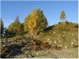 53
53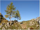 54
54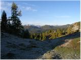 55
55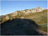 56
56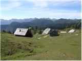 57
57
Discussion about the trip Stara Fužina - Planina Krstenica
|
| Iguana21. 11. 2010 |
Yesterday from S. Fužina to Planina Krstenica. Long and quite strenuous path, with wonderful Mostnica. Occasional sun ray along the path, at the top quite cloudy. Snow in some places up to the knees. Criticism for markings, barely noticeable, especially with so much fallen timber, making orientation even harder. This path probably hasn't been marked for several years.
|
|
|
|
| macek123. 10. 2012 |
Traces of cyclists' 'pleasures'.
|
|
|
|
| ajdaa7. 07. 2013 |
With the PD Rašica camp, we visited Krstenica starting from our camp, went past Bohinj Lake to the start of the trail to Voje where we drank and headed into the long steep section. At the end of the steep section, we had a snack. After the snack, we ascended to Krstenica where we had another snack. After the snack, we descended to Planina Blato and from there to Vogar where it suddenly rained on us. From there back to our camp. View nice, weather too, temperature - too hot. Descent same trail.    
|
|
|
|
| lojz18. 10. 2021 10:38:34 |
What is the condition of this trail? Apparently, a storm a few years ago caused quite some damage.
|
|
|
|
| exwannabe18. 10. 2021 19:34:10 |
No problem along the valley, up to Pl. doma in Voje. Further on.... last time I hiked, the first part of the trail was OK (that steepest part), then higher up, where the trail levels out a bit, there was a lot of logging (problem because no markers), one section was virtually bare rock. In that part there were lots of tracks and no markers anywhere, so you have to go a bit by feel or if you've been there before you at least know which direction to go. Then the very last part of the trail was OK again. Otherwise it can be quite problematic. Option, GPS. But this info is about a year old... so maybe they've fixed something this year.
|
|
|
|
| lojz18. 10. 2021 20:18:16 |
|
|
|
|
| Luka2829. 04. 2022 18:27:55 |
Condition 29.4.22
Golosek still in catastrophic condition, no markers. It was our first time up and of course we got lost. With the help of Google Maps we somehow got to the forest path from pl. Blato, so we didn't see the target at all. At the end, hiking from Blato to Stara Fužina, because some shepherds don't open the road until 1.5. due to "winter conditions". Parking for 7h was 21€. In short, it was a desperate trip in the end.
|
|
|
|
| padez29. 04. 2022 20:40:59 |
The hiking path is managed by PD Železničar Ljubljana.
The path has been in catastrophic condition for years and nothing indicates it will be fixed. Same situation at Krstenica - Grintovca and also Crno jezero - shelter Draga Bregarja. On this path felled larches have been lying for more than thirty!!! years! All mentioned sections are managed and maintained by the same mountaineering society - Železničar Ljubljana! Shame!!!
|
|
|
|
| Luka2830. 04. 2022 04:45:57 |
Sad...
The ascent itself is also deadly boring, designed to sap the hiker's will for everything
|
|
|
|
| pegasus12. 09. 2023 20:22:13 |
Walked this path today. The fallen trees in the steep section are mostly cleared and do not significantly hinder walking, up at the logging area the path is routed slightly differently than on the maps, you just have to follow the few new markings. If you get lost anyway, the cairns will save you.
But the steep section is softly covered with leaves and humus, ideal surface for barefoot walking enthusiasts
|
|
|
To post a comment you must log in:
If you do not yet have a username, you must first
register.