Stara Fužina - Planina Krstenica (via planina Zgornja Grintovica)
Starting point: Stara Fužina (573 m)
| Latitude/Longitude: | 46,29030°N 13,88680°E |
| |
Route name: via planina Zgornja Grintovica
Walking time: 4 h
Difficulty: easy unmarked way
Elevation gain: 1097 m
Elevation difference along the route: 1130 m
Map: Triglav 1:25.000
Recommended equipment (summer):
Recommended equipment (winter): ice axe, crampons
Views: 7.389
 | 1 person like this post |
Access to starting point:
From the Ljubljana - Jesenice motorway, take the Lesce exit and follow the road towards Bled and further towards Bohinjska Bistrica. Continue driving towards Lake Bohinj (Ribčev laz), where we reach a junction and continue right towards Stara Fužina. In Stara Fužina, at the junction by the chapel, turn sharply left onto the ascending road towards planina Blato, planina Vogar and Voje Valley. The road then takes us to the toll booth area, where we park at the arranged paid parking lot.
Route description:
At the beginning of the parking lot, signs for the Mostnica gorges and waterfall direct us right onto a wide path, along which we reach Hudičev most in a few minutes. Continue straight ahead (right over the Uskovnica bridge via planina Blatce and Stara Fužina), a little further on, at the information board for the Mostnica gorges, go slightly right. At the next junction, go slightly right again (left Vogar, also possible to Voje), then we reach the place where they collect the fee for maintaining the path through the Mostnica gorges (adult entrance fee was 3 euros in June 2018).
At the mentioned spot, the path splits, and we choose the left or right path. Both paths continue near the gorges (there is a side path off the right path to see the elephant, a natural feature), later they merge into one path, along which we ascend to the gravel road. Follow the road to the right, and quickly reach the Planinska koča na Vojah.
Continue along the road that runs through Voje Valley, following the signs for the Mostnica waterfall. A little further on, the road splits, and we can continue left on the slightly shorter road with signs for Velo polje, or right on a path a few minutes longer that passes by the Mostnica waterfall.
Near the waterfall, at the head of Voje Valley, both paths merge, and we follow the marked path towards Triglav and Vodnikov dom na Velem polju.
The fairly wide path then enters dense forest and ascends above the waterfall, which we can partially see below the path, then the path turns left and ascends westwards in a few switchbacks, leading us along relatively steep slopes. At an altitude of about 1150 meters, the path levels out, and a little further it takes us out of the forest to planina Spodnja Grintovica, where there is a water trough that is open only in the summer months.
On the pasture, we notice the inscription "Pl. Grintovica", which directs us left to the water trough (straight to Triglav and Velo polje), but it is better to continue along the left edge of the pasture to the nearby cairn, where we notice the continuation of the path towards planina Zgornja Grintovica. Here the path turns sharply left, and just a few tens of meters further we join the path that leads past the aforementioned water trough. We continue along the wide path, which after a little more than ten minutes of further walking takes us out of the forest to planina Zgornja Grintovica.
On the pasture, we will notice signs for Krstenica on one of the huts, directing us to a clearly visible trail that starts at the nearby cairn. The path then transversely ascends the upper edge of the pasture, then enters dense forest, where it occasionally starts to fade, but orientation is not difficult, as unofficial arrow markings show the way, and here and there we also spot some old, quite faded markings. The path through the forest occasionally steepens, then turns slightly left, where it temporarily levels out, and the forest also becomes sparser. The path, which briefly runs through tall grass, returns to the forest and ascends steeply. After a short steep ascent through the forest, the path turns slightly right, crosses a torrent gully, then turns left again and ascends further along the edge of the torrent, which is quite wide here, so the path is damaged in several places in this section, but since the slope is not very steep, it doesn't cause major problems (some extra caution is still needed). A few more minutes of steep walking follow, then the path suddenly levels out and takes us to a viewpoint on the eastern edge of planina Krstenica. From the viewpoint, we continue along the gentle path, which after a few minutes of slight descent takes us to the huts on the aforementioned pasture.
Stara Fužina - Koča na Vojah 0:45, Koča na Vojah - zatrep doline Voje 0:35, zatrep doline Voje - planina Spodnja Grintovica 1:20, planina Spodnja Grintovica - planina Zgornja Grintovica 0:15, planina Zgornja Grintovica - planina Krstenica 1:05.

The trip can be extended to the following destinations: Planina Jezerce,
Krsteniški Stog (0 min),
Jezerski Stog,
Prevalski Stog (1 h 5 min),
Ogradi (1 h),
Škednjovec,
Vrh Hribaric,
Vršaki (Vrh za Koritami),
Vršaki (Srednji vrh),
Vršaki (South peak),
Vršaki (Vzhodni vrh),
Teme (Hribarice),
Poprovec,
Kanjavec,
Kanjavec (West peak)
Photos:
 1
1 2
2 3
3 4
4 5
5 6
6 7
7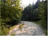 8
8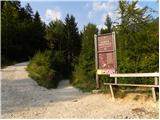 9
9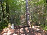 10
10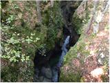 11
11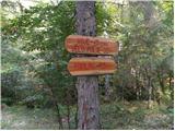 12
12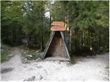 13
13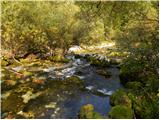 14
14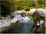 15
15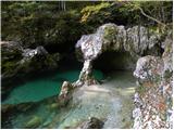 16
16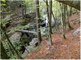 17
17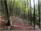 18
18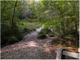 19
19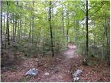 20
20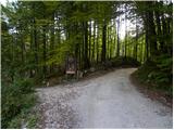 21
21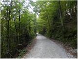 22
22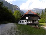 23
23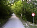 24
24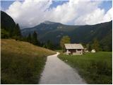 25
25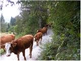 26
26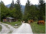 27
27 28
28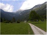 29
29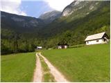 30
30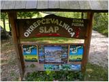 31
31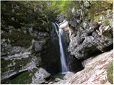 32
32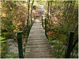 33
33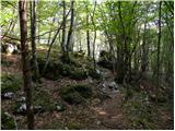 34
34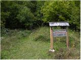 35
35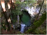 36
36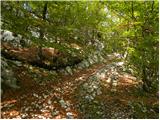 37
37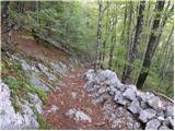 38
38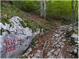 39
39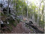 40
40 41
41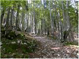 42
42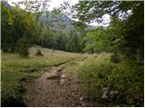 43
43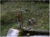 44
44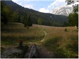 45
45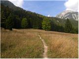 46
46 47
47 48
48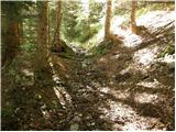 49
49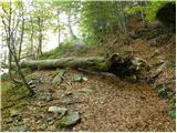 50
50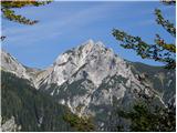 51
51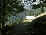 52
52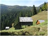 53
53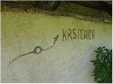 54
54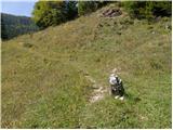 55
55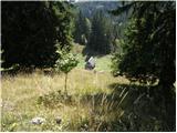 56
56 57
57 58
58 59
59 60
60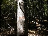 61
61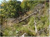 62
62 63
63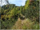 64
64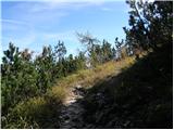 65
65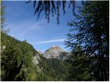 66
66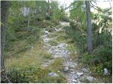 67
67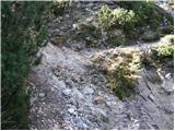 68
68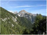 69
69 70
70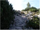 71
71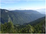 72
72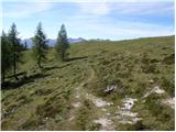 73
73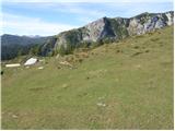 74
74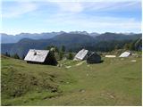 75
75
Discussion about the trip Stara Fužina - Planina Krstenica (via planina Zgornja Grintovica)
|
| grega_p13. 10. 2019 |
Today I did the trail in the opposite direction, I reached Planina Krstenica from Vogar via Blato. Larches are slowly turning yellow up top, so it's the right moment to visit this idyll if you have time.
The upper part of the trail in the description (where the trail crosses the torrent gully) is indeed a bit uncomfortable as it's full of scree, but with a little caution it will be fine. Also in the forest above Zg. Grintovica the trail gets lost due to leaves and you need to be careful, but nothing serious. I didn't notice that other junction except the trail past the trough - I was obviously already thinking more about the valley...
Also, since these days they're felling a lot of trees because of the bark beetle, there are quite a few dug-up sections and muddy parts.
Best, Grega
|
|
|
To post a comment you must log in:
If you do not yet have a username, you must first
register.