Stara Fužina - Planina Vodični vrh
Starting point: Stara Fužina (573 m)
| Latitude/Longitude: | 46,29030°N 13,88680°E |
| |
Walking time: 2 h 45 min
Difficulty: easy marked way
Elevation gain: 921 m
Elevation difference along the route: 930 m
Map: Triglav 1:25.000
Recommended equipment (summer):
Recommended equipment (winter): ice axe, crampons
Views: 7.391
 | 2 people like this post |
Access to starting point:
We drive to Bohinjska Bistrica, then follow the signs for Lake Bohinj. Upon arriving at Lake Bohinj in the settlement of Ribčev Laz, we turn right towards Stara Fužina. The route continues past the Church of St. John the Baptist, and soon we reach the settlement of Stara Fužina, from where we follow the signs for the Mostnica Gorges and the pastures Blato, Vogar and Voje. Above the settlement of Stara Fužina, we arrive at the start of the toll road to the pastures Blato, Vogar and Voje, where we park at the paid parking lot.
Route description:
From the parking lot, we continue along the asphalt road towards Planina Blato, Planina Vogar and Voje Valley. The initially fairly steep road soon flattens and leads us to a sign at a junction.
At the sign, we leave the asphalt road and continue left towards Planina Vogar and Pršivec. We first ascend transversely across a scenic pasture, then the path enters the forest, climbing through it along a stony cart track. In a few long serpentines, we ascend to a higher level where the path levels out somewhat. A little further, we notice signs for the NOB monument, located at a beautiful viewpoint and paraglider take-off site, from which we have a nice view of Lake Bohinj, Rudnica and the Bohinj-Tolmin Mountains, sometimes called the Lower Bohinj Mountains.
From the viewpoint, we return to the marked path, which quickly brings us to the eastern edge of Planina Spodnji Vogar. The path ahead mostly ascends gently across meadows, and along the way we notice a large number of former shepherds' huts, now mostly converted into weekend cottages. We follow this path, which continues gently ascending, to Kosijev dom na Vogarju, which we reach after a few minutes of further walking.
From the hut, we continue right towards Pršivec and Planina pri Jezeru, along a wide cart track that passes a small cross and leads to a marked junction.
At the junction, we continue left towards Planina Vodični vrh, Črno jezero and Pršivec (right Planina pri Jezeru). The path soon enters the forest after the junction and ascends transversely further on. We follow the path to Pršivec for about another five minutes, then a marked path branches right to Planina Vodični vrh (the branch is not specially marked but is signposted). We continue along this path, which steeply ascends to the nearby gravel road. When we step onto the road, we follow it left, but walk only a few dozen steps along it, then continue right onto a relatively steep cart track. We walk briefly on the track, then rather faded markings direct us slightly left onto the marked footpath. Along the path, we ascend more steeply through the forest, then the trail flattens and crosses an old tractor track. We ascend gently for a few more minutes, then the path leads onto a steep slope, over which we begin to ascend steeply to the left. Higher up, the trail leaves the slope into a small valley, where it becomes somewhat harder to follow. A little further on, the forest thins and the path turns first slightly left, then right into dense forest, where it completely flattens. After a few minutes of easy walking, the path begins to ascend again and leads us to a marked but less noticeable junction.
Here we leave the marked path leading further to Planina pri Jezeru and continue left along the equally marked path, along which we descend to Planina Vodični vrh in one minute of further walking.
Starting point - Vogar viewpoint 1:00, Vogar viewpoint - Kosijev dom 0:15, Kosijev dom - Planina Vodični vrh 1:30.

Photos:
 1
1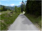 2
2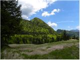 3
3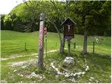 4
4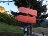 5
5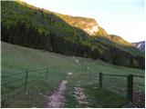 6
6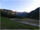 7
7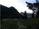 8
8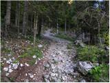 9
9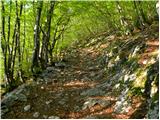 10
10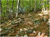 11
11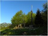 12
12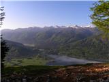 13
13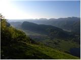 14
14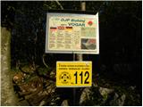 15
15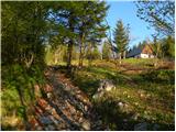 16
16 17
17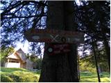 18
18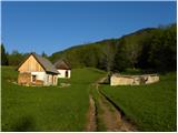 19
19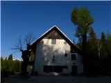 20
20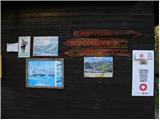 21
21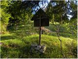 22
22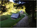 23
23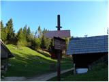 24
24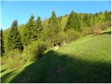 25
25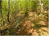 26
26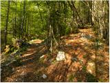 27
27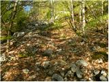 28
28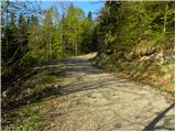 29
29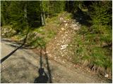 30
30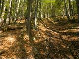 31
31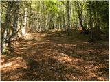 32
32 33
33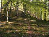 34
34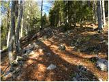 35
35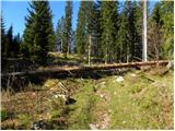 36
36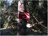 37
37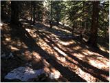 38
38 39
39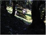 40
40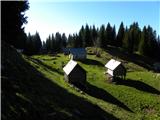 41
41
Discussion about the trip Stara Fužina - Planina Vodični vrh
To post a comment you must log in:
If you do not yet have a username, you must first
register.