Stara Fužina - Planina Zgornja Grintovica
Starting point: Stara Fužina (573 m)
| Latitude/Longitude: | 46,29030°N 13,88680°E |
| |
Walking time: 2 h 55 min
Difficulty: easy marked way
Elevation gain: 677 m
Elevation difference along the route: 705 m
Map: Triglav 1:25.000
Recommended equipment (summer):
Recommended equipment (winter): ice axe, crampons
Views: 7.134
 | 3 people like this post |
Access to starting point:
From the Ljubljana - Jesenice motorway, take the Lesce exit and follow the road towards Bled and further towards Bohinjska Bistrica. Continue driving towards Lake Bohinj (Ribčev laz), where we reach a junction and continue right towards Stara Fužina. In Stara Fužina, at the junction by the chapel, turn sharply left onto the ascending road towards planina Blato, planina Vogar and Voje valley. The road then takes us to the toll booth area, where we park at the organized paid parking lot.
Route description:
At the beginning of the parking lot, signs for the Mostnica gorges and waterfall direct us right onto a wide path, along which we arrive at Hudičev most in a few minutes. Continue straight ahead (right across the Uskovnica bridge via planina Blatce and Stara Fužina), a little further, at the information board for the Mostnica gorges, we go slightly right. At the next junction, go slightly right again (left Vogar, also possible to Voje), then we reach the place where they collect the fee for maintaining the path through the Mostnica gorges (adult entrance fee was 3 euros in June 2018).
At the mentioned place, the path splits, and we choose the left or right path. Both paths continue near the gorges (there is a side path from the right path to see the elephant, a natural feature), later they merge into one path, along which we ascend to the gravel road. Follow the road to the right, along which we quickly reach Planinska koča na Vojah.
Continue along the road that runs through the Voje valley, following the signs for the Mostnica waterfall. A little further, the road splits, and we can continue left along the slightly shorter road with signs for Velo polje, or right along the slightly longer path that leads past the Mostnica waterfall.
Near the waterfall, at the head of the Voje valley, both paths merge, and we follow the marked path towards Triglav and Vodnikov dom na Velem polju.
The fairly wide path further enters dense forest and ascends above the waterfall, which we can partially see below the path, then the path turns left and ascends in a few serpentines to the west, leading us along relatively steep slopes. At an altitude of approximately 1150 meters, the path levels out, a little further it takes us out of the forest to planina Spodnja Grintovica, where there is a water trough that is open only in the summer months.
On the planina, we notice the inscription "Pl. Grintovica", which directs us left to the water trough (straight Triglav and Velo polje), but it is better to continue along the left edge of the planina to the nearby cairn, where we notice the continuation of the path towards planina Zgornja Grintovica. Here the path turns sharply left, just a few tens of meters further we join the path that leads past the aforementioned water trough. We continue along the wide path, which after a little more than ten minutes of further walking takes us out of the forest to planina Zgornja Grintovica.
Stara Fužina - Koča na Vojah 0:45, Koča na Vojah - zatrep doline Voje 0:35, zatrep doline Voje - planina Spodnja Grintovica 1:20, planina Spodnja Grintovica - planina Zgornja Grintovica 0:15.

Along the route: Hudičev most (572m), Korita Mostnice (595m),
Koča na Vojah (690m), Zatrep doline Voje (750m), Planina Spodnja Grintovica (1156m)
Photos:
 1
1 2
2 3
3 4
4 5
5 6
6 7
7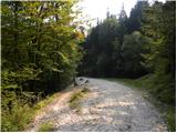 8
8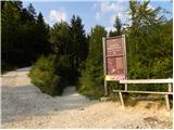 9
9 10
10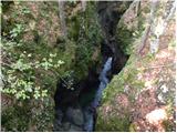 11
11 12
12 13
13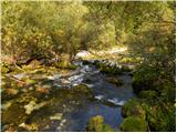 14
14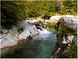 15
15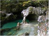 16
16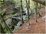 17
17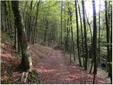 18
18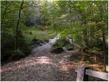 19
19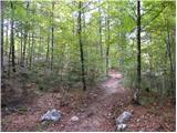 20
20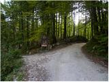 21
21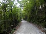 22
22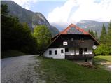 23
23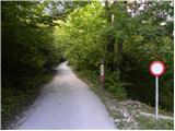 24
24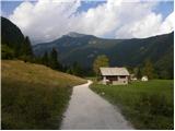 25
25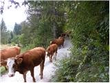 26
26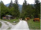 27
27 28
28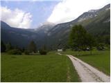 29
29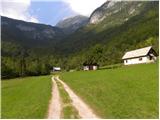 30
30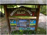 31
31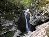 32
32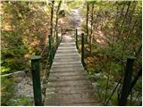 33
33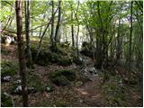 34
34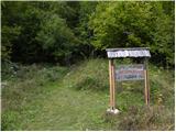 35
35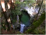 36
36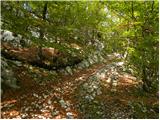 37
37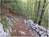 38
38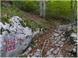 39
39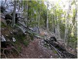 40
40 41
41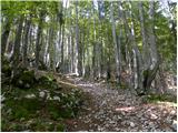 42
42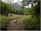 43
43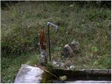 44
44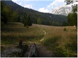 45
45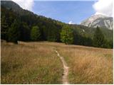 46
46 47
47 48
48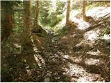 49
49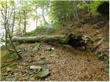 50
50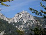 51
51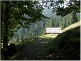 52
52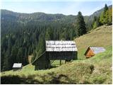 53
53
Discussion about the trip Stara Fužina - Planina Zgornja Grintovica
|
| saso.alpinist21. 09. 2008 |
This alpine pasture is really beautiful. I don't know why some people don't like it too much. If you stayed there just one weekend in good weather and socialized with the renters of the local huts (I'm one of them  ) you would soon change your opinion. On Grintovica, only the greatest legends meet... that is, only the best company... and if you ask them about the history of this pasture or some local mountaineering stories, they will gladly answer your questions and invite you for tea, coffee, a drink of something at the time,... and if you stay longer, they'll probably invite you to a small bonfire and of course a meal prepared over the fire. ) you would soon change your opinion. On Grintovica, only the greatest legends meet... that is, only the best company... and if you ask them about the history of this pasture or some local mountaineering stories, they will gladly answer your questions and invite you for tea, coffee, a drink of something at the time,... and if you stay longer, they'll probably invite you to a small bonfire and of course a meal prepared over the fire.
During storms, we've encountered foreigners several times who didn't know where to go anymore, so we welcomed them nicely, fed them, dried them, some even stayed overnight,... and all were really very satisfied and returned to this pasture again.
From the pasture, there are also numerous paths to the surrounding hills... e.g. Krstenica, Voje, Blato, Velo Polje, Vodnikov dom and many others.
The pasture also offers a magnificent view of most of the southern Bohinj Alps, Uskovnica, Tošč, and Triglav is visible too.
On Grintovica, we also have the second purest water in Slovenia, which springs below Krstenica.
The pasture is occasionally visited by Bohinj shepherds' goats, which cross the pasture either when driving livestock to higher pastures or before the start of Kravji bal in Bohinj.
But Attention! Guys from TNP (Triglav National Park) also come here, watching for hazards and nuisances that hikers or "residents of Grintovica pasture" might cause. So please do not litter in nature and do not light fires in unsecured places. Also leave protected flowers in peace and do not scare mountain animals.
Otherwise, on Grintovica we live by one principle: "Soul, eat, drink and be of good cheer!"
Enjoy your trip!
Best regards,
Sašo
|
|
|
|
| mukica22. 09. 2008 |
Hope we see each other soon...
|
|
|
To post a comment you must log in:
If you do not yet have a username, you must first
register.