Stara Fužina - Triglav (via Planika and Triglavska škrbina)
Starting point: Stara Fužina (573 m)
| Latitude/Longitude: | 46,29030°N 13,88680°E |
| |
Route name: via Planika and Triglavska škrbina
Walking time: 7 h 45 min
Difficulty: very difficult marked way
Elevation gain: 2291 m
Elevation difference along the route: 2380 m
Map: Triglav 1:25.000
Recommended equipment (summer): helmet, self belay set
Recommended equipment (winter): helmet, self belay set, ice axe, crampons
Views: 26.115
 | 1 person like this post |
Access to starting point:
From the Ljubljana-Jesenice motorway, take the Lesce exit and follow the road towards Bled and further towards Bohinjska Bistrica. Continue driving towards Lake Bohinj (Ribčev laz), where we reach a junction, continuing right towards Stara Fužina. In Stara Fužina, at the junction by the chapel, turn sharply left onto the ascending road towards planina Blato, planina Vogar and dolina Voje. Follow this road to the parking lot where they collect road toll and parking fee.
Route description:
At the beginning of the parking lot, signs for the Mostnica gorges and waterfall direct us right onto a wide path, along which we reach Hudičev most in a few minutes. Continue straight ahead (right across the bridge Uskovnica via planina Blatce and Stara Fužina), a little further, at the information board for the Mostnica gorges, go slightly right. At the next junction, go slightly right again (left Vogar, also possible to Voje), then we arrive at the place where they collect the fee for maintaining the path through the Mostnica gorges (adult entrance fee was 3 eur in June 2018).
At the mentioned place, the path splits, and we choose the left or right path. Both paths continue near the gorges (there is a side path off the right path to see the elephant, a natural feature), later they merge into one path, along which we climb to the gravel road. Follow the road to the right, along it we quickly reach the Planinska koča na Vojah.
Continue along the road that continues through the Voje valley, but we follow the signs for the Mostnica waterfall. A little further, the road splits, and we can continue left along the slightly shorter road with signs for Velo polje, or right along the path a few minutes longer that leads past the Mostnica waterfall.
Near the waterfall, at the head of the Voje valley, both paths merge, and we follow the marked path towards Triglav and Vodnikov dom na Velem polju.
The fairly wide path ahead enters dense forest and climbs above the waterfall, which we can partially see below the path, then the path turns left and climbs westward in a few serpentines, leading us along relatively steep slopes. At an altitude of about 1150 meters, the path levels out, a little further it takes us out of the forest to planina Spodnja Grintovica, where there is a water trough that is open only in the summer months.
At the beginning of the pasture, a path branches left towards planina Zgornja Grintovica and planina Krstenica, but we continue straight and on the upper part of the pasture re-enter the forest, the path ahead is narrower and no longer resembles a mule track. A steeper ascent follows through the forested slopes of Tisovec, which is a side ridge of the Stogov ridge, when higher up the path crosses to the northern slopes of the mentioned hill, it levels out and enters the indistinct valley Jurjevčeva vrtača.
Here, at the beginning of the valley, a fairly inconspicuous path branches right downward towards the former planina Vrtača.
Continue along the marked path that leads us through gradually sparser forest, higher up the path turns right and after a few more minutes of walking brings us to a poorly marked junction in the area called Razorje, from which we continue right towards Vodnikov dom na Velem polju (slightly left planina pod Mišelj vrhom).
A steeper ascent follows again along the indistinct ridge of the lesser-known peak Na Zagonu (1819 m), then the path levels out and brings us to a marked junction where we join the path from Pokljuka or Uskovnica.
Continue left towards Vodnikov dom (sharply left Velo polje, right Pokljuka) and after about 20 minutes crossing the slopes of Tosca we reach Vodnikov dom na Velem polju, where there is the next junction.
Here too, continue straight towards Triglav, the path begins to ascend transversely along the slopes of Vernar, higher up it also becomes technically demanding. Some traversing follows, aided by a fixed cable, higher up we reach a steep drop where we climb stone steps with the help of numerous pegs and a fixed cable.
The path ahead levels out, the slope becomes less steep and near Konjsko sedlo also somewhat more grassy.
We easily descend to Konjsko sedlo, from the marked junction at the saddle we head left towards Dom Planika pod Triglavom (straight Triglavski dom na Kredarici and Dom Valentina Staniča pod Triglavom, right Krma) and begin a fairly steep ascent westward. For a while we approach Mokra skala (2266 m), then the path turns right and enters an indistinct ridge, where it temporarily levels out. The marked path higher up bypasses a small cirque on the right side, then begins to turn left. Another about ten minutes of ascent follows with nice views of the Triglav massif and surrounding peaks, and we reach Dom Planika pod Triglavom.
At the hut, head onto the path towards Triglav via Triglavska škrbina, also called Gorjanska pot. The path ahead first almost horizontally crosses the high mountain cirque Triglavski kot, where snow persists for most of the year. On the other side of the cirque, the path climbs through scree to the start of the climbing section. The path steeply ascends with the help of pegs and fixed cables. The well-protected path is exposed to falling rocks, so a helmet is mandatory! The last meters below Triglavska or Bovška škrbina are less steep but no less dangerous. Ascending on loose sand requires great caution to avoid slipping. At the škrbina, where the path from Dolič and Plemenic joins, continue right upward along the steep but well-protected path. After a few minutes, the steepness eases, and only a few minutes of ascent along the summit slope of Triglav await us to the top.
Stara Fužina - Koča na Vojah 0:45, Koča na Vojah - zatrep doline Voje 0:35, zatrep doline Voje - planina Spodnja Grintovica 1:20, planina Spodnja Grintovica - Razorje 1:25, Razorje - Na Zagonu 0:25, Na Zagonu - Vodnikov dom 0:20, Vodnikov dom - Konjsko sedlo 0:30, Konjsko sedlo - Planika 1:00, Planika - Triglavska škrbina 0:50, Triglavska škrbina - Triglav 0:35.

Along the route: Hudičev most (572m), Korita Mostnice (595m),
Koča na Vojah (690m), Zatrep doline Voje (750m),
Planina Spodnja Grintovica (1165m), Jurjevčeva vrtača (1407m), Razorje (1677m), Na Zagonu (1819m),
Vodnikov dom (1817m), Konjsko sedlo (2020m),
Dom Planika (2401m), Triglavska škrbina (2655m)
Photos:
 1
1 2
2 3
3 4
4 5
5 6
6 7
7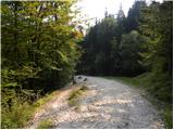 8
8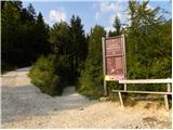 9
9 10
10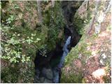 11
11 12
12 13
13 14
14 15
15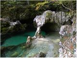 16
16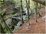 17
17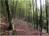 18
18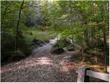 19
19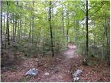 20
20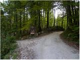 21
21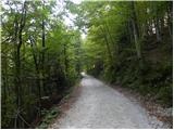 22
22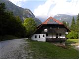 23
23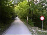 24
24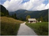 25
25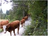 26
26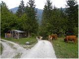 27
27 28
28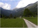 29
29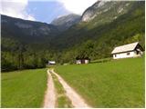 30
30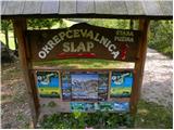 31
31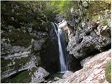 32
32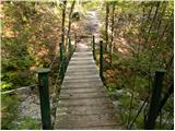 33
33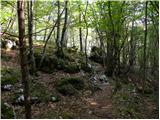 34
34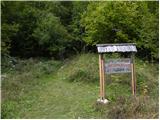 35
35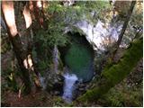 36
36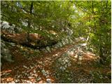 37
37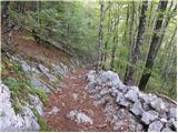 38
38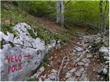 39
39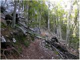 40
40 41
41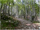 42
42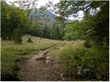 43
43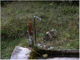 44
44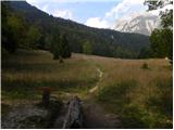 45
45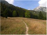 46
46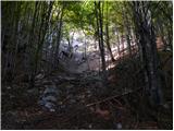 47
47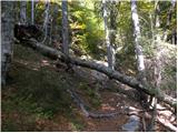 48
48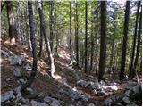 49
49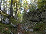 50
50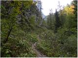 51
51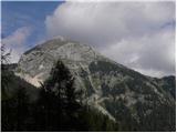 52
52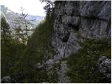 53
53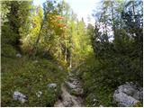 54
54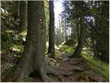 55
55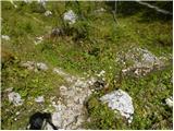 56
56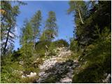 57
57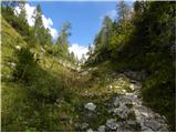 58
58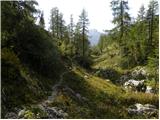 59
59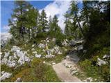 60
60 61
61 62
62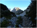 63
63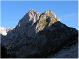 64
64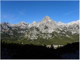 65
65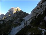 66
66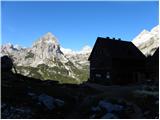 67
67 68
68 69
69 70
70 71
71 72
72 73
73 74
74 75
75 76
76 77
77 78
78 79
79 80
80 81
81 82
82 83
83 84
84 85
85 86
86 87
87 88
88 89
89 90
90 91
91 92
92 93
93 94
94 95
95 96
96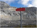 97
97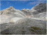 98
98 99
99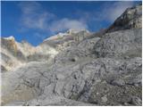 100
100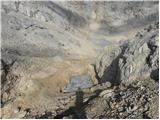 101
101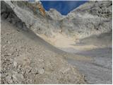 102
102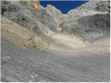 103
103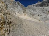 104
104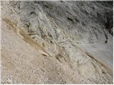 105
105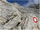 106
106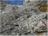 107
107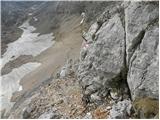 108
108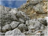 109
109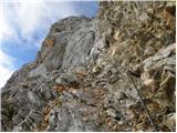 110
110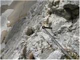 111
111 112
112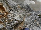 113
113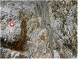 114
114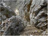 115
115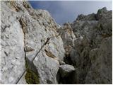 116
116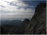 117
117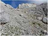 118
118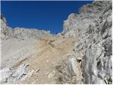 119
119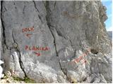 120
120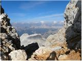 121
121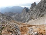 122
122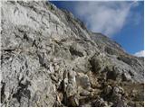 123
123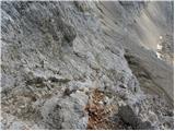 124
124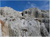 125
125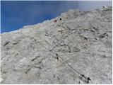 126
126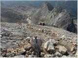 127
127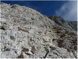 128
128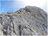 129
129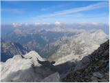 130
130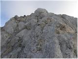 131
131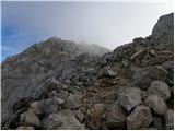 132
132 133
133
Discussion about the trip Stara Fužina - Triglav (via Planika and Triglavska škrbina)
|
| lverwulgen16. 02. 2015 |
Hey,
This summer, we would like to do this ascent. We have no climbing experience, but we are sporty and want some challenge. Is it still suitable for us? & Cabins where you can stay, do you have to book them or can you just go if you want to sleep. I hope someone can help me. & Sorry if there are errors in the text, but I translated it with a program. Thanks in advance!
|
|
|
|
| VanSims16. 02. 2015 |
We are happy to provide you with information. Triglav ascent is a challenge but does not require alpinistic climbing. The easiest route starts at Planika, which becomes exposed towards the top and is not for the vertiginous. It is an easier (A/B) via ferrata. The route from Dolič is also not so difficult. The route from Kredarica is somewhat less easy, exposed but very well secured and very popular.
If you are experienced, we warmly recommend the slightly harder (climbing up to I) route via Plemenice or the other route from Planika (Gorjanska).
Cabins where you can stay also exist! (Dolič, Planika, Kredarica, Staničeva). Booking is highly recommended in high season (July, August) as there are many people. In September it's not so crowded, if you want fewer people. Later snow falls and winter gear is needed until May. In June the southern side is usually snow-free.
Hoping your program understands this, best regards and welcome to our country!
|
|
|
|
| jprim16. 02. 2015 |
@vanSims
I'm just wondering ... it's still far from summer.
|
|
|
|
| slamca16. 02. 2015 |
With such a comment - response one can only seriously wonder. Are we really such morons? 
|
|
|
|
| VanSims16. 02. 2015 |
@slamca: I just tried to adapt to his program. When he copies this into it, I think he'll get the best translation into his language.
|
|
|
|
| smatjaz16. 02. 2015 |
Bemtiš, wouldn't it be easier to do it all in English, which all translators translate best 
|
|
|
|
| ločanka17. 02. 2015 |
I laughed at Vansimses's description! It's for laughs!
|
|
|
|
| valerija11217. 02. 2015 |
Why not choose the route from Pokljuka instead?
Is it really necessary from Bohinj and thus gain the greatest elevation difference?
|
|
|
|
| redbull17. 02. 2015 |
 good description, can't go without laughter good description, can't go without laughter
|
|
|
To post a comment you must log in:
If you do not yet have a username, you must first
register.