Stari trg (Pilštanj) - Debeli vrh (Bohor)
Starting point: Stari trg (Pilštanj) (299 m)
| Latitude/Longitude: | 46,09869°N 15,52284°E |
| |
Walking time: 3 h 10 min
Difficulty: easy marked way
Elevation gain: 622 m
Elevation difference along the route: 700 m
Map:
Recommended equipment (summer):
Recommended equipment (winter): ice axe, crampons
Views: 53
 | 1 person like this post |
Access to starting point:
a) We drive to Šentjur, then follow the signs for Podsreda and Planina pri Sevnici. At the end of Šentjur we turn left towards Podsreda, then we drive along a rather winding road to the settlement Lesično, from where we follow the signs for Kozje. When Lesično ends we will come to a small gorge, where on the left side of the road we will notice a gravel rest area with a table, benches and trash bins next to it. We park here.
b) From the Brežice - Podčetrtek road at the edge of the settlement Bistrica ob Sotli we turn left (right from the direction of Podčetrtek) towards Podsreda. We bypass the center of Podsreda on the right side, then we drive to the settlement Kozje and continue along the main road towards Lesično. Before Lesično we reach a junction, where the road to Pilštanj branches off to the right (this part is called Stari trg), we continue straight for about 500 meters and then on the right we notice a larger gravel parking lot, where we park.
c) From the direction of Sevnica and Krško we drive to Brestanica, then follow the signs for Podsreda. A climb follows, then a descent into Podsreda, where at the end of the settlement we turn left towards Šentjur and Kozje. When we reach Kozje we continue along the main road towards Lesično. Before Lesično we reach a junction, where the road to Pilštanj branches off to the right (this part is called Stari trg), we continue straight for about 500 meters and then on the right we notice a larger gravel parking lot, where we park.
Route description:
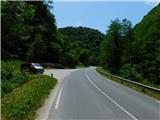
From the parking lot we continue on foot along the main road towards Kozje. Since there is no sidewalk along the road, caution is required on this approximately 500-meter-long section. When the valley widens a little, we reach the marked road junction for Pilštanj (hamlet Stari trg). Since there are no suitable places for safe parking right at the junction, the decision to park at the previously mentioned organized parking lot is the best choice.
At this junction we leave the main road and go right towards Bredič and Koče na Bohorju. Immediately after the junction we cross Bistrica over a bridge, then bypass the nearby houses on the right side. We bypass the last house on the right along an overgrown mountain path that crosses a strip of forest, then it leads us to a meadow, over which we ascend towards its upper part; the path is not very well traceable across the meadow. When we return to the forest the path becomes clearly visible, but it remains overgrown. Next comes crossing an older clearing overgrown with shrubs, from which we get a view of the hills on the left bank of Bistrica.
The path ahead returns to the forest, the path gradually becomes less overgrown, but still poorly trodden. When we reach the ridge higher up the path turns right and begins to ascend steeply along the ridge; during the ascent we temporarily get a view of the forested ridge and the summit of Bredič. When the steepness eases we quickly leave the forest and then cross a meadow without major changes in elevation, bypassing a hunting observation post on the right side.
On the other side of the meadow we step onto a forest road, which we follow left uphill; higher up at several junctions we follow the marked directions. When we reach a somewhat wider gravel road we only cross it and continue following the marked path that continues along a cart track. For a few minutes we ascend moderately along a rather overgrown cart track and reach a marked fork, where we go right towards Bohor (left Kozje and Bredič).
A moderate descent follows along a quite overgrown cart track, then lower down we cross a forest road once more. When we return to the road we continue along it to a junction, where we continue on the slightly right road; markings continue along it (here, if we continue sharply left we can return to Kozje). In the continuation we begin to ascend again; at several junctions we follow the markings, and higher up we join the path from Lesično.
Further on the path also leads us along forest roads, where we follow the markings; the path also leads us past the Tovornik homestead, to which we descend slightly.
After the homestead we go slightly right and begin to ascend again; higher up we keep to the left directions.
Higher up a short transverse ascent to the left follows; when we reach the ridge we are already at Brest, where there is also a marked fork.
We continue right towards Koča na Bohorju, where we begin to ascend gently through the forest; in the continuation we cross the slopes of Debeli vrh in a slight ascent to the left. When the path leads us to the forested ridge west of Debeli vrh, we go sharply right from the fork towards Debeli vrh (straight Koča na Bohorju) onto a poorer path.
Initially still well traceable, the path soon after the fork begins to disappear; along the path we notice only some quite faded markings. We then follow this path, which later more resembles easier off-trail terrain, to Debeli vrh, which we recognize by the metal sign with the inscription Debeli vrh.
Stari trg - razpotje Vini vrh 1:00, razpotje Vini vrh - Log nad Lesičnim 0:25, Log nad Lesičnim - Brest 1:20, Brest - Debeli vrh 0:25.

Along the route: Pašenca (530m), Vini vrh (636m), Log nad Lesičnim (595m),
Brest (Bohor) (808m), Odcep za Debeli vrh (873m)
Photos:
 1
1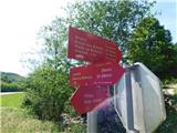 2
2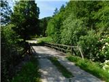 3
3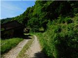 4
4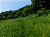 5
5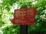 6
6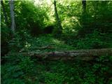 7
7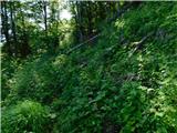 8
8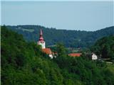 9
9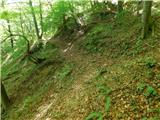 10
10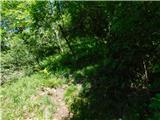 11
11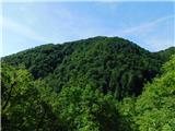 12
12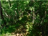 13
13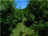 14
14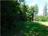 15
15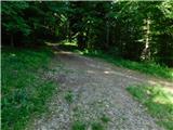 16
16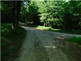 17
17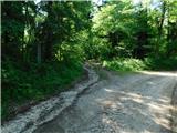 18
18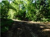 19
19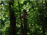 20
20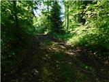 21
21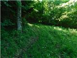 22
22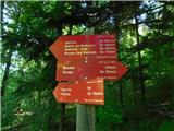 23
23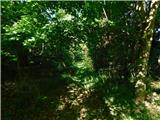 24
24 25
25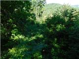 26
26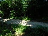 27
27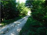 28
28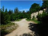 29
29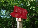 30
30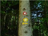 31
31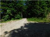 32
32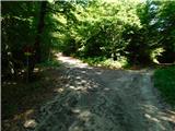 33
33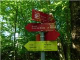 34
34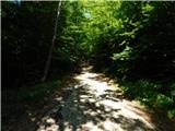 35
35 36
36 37
37 38
38 39
39 40
40 41
41 42
42 43
43 44
44 45
45 46
46 47
47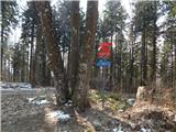 48
48 49
49 50
50 51
51 52
52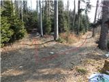 53
53 54
54 55
55 56
56 57
57 58
58 59
59 60
60 61
61
Discussion about the trip Stari trg (Pilštanj) - Debeli vrh (Bohor)
To post a comment you must log in:
If you do not yet have a username, you must first
register.