Stomaž - Koča Antona Bavčerja na Čavnu
Starting point: Stomaž (285 m)
| Latitude/Longitude: | 45,89964°N 13,85666°E |
| |
Walking time: 2 h 15 min
Difficulty: easy marked way
Elevation gain: 957 m
Elevation difference along the route: 957 m
Map: Goriška 1:50.000
Recommended equipment (summer):
Recommended equipment (winter): ice axe, crampons
Views: 13.180
 | 2 people like this post |
Access to starting point:
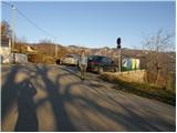
We drive on the highway from Razdrtega towards Nova Gorica or vice versa and go to the exit Ajdovščina. Then at the crossroad, we turn left in the direction of Nova Gorica and we drive to the village Cesta and immediately after the village we turn right in the direction of Stomaž. We follow the road, which starts ascending, to a smaller parking lot near the cemetery in the village Stomaž.
Route description:
From a smaller parking lot we continue on the road past houses ahead. After a few minutes of walking, the first asphalt, then macadam road brings us to the spot, where a marked footpath branches off to the right towards Čavn. The marked path at the beginning runs on a cart track which soon changes into a footpath and is moderately ascending through the forest. The path ahead brings us to a larger clearing, in the middle of which we notice a hunting observatory. After that, the path again passes into the forest, where we are for quite some time moderately ascending. And the path at Pihalo (small cave and tied rock) starts ascending steeper on mostly poorly marked path. The steepness of the path decreases, when the path brings us on unvegetated plateau terrain of Mala gora, where there is also a crossing.
Here we continue straight in the direction of Čavn (left mountain hut on Mala gora 10 minutes) on a quite overgrown path in the summertime. After that, the path crosses a lane of forest and a little higher it joins the path from Lokavec. Here we continue left and we follow the path which in a few minutes brings us to the mountain hut Dom na Čavnu.

Photos:
 1
1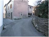 2
2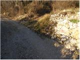 3
3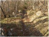 4
4 5
5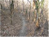 6
6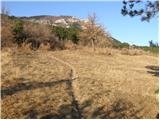 7
7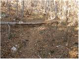 8
8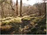 9
9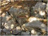 10
10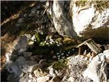 11
11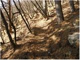 12
12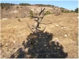 13
13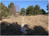 14
14 15
15 16
16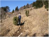 17
17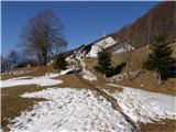 18
18
Discussion about the trip Stomaž - Koča Antona Bavčerja na Čavnu
|
| Gost17. 02. 2008 |
Quite a steep ascent, but a wonderful trip. Although the temperature was around freezing all the time I didn't feel cold. Due to the mild winter we will hike all the hills around Ajdovščina this year. All that we have done so far have proven to be wonderful. I recommend.
Marko
|
|
|
To post a comment you must log in:
If you do not yet have a username, you must first
register.