Štore - Sveti Lovrenc (Kompole)
Starting point: Štore (240 m)
| Latitude/Longitude: | 46,22130°N 15,32150°E |
| |
Walking time: 30 min
Difficulty: easy marked way
Elevation gain: 75 m
Elevation difference along the route: 95 m
Map: Posavsko hribovje Boč - Bohor 1:50.000
Recommended equipment (summer):
Recommended equipment (winter):
Views: 2.565
 | 1 person like this post |
Access to starting point:
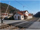
Štore is accessible ideally with the help of the railway. On the road... you leave the highway in Celje and practically in the center of Celje go towards Štore or Šentjur. You park the car near the Štore railway station, where there are enough parking spots available and there is also the beginning of the marked mountain path.
Route description:
The beginning of the path is at the railway station in Štore. We go through Voglajna, where a signpost immediately points us left a few tens of elevation metres uphill. At the first structure immediately left and we follow the mountain path through the forest directly above Voglajna. When we get out of the forest in the settlement Draga we follow the meadow path also directly above Voglajna and further on the asphalt road to the bridge over the river Voglajna or to the crossing named Opoka. Left over the bridge goes path for Dramlje, Konjiška gora..., straight ahead to Resevna, while we continue sharply right in the forest on a narrower forest path, partly road towards Kompole or Sv. Lovrenc.
At the crossing, we have also reached the XIV Division trail and after a few hundred metres we leave the forest and beside the equestrian ranch we step on an asphalt connection and continue left in a moderate ascent by the sports field and tourist homestead. A gentle descent follows and we soon reach the center of the settlement with the church of St. Lovrenc and branch school.

Photos:
 1
1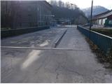 2
2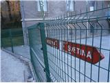 3
3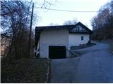 4
4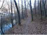 5
5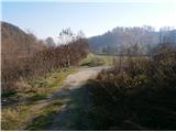 6
6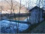 7
7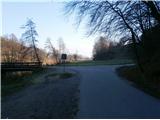 8
8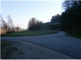 9
9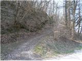 10
10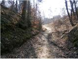 11
11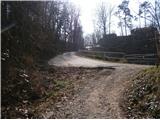 12
12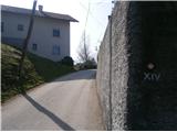 13
13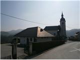 14
14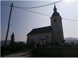 15
15
Discussion about the trip Štore - Sveti Lovrenc (Kompole)
|
| bruny27. 12. 2014 |
Along the described path late afternoon today higher into the world of Celje hills/eastern line. Pleasant miniature path, suitable for everyone. The description from last year was done rather ,,so-so,, the material was available in photos and the idea for a short undemanding path, into the basic gravelly world above Voglajna. ,,Here and there,, I use it lately for continuations higher... Today quite concretely and of course in continuation, dark - evening. Maybe something more!? in the conditions...
|
|
|
|
| bruny15. 02. 2015 |
Today descent on the described path. Pleasant descent, because my buddy and I had already quite a mileage behind us...Also the descent on the described path directly above Voglajna is certainly interesting and an excellent starting point for a quick return home by train.
|
|
|
|
| bruny6. 02. 2016 |
Along the described trail today afternoon in a short activity between the Voglajna river and the hills above Voglajna... It would also be an excellent start for higher into the world of Celje hills but today only Voglajna hills... Best regards
|
|
|
|
| bruny20. 10. 2025 15:32:27 |
Today ascent along the described path. It was a nice autumn day with some sun and cloudiness...
|
|
|
To post a comment you must log in:
If you do not yet have a username, you must first
register.