Strahomer - Krim (via Kramarca)
Starting point: Strahomer (309 m)
| Latitude/Longitude: | 45,94240°N 14,48780°E |
| |
Route name: via Kramarca
Walking time: 2 h 10 min
Difficulty: easy marked way
Elevation gain: 798 m
Elevation difference along the route: 798 m
Map: Ljubljana - okolica 1:50.000
Recommended equipment (summer):
Recommended equipment (winter):
Views: 23.846
 | 1 person like this post |
Access to starting point:
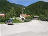
From the southern Ljubljana bypass, we head to the Rudnik exit and follow the road ahead in the direction of Ig. At the intersection in Ig, we continue right in the direction of Iška vas, and then in the village Staje we continue right towards the village Vrbljene. In Vrbljene we continue left towards the village Strahomer, and there on a well-maintained asphalt parking lot by the river Iška we also park.
Route description:
From the parking lot, we head onto the asphalt road, which crosses the river Iška over a bridge. The road ahead begins to ascend gently and takes us past the church to a marked junction, where we continue straight in the direction of Krim over Kramarca (right Krim over Strmec).
We continue the path along a gentle cart track that crosses the slopes towards the south. After a few minutes of walking, the cart track turns slightly to the right and begins to ascend more steeply. Higher, the aforementioned cart track turns sharply to the right, but we leave it right at that spot and continue left along a somewhat narrower cart track (the aforementioned junction is somewhat poorly marked). We continue the ascent along an occasionally quite overgrown cart track, which twice crosses the power line and then returns to the forest.
Higher, the path brings us to an intersection of forest roads, where we continue straight in the direction of Krim. We follow the aforementioned road for only about 100 m, then continue right along the marked footpath, which begins to ascend above the village Gornji Ig (among the treetops we get some views of the aforementioned village). The path ascends somewhat more steeply higher up and brings us to a forest road, which we follow to the left. After a few steps along the aforementioned road, we reach an excellently marked junction, where we continue sharply right along the ascending cart track in the direction of Krim (straight ahead Iški Vintgar and Iška vas). There follows a traverse ascent along a wide cart track, which higher up brings us to a large parking lot or turning area below the summit of Krim. From here we continue past the cross along the increasingly panoramic mountain path, along which we ascend to the summit in less than 5 minutes of further walking.

Photos:
 1
1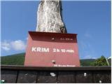 2
2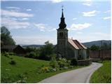 3
3 4
4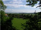 5
5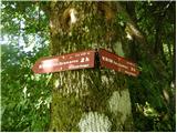 6
6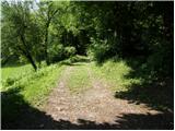 7
7 8
8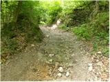 9
9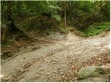 10
10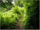 11
11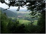 12
12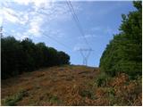 13
13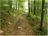 14
14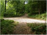 15
15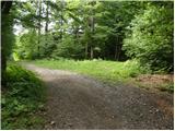 16
16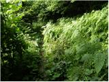 17
17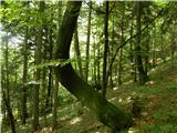 18
18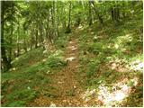 19
19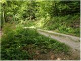 20
20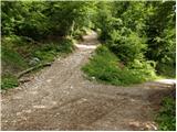 21
21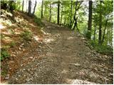 22
22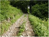 23
23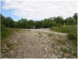 24
24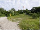 25
25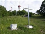 26
26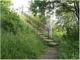 27
27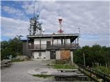 28
28 29
29
Discussion about the trip Strahomer - Krim (via Kramarca)
|
| erikaleon3. 03. 2011 |
went up the described path, returned via Strmec
|
|
|
|
| BlazG15. 10. 2013 |
On 24.8.2013 went on this path, super path, but the second half is quite steep, yet it can be fully run both on ascent and descent. View is super, but the antennas are indeed a bit disturbing. At least to me. Since I don't know how to edit the GPS track, you can view it here: http://www.strava.com/activities/77116015
|
|
|
|
| Mikens23. 06. 2019 |
IMPORTANT!
I ask all hikers to keep their dogs on a leash! (bear area.)
Best hunting regards.
Klement Mal, LD Tomišelj
|
|
|
To post a comment you must log in:
If you do not yet have a username, you must first
register.