Stranska vas (Pri Jurčku) - Koča Klobuk
Starting point: Stranska vas (Pri Jurčku) (360 m)
| Latitude/Longitude: | 46,05970°N 14,42950°E |
| |
Walking time: 22 min
Difficulty: easy unmarked way
Elevation gain: 73 m
Elevation difference along the route: 82 m
Map: Ljubljana - okolica 1:50.000
Recommended equipment (summer):
Recommended equipment (winter):
Views: 1.990
 | 1 person like this post |
Access to starting point:
A) From the highway Ljubljana - Koper, we take the exit Brezovica, then continue driving towards Dobrova. From the roundabout in Dobrova, we continue in the direction of Polhov Gradec, then after 100 m right towards Šentvid. When we arrive in Stranska vas, at the intersection in the middle of the village we turn right, then after a few hundred meters slightly left in the direction of A. Škulj and open-door farm Pri Jurčku. 50 m further we go left again, then we drive to a smaller parking lot which is located above the open-door farm Pri Jurčku (for parking, first ask at the mentioned farm).
B) First we drive to Horjul, then continue driving towards Dobrova. When we arrive in the mentioned place, from the roundabout we turn in the direction of Polhov Gradec, then after 100 m right towards Šentvid. When we arrive in Stranska vas, at the intersection in the middle of the village we turn right, then after a few hundred meters slightly left in the direction of A. Škulj and open-door farm Pri Jurčku. 50 m further we go left again, then we drive to a smaller parking lot which is located above the open-door farm Pri Jurčku (for parking, first ask at the mentioned farm).
C) From the Ljubljana ring road, we take the exit Ljubljana - Podutik, then continue driving towards Podutik. At the traffic light near the parish church in Podutik we continue straight, then we gradually begin to ascend towards the pass Preval. After the pass we begin to descend towards Stranska vas, where at the first intersection we continue on the main road and drive across the bridge. At the next intersection in the middle of the village (where the road temporarily narrows) left onto the side road. There follows a few hundred meters of driving, then slightly left in the direction of A. Škulj and open-door farm Pri Jurčku. 50 m further we go left again, then we drive to a smaller parking lot which is located above the open-door farm Pri Jurčku (for parking, first ask at the mentioned farm).
Route description:
From the marked parking lot, we continue on a cart track which ascends over a partly grassy slope. Just a little above the nearby pasture we cross a second asphalt road, behind it along the cart track we arrive at a belt of forest. When we enter the forest we go right and in a few steps we exit the forest, at the edge of a larger meadow. For a few minutes we ascend along the edge of a panoramic meadow, from which a nice view opens up that reaches all the way to Krim and even farther. At the end of the meadow we enter a belt of forest again, then continue straight ahead (right to the hunting cottage Lovska koča na Klobuku - path that bypasses the summit), along the path that ascends over an initially somewhat steeper grassy slope. The path soon levels out and leads us to the panoramic summit.
From the summit we continue straight, return to the forest, then after some 10 steps of further walking we arrive at the hunting cottage Lovska koča na Klobuku.
Description and pictures refer to the condition in 2015 (November).

Along the route: Klobuk (441m)
Photos:
 1
1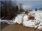 2
2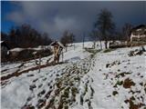 3
3 4
4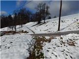 5
5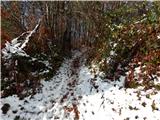 6
6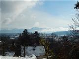 7
7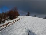 8
8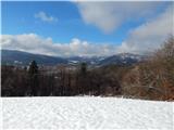 9
9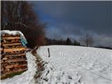 10
10 11
11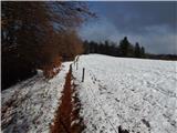 12
12 13
13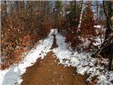 14
14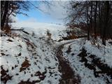 15
15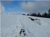 16
16 17
17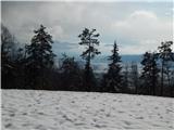 18
18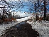 19
19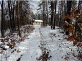 20
20 21
21
Discussion about the trip Stranska vas (Pri Jurčku) - Koča Klobuk
To post a comment you must log in:
If you do not yet have a username, you must first
register.