Straža (Jesenice) - Jelenkamen (via Kozjek)
Starting point: Straža (Jesenice) (560 m)
| Latitude/Longitude: | 46,42900°N 14,08250°E |
| |
Route name: via Kozjek
Walking time: 1 h 35 min
Difficulty: partly demanding unmarked way
Elevation gain: 536 m
Elevation difference along the route: 536 m
Map: Karavanke - osrednji del 1:50.000
Recommended equipment (summer):
Recommended equipment (winter): ice axe, crampons
Views: 5.372
 | 2 people like this post |
Access to starting point:
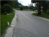
From the Ljubljana - Jesenice highway take the Lipce exit, where we turn right towards Jesenice. In the Javornik settlement at the junction with traffic lights we turn left towards the town centre. At the second traffic-light junction (by the gymnasium) we drive right back towards Tomšičeva cesta past the primary school on the left. We drive a further 2.5 km to the end of Tomšičeva ulica, or to the spot where beside the railway track there is the last bus stop below the slope. There is a large parking lot here, i.e. our starting point.
Route description:
From the parking lot we head up the asphalt road, where just below the top on the left we notice a path onto which we step and turn left along it past the gardens on the left. We soon come close to residential buildings on the left, where we cross a short track (leading only to the nearby water intake on the right). The path now rises slightly towards the power line which we soon reach. Here we turn right uphill eastwards along the gravel path.
Soon after reaching the second power line the path turns left into a short wood (where in season we encounter a wire fence), behind which we step onto the foot (hunting) path running east-west. We turn left (westwards) across the pasture, at the end of which we notice a small bench; we continue right, steeper uphill. Soon the gradient eases and the path turns left towards the exposed rocky "baba", where we can enjoy the view.
We continue into deciduous forest (westwards), where the path crossing the slope first descends slightly then leads us into a somewhat wider area of coniferous forest. Here among ferns we reach the edge where there is a junction from which we continue right along the edge for a further 40 m. When we reach another junction we turn left - west. The partly zigzagging path in this direction crosses a small gully and after some time turns left southwards uphill, at the top of which we turn right again - west. Here we walk for a short time through nice flat coniferous woodland (ploskev), some 15 m from the left edge. At the end of the flat section the path turns slightly right, from where at the same level it again crosses the slope of Jelenkamen.
Soon we reach another viewpoint on the left (balcony), but continue right uphill. After a while on the path now heading west again we encounter two zigzags (first right, straight ahead hunting path). Then, after crossing the narrow gully, quite soon we reach a marked path coming from the left (Ukova starting point), where we continue right - east uphill. After a few minutes' ascent we emerge from the forest to a spot with partial view of the valley, which does not last long. When we see some kind of bench on the left, the path turns sharply left (almost back north-westwards) and ascends moderately. Very soon the markers direct us steeply uphill due north then increasingly right eastwards, reaching the first viewpoint over the Ljubljana basin (ridge).
From here the path goes left uphill then right again to the second (main) viewpoint, located 50 m right of the marked path on rocks with a bench. From this ridge the path heading left northwards uphill steepens further and soon we encounter the first fixed cable. After 20 m of secured path the gradient first eases then the path makes its final ascent to the summit, reached in a few minutes.

Photos:
 1
1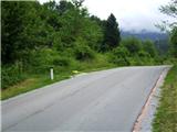 2
2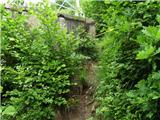 3
3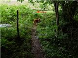 4
4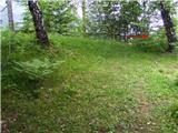 5
5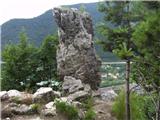 6
6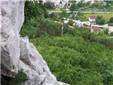 7
7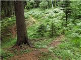 8
8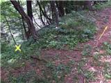 9
9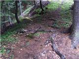 10
10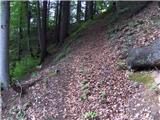 11
11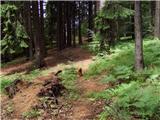 12
12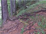 13
13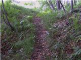 14
14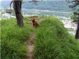 15
15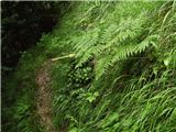 16
16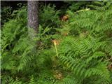 17
17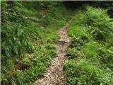 18
18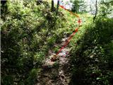 19
19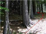 20
20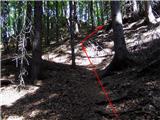 21
21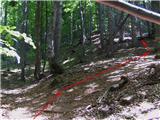 22
22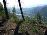 23
23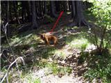 24
24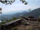 25
25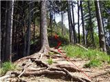 26
26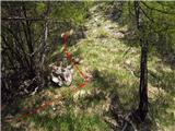 27
27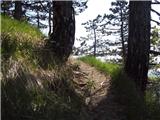 28
28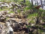 29
29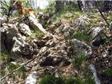 30
30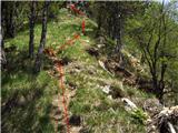 31
31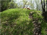 32
32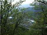 33
335036994.th.jpg) 34
34
Discussion about the trip Straža (Jesenice) - Jelenkamen (via Kozjek)
To post a comment you must log in:
If you do not yet have a username, you must first
register.