Starting point: Straža (253 m)
| Latitude/Longitude: | 46,10050°N 13,95010°E |
| |
Walking time: 3 h 30 min
Difficulty: easy marked way
Elevation gain: 826 m
Elevation difference along the route: 950 m
Map: Škofjeloško in Cerkljansko hribovje 1:50.000
Recommended equipment (summer):
Recommended equipment (winter): ice axe, crampons
Views: 4.902
 | 2 people like this post |
Access to starting point:
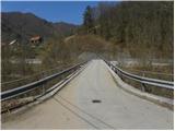
A) First, we drive to Idrija, and then we continue driving towards Tolmin. When we get to the settlement Straža, more precisely when we notice the traffic light at the crossroad, where the road to Cerkno branches off to the right, only a few meters before the crossroad we turn left over the bridge across the river Idrijca onto the road in the direction of the village Jagršče. We can park right behind the bridge or higher up at an appropriate place by the road.
B) From Most na Soči or Podbrdo we drive to the settlement Bača pri Modreju, and then we continue driving towards Idrija. Only a few meters after the crossroad, where the road from Cerkno joins from the left, we turn right in the direction of the village Jagršče. We can park right behind the bridge or higher up at an appropriate place by the road.
Route description:
We continue on the road which at first runs parallel with the river Idrijca and then leads us past a few houses. The road turns a little to the right and we continue by following the signs for »Jagršče«. The asphalt road then for quite some time ascends in zig-zags through the forest. Higher up, increasingly beautiful views start to open up and the road brings us also out of the forest. A short ascent follows on a panoramic road to the church in the village Jagršče.
At the crossroad at the church, we continue left and the road, which is slightly ascending, brings us into the forest. In the forest the asphalt quickly ends and we soon get to a marked junction. Left leads a marked path towards the summit Jelenk, and we continue on the road which further descends a little. When we come out of the forest a view towards the summit Vrhovec opens up, which is still quite far. The road then soon stops descending and turns a little to the right.
Further on, we for quite some time still walk on the macadam road and the path leads us past a few farms. At the junctions, we stick to the main road and follow the signs for the cycling path. Later, the road again starts descending a little and brings us to a marked crossroad in the forest. Right downwards leads the road towards the village Šebrelje, and we continue left upwards.
The road for some time leads through the forest and then we come to a saddle where we will on the left side of the road notice a chapel.
On the saddle, we leave the main road and continue slightly to the right on a narrow cart track which leads along the left side of the house. The cart track ascends through the forest and brings us onto grassy slopes. We still follow the cart track which ascends in zig-zags on grassy slopes. A little below the top the cart track ends and then follows an ascent on a grassy slope towards the summit, which we already see in front of us. For orientation we also get help from a big sign, which is situated on the top of the hill.

Photos:
 1
1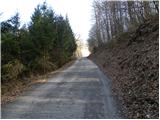 2
2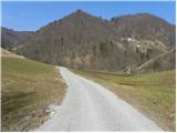 3
3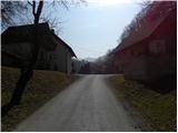 4
4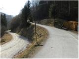 5
5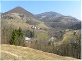 6
6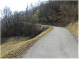 7
7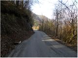 8
8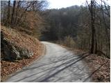 9
9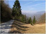 10
10 11
11 12
12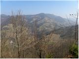 13
13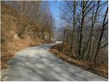 14
14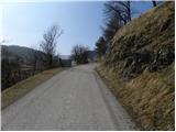 15
15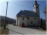 16
16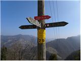 17
17 18
18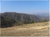 19
19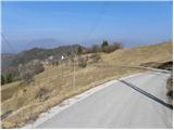 20
20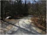 21
21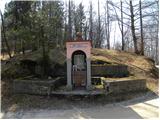 22
22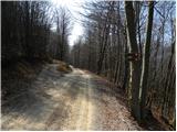 23
23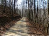 24
24 25
25 26
26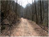 27
27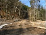 28
28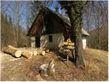 29
29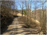 30
30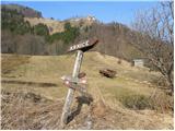 31
31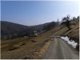 32
32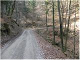 33
33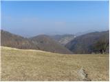 34
34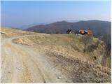 35
35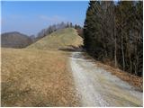 36
36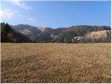 37
37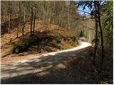 38
38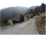 39
39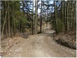 40
40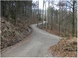 41
41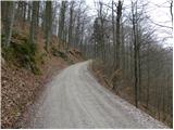 42
42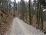 43
43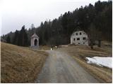 44
44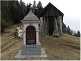 45
45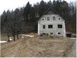 46
46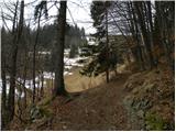 47
47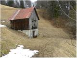 48
48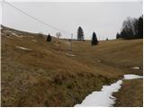 49
49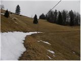 50
50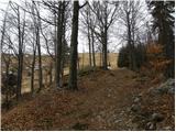 51
51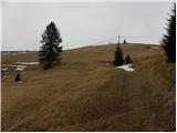 52
52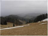 53
53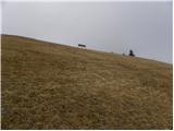 54
54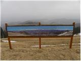 55
55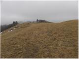 56
56 57
57
Discussion about the trip Straža - Vrhovec
To post a comment you must log in:
If you do not yet have a username, you must first
register.