Strmec - Debela peč (old path)
Starting point: Strmec (1520 m)
| Latitude/Longitude: | 46,39020°N 13,96750°E |
| |
Route name: old path
Walking time: 2 h 15 min
Difficulty: easy marked way
Elevation gain: 494 m
Elevation difference along the route: 600 m
Map: TNP 1:50.000
Recommended equipment (summer):
Recommended equipment (winter): ice axe, crampons
Views: 13.953
 | 1 person like this post |
Access to starting point:
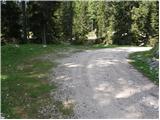
From the Ljubljana - Jesenice highway, we take the Lesce exit and follow the road towards Bled; there, at the traffic-light-controlled intersection, signs for Pokljuka direct us to the right. We follow this road, which in the lower part leads through some villages and later starts to ascend more steeply, to Mrzli Studenec (mountain pasture located more than 50 m beyond the intersection where the road to Bohinj branches off to the left downhill). In the middle of the mentioned mountain pasture, a road branches off to the right from the main road to Medvedova konta, Pri Rupah and mountain pasture Javornik. Here we turn right and follow the road to the next intersection, where we continue right towards Medvedova konta (straight to mountain pasture Javornik). The road ahead, after a shorter ascent, descends and brings us to the next intersection, where we continue perpendicularly left. Then, at the first right branch-off, we turn right. Soon another road branches off sharply to the right; here we go straight and only about 100 m behind that, at the intersection, sharply right. Now we drive approximately 3 km to the first left branch-off. Here we turn left and drive to the parking lot, where signs direct us to the mountain pasture Klek. We park on a smaller parking lot by the road.
Route description:
From the parking lot, we return a few meters back, then head onto the footpath towards Lipance, Klek and Debela peč. The path continues along a cart track that brings us past the animal watering trough to the first shepherd huts on mountain pasture Klek. From the mentioned huts, a beautiful view opens up across the entire mountain pasture, and we continue slightly right, descending diagonally to the second part of the mountain pasture, where a few more shepherd dwellings stand.
We continue along a poorly visible path which, after just a few dozen steps of further walking, enters a larch forest. Here the trail becomes more distinct again, and we follow it towards Lipance. There follow a few shorter ascents and descents along an occasionally poorly visible trail. After approximately 30 minutes of walking from mountain pasture Klek, we reach a marked junction, where we continue left towards Blejska koča or Lipance (slightly right Debela peč - usual path from mountain pasture Klek). The path continues diagonally towards the southwest and proceeds without major changes in elevation. A little further on, we step out of the sparse forest into a belt of bare slopes. Here, on the right side on a larger rock, we notice an already quite faded inscription Debela peč, directing us right uphill.
At the mentioned rock, we leave the wider and well-marked path leading towards Blejska koča and continue the ascent right along the route of the former path. There are almost no traces of the path left, but old faded blazes are still visible. Further on, we ascend the slope straight upwards, aided for orientation by the old blazes. Higher up, the trail turns right through a belt of dwarf pines, then again slightly left or straight upwards. The steep trail continues along steep grassy slopes overgrown with dwarf pines. A little further, we gradually arrive below shorter cliffs; the path becomes a bit steeper and ascends above the cliffs via a grassy ledge overgrown with dwarf pines. Here the trail turns right and joins the previously mentioned usual path from mountain pasture Klek to Debela peč.
When we reach the well-marked mountain path, we ascend quite steeply for a while longer, then the path, from which increasingly beautiful views open up, gradually becomes less steep. Further on, we ascend for some time through increasingly sparse dwarf pines; the path takes us several times onto the ridge, from which a beautiful view opens towards Krma and the mountains above Krma valley (in the background, the peaks above Vrata valley are also nicely visible). We follow this path, which is no longer particularly steep further on, all the way to the panoramic summit, which we reach after a few minutes of further walking.

Photos:
 1
1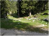 2
2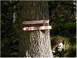 3
3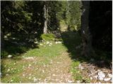 4
4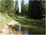 5
5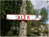 6
6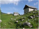 7
7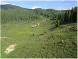 8
8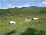 9
9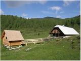 10
10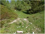 11
11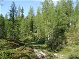 12
12 13
13 14
14 15
15 16
16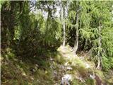 17
17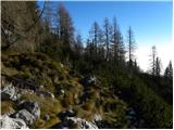 18
18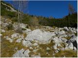 19
19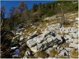 20
20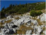 21
21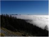 22
22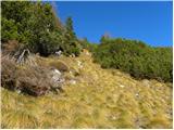 23
23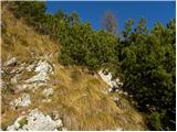 24
24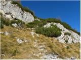 25
25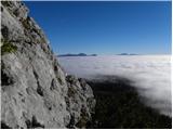 26
26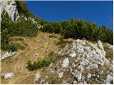 27
27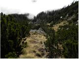 28
28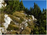 29
29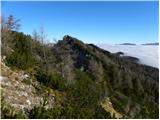 30
30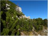 31
31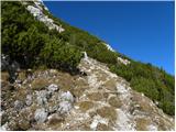 32
32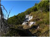 33
33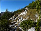 34
34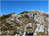 35
35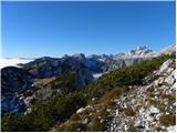 36
36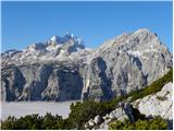 37
37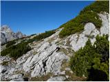 38
38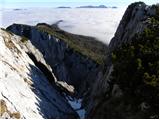 39
39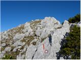 40
40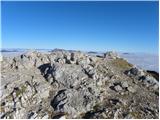 41
41 42
42
Discussion about the trip Strmec - Debela peč (old path)
To post a comment you must log in:
If you do not yet have a username, you must first
register.