Strmec - Debela peč (via Spodnja Brda)
Starting point: Strmec (1520 m)
| Latitude/Longitude: | 46,39020°N 13,96750°E |
| |
Route name: via Spodnja Brda
Walking time: 2 h 45 min
Difficulty: easy marked way
Elevation gain: 494 m
Elevation difference along the route: 750 m
Map: TNP 1:50.000
Recommended equipment (summer):
Recommended equipment (winter): ice axe, crampons
Views: 14.723
 | 1 person like this post |
Access to starting point:
From the Ljubljana - Jesenice highway, take the Lesce exit and follow the road towards Bled; there, at the traffic-light-controlled intersection, signs for Pokljuka direct us to the right. We follow this road, which in the lower part runs through some villages and later starts to ascend more steeply, to Mrzli Studenec (mountain pasture located more than 50 m behind the intersection where the road to Bohinj branches off to the left downwards). In the middle of the mentioned mountain pasture, a road branches off to the right from the main road towards Medvedova konta, Pri Rupah and mountain pasture Javornik. Here we turn right and follow the road to the next intersection, where we continue right in the direction of Medvedova konta (straight to mountain pasture Javornik). The road ahead, after a short ascent, descends and brings us to the next intersection, where we continue perpendicularly left. Then, at the first right branch-off, we turn right. Soon another road branches off sharply to the right; here we go straight and only about 100 m behind that, at the intersection, sharply right. Now we drive approximately 3 km to the first left turn-off. Here we turn left and drive to the parking lot, where signs direct us to mountain pasture Klek. We park on a smaller parking lot by the road.
Route description:
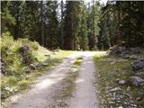
Near the parking lot we notice signs for mountain pasture Klek. We head onto a wide footpath that after a few minutes brings us out of the forest onto an extensive mountain pasture, where some shepherd huts stand.
From the upper part of the mountain pasture we descend down the mountain pasture and further follow the marked path, which on the other side goes into a larch forest. Further we follow a locally somewhat poorly visible path slightly upwards. After a few minutes of pleasant walking the path brings us to a larger clearing, where we arrive at a marked junction.
To the right upwards the direct path to Debela peč branches off, but we continue left mostly slightly upwards in the direction of Lipanca. We follow the path, which occasionally even descends a little, through mostly larch forest to the next junction.
Here we head right in the direction of Debela peč more steeply upwards, left to Lipanca. After a short ascent the path joins the usual approach to Debela peč from Blejska koča.
We continue right upwards along an increasingly panoramic path to the ridge, where a beautiful view opens up on the highest peaks of the Julian Alps. Here the path turns right and crosses the slopes of Okroglež. A little further ahead the path descends for a short time and brings us to the foot of the last ascent. Here the path ascends and after ten minutes of walking along the summit slope of the mountain brings us to the panoramic summit.

Photos:
 1
1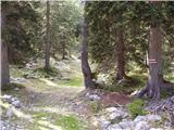 2
2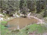 3
3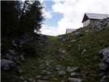 4
4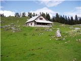 5
5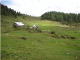 6
6 7
7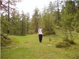 8
8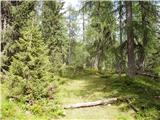 9
9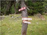 10
10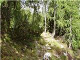 11
11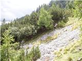 12
12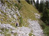 13
13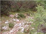 14
14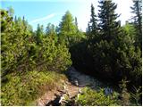 15
15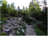 16
16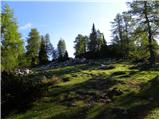 17
17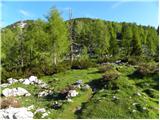 18
18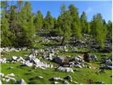 19
19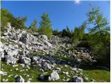 20
20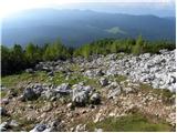 21
21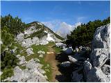 22
22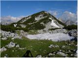 23
23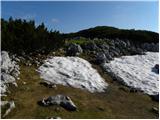 24
24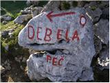 25
25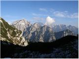 26
26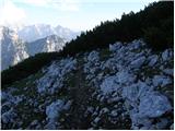 27
27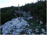 28
28 29
29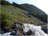 30
30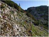 31
31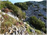 32
32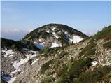 33
33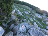 34
34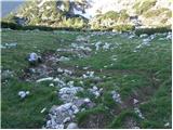 35
35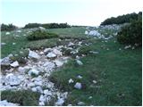 36
36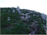 37
37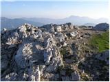 38
38 39
39
Discussion about the trip Strmec - Debela peč (via Spodnja Brda)
|
| balon5. 04. 2023 11:25:40 |
Hello,
is the trail suitable for a dog?
Thanks,
Alen
|
|
|
|
| funnyboy5. 04. 2023 11:32:48 |
Depends on the dog's ability, but in principle it is suitable for a dog 
|
|
|
To post a comment you must log in:
If you do not yet have a username, you must first
register.