Strmica - Toško Čelo (via Brezarjevo brezno)
Starting point: Strmica (349 m)
| Latitude/Longitude: | 46,07880°N 14,44060°E |
| |
Route name: via Brezarjevo brezno
Walking time: 45 min
Difficulty: easy unmarked way
Elevation gain: 241 m
Elevation difference along the route: 250 m
Map: Ljubljana - okolica 1:50.000
Recommended equipment (summer):
Recommended equipment (winter):
Views: 5.100
 | 2 people like this post |
Access to starting point:
A) From the Ljubljana ring road, we head to the exit Ljubljana - Podutik, then continue driving towards Podutik. At the traffic light near the parish church in Podutik, we continue straight, then gradually begin ascending towards the Preval saddle. Approximately 100 m before the Podutik quarry, we turn sharply right onto the Cesta Andreja Bitenca road, along which we also notice signs for Brezarjevo brezno. We drive along the mentioned road for another good 200 m, then on the left side of the road we notice signs for Brezarjevo brezno, where the described footpath starts. There are no arranged parking spots at the starting point.
B) From the Ljubljana - Koper highway, we head to the Brezovica exit, then continue driving towards Dobrova and Polhov Gradec. At the end of Dobrova, signs for Šentvid direct us right onto a narrower road, along which we continue driving. Further on, the road leads through Stranska vas, after which it begins ascending towards Preval. After Preval, we descend towards Podutik, then some 100 m after the quarry continue left onto the Cesta Andreja Bitenca road, along which we also notice signs for Brezarjevo brezno. We drive along the mentioned road for another good 200 m, then on the left side of the road we notice signs for Brezarjevo brezno, where the described footpath starts. There are no arranged parking spots at the starting point.
Route description:
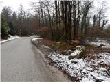
From the starting point, we head onto a forest path in the direction of Brezarjevo brezno, which without major changes in altitude brings us to the junction with a somewhat better trodden path, which we follow to the right (left Kucja dolina). The right path splits already after a few steps, and we continue slightly left (along the slightly right path we can reach Velikega Brezarjevega brezna in a few steps). A gentle ascent follows through the forest, then the path leads us below the high-voltage power line. On the other side of the power line we cross a short strip of forest, then the path leads us across a somewhat larger clearing, where we continue straight, again into the forest. Through the forest we ascend for a short time along a wider cart track, then the trodden path turns slightly to the right and begins to ascend moderately. The path quickly flattens and approaches completely the asphalt road that leads to Toško Čelo.
When we reach the edge of the road, we also reach the better marked path from Preval (until now along the path we could notice only some old faded blazes), which continues slightly right of the road. Further on we follow the blazes, and when we step out of the forest we continue somewhat to the right, then ascend across the meadow. Crossing a strip of bushes follows, then we already arrive at the hunting cottage on Toško Čelo.
Description and pictures refer to the condition in 2016 (February).

Along the route: Veliko Brezarjevo brezno (355m)
Photos:
 1
1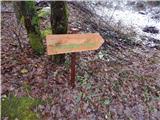 2
2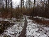 3
3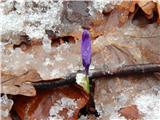 4
4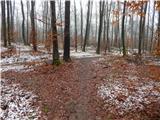 5
5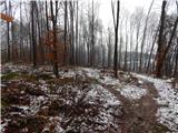 6
6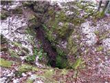 7
7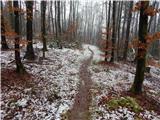 8
8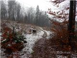 9
9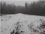 10
10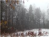 11
11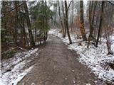 12
12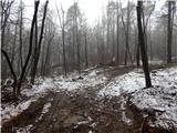 13
13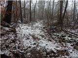 14
14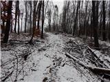 15
15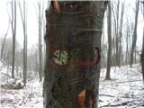 16
16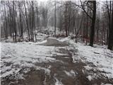 17
17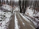 18
18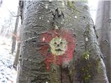 19
19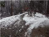 20
20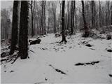 21
21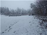 22
22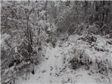 23
23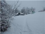 24
24 25
25
Discussion about the trip Strmica - Toško Čelo (via Brezarjevo brezno)
|
| oldtimer 5527. 02. 2016 |
The described path is very interesting and I walk it many times. The description is good, I would just point out the naming of the starting point. This is Strmica, locals call it "Strnca". The walking time stated is somewhat "stretched". 
|
|
|
To post a comment you must log in:
If you do not yet have a username, you must first
register.