Strugarje / Strugarjach - Sinacher Gupf / Psinski vrh
Starting point: Strugarje / Strugarjach (1086 m)
| Latitude/Longitude: | 46,48230°N 14,19990°E |
| |
Walking time: 1 h 30 min
Difficulty: easy marked way
Elevation gain: 491 m
Elevation difference along the route: 491 m
Map: Karavanke - osrednji del 1:50.000
Recommended equipment (summer):
Recommended equipment (winter): ice axe, crampons
Views: 4.448
 | 1 person like this post |
Access to starting point:
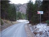
We drive to the border crossing Ljubelj and continue on the Austrian side. Soon after that, when we notice a smaller church on the left side of the road, the road towards the village Žabnica / Bodental branches off to the left. At the crossroads after the village Slovenji Plajberk we continue straight in the direction of Strugarje / Strugarjah. We follow this road to the beginning of the mentioned village and park just a few dozen meters ahead on the parking lot by the road near the mountain signposts (marked as Križnik on the map).
Route description:
From the parking lot, we continue on the road ahead, which after 20 minutes of a light ascent with nice views brings us to a hamlet in the village Strugarje / Strugarjah. Here we continue among houses still on the road. We leave the road a few dozen meters after the village at the spot where the blazes point us to the right.
The path ahead, after a few meters of walking through a meadow, brings us to the edge of the forest, where on the right side we notice a hunting observatory. Here our path turns left slightly downwards and after a few meters of descent brings us to a cart track, which we follow to the right. This cart track already after a few steps has a junction, where we continue straight upwards (left downwards Bistrica v Rožu / Feistritz). Further, we continue on the cart track, which ascends quite steeply and a little higher brings us to a larger clearing overgrown with high grass. At the end of this clearing we leave the cart track and turn left onto a marked path. The path then, already after a shorter gentle ascent, crosses a cart track (to here possible also on the cart track). Here the path brings us to the western ridge along and beside which we then ascend. The path ahead mostly runs through the forest, which thins out only a few minutes below the summit. Ahead follows a light ascent on the increasingly panoramic upper slope to the cross, which stands on the top.

Photos:
 1
1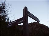 2
2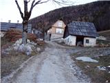 3
3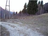 4
4 5
5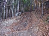 6
6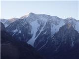 7
7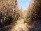 8
8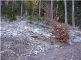 9
9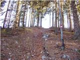 10
10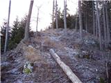 11
11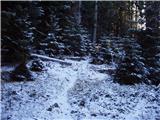 12
12 13
13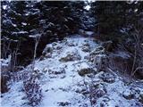 14
14 15
15 16
16
Discussion about the trip Strugarje / Strugarjach - Sinacher Gupf / Psinski vrh
|
| Gost28. 12. 2007 |
Today we spent the day in beautiful sunny weather with our neighbors in Carinthia. Pleasant hike, but the path is icy in some places due to lack of snow (recommend crampons). More can be read in the book by Mr. Željko Kozinc "Lep dan kliče 4".
Best regards, Joži, Miha
|
|
|
|
| MateZ10. 07. 2020 |
Yesterday I was at Psinski vrh. Nice trip, nice views and not a single living soul. Watch out on the access road where there are some wild torrent crossings.
|
|
|
To post a comment you must log in:
If you do not yet have a username, you must first
register.