Stržišče - Jehlc (Špičasta kupa)
Starting point: Stržišče (756 m)
| Latitude/Longitude: | 46,21330°N 13,92350°E |
| |
Walking time: 3 h 30 min
Difficulty: easy unmarked way
Elevation gain: 906 m
Elevation difference along the route: 1000 m
Map: TNP 1:50.000
Recommended equipment (summer): helmet
Recommended equipment (winter): helmet, ice axe, crampons
Views: 524
 | 2 people like this post |
Access to starting point:
A) First, we drive to Škofja Loka, and then we continue driving towards Železniki, Podbrdo and Tolmin. A few kilometers after Podbrdo, we will get to a crossroad, where a narrower ascending road towards villages Znojile, Stržišče and Kal branches off sharply to the right. We follow the relatively narrow road towards the village Stržišče. Because in the mentioned settlement there aren't any parking spots, it is good that we park already a little below the village, on an appropriate place by the road.
B) From the road Idrija - Most na Soči, at settlement Bača pri Modreju we turn right, or left, if we come from the direction of Posočje and we continue driving towards Podbrdo. After settlement Hudajužna, we get to a crossroad, where signs for villages Znojile, Stržišče and Kal point us to the left onto a narrower ascending road. We follow the relatively narrow road towards the village Stržišče. Because in the mentioned settlement there aren't any parking spots, it is good that we park already a little below the village, on an appropriate place by the road.
Route description:
When we arrive in Stržišče, the road first leads us past a concrete trough with water, and then past a few houses we arrive at a crossroad, where we continue sharply left in the direction of Rodica and village Rut (straight Kal). The road on which we continue soon splits, and we continue on the upper right road (left leads to the nearby house), which before the next house we leave and continue slightly right on a cart track, which quickly passes into the forest. During the ascent through the forest, occasionally some views open up towards Matajurski vrh and Črna prst. A little further, on a saddle north of the peak Vidizek (977 m), we reach the road which leads towards the mountain pasture Stržiška planina and hunting cottage Sanek and the road which leads towards Kalarsko brdo; we only cross the mentioned road and continue the path on a wide cart track in the direction of Rodica and Rut.
Behind the pasture, by the edge of which there is a wooden cottage, the path passes into the forest and first leads us past a smaller spring, then also past some signposts of the Slovenian geological trail. The path further occasionally runs below cliffs, where mainly in spring time and after rain there is increased danger of falling rocks. Next follows crossing a torrent bed, then the path leads us past an indistinct but quite panoramic summit Grive (893 m), which is only a few 10 steps distant from the path to the left. From here onwards, the path lightly descends for some time, then leads us past another vantage point (access to the vantage point is marked, but the path to it is already completely overgrown). After the vantage point, the path turns right, then after further crossing brings us to Tomčeva grapa. The wide path all the time, behind the gully gradually starts lightly ascending, then past a stone trough and a year 1910 carved into the wall, brings us to a marked junction, where slightly to the left branches off the path towards the village Rut; we continue straight and continue the ascent further on the wide path. The path further ascends for quite some time below the summit Lajte (1056 m), then joins the macadam road which leads from the village Rut.
We continue the ascent on a wide macadam road, which a few minutes higher brings us to an unmarked crossroad; we continue on the right road, beside which there is a traffic sign prohibiting further driving and a gate. Behind the gate, the road starts to ascend more steeply, then at the next crossroad, where a narrower road branches off to the right, we continue straight, on which we walk to the place where the road narrows or splits into two cart tracks.
We continue on the upper wider cart track, beside which there are signs for Rodica. Further, for some time we ascend transversely on a poorer road or cart track, which leads us past the hunting observatory and occasional views on the mountains on the other side of Baška grapa. Higher, a marked path from the village Grant joins us from the left, a few 10 meters further from the cart track we continue right in the direction of Rodica (straight Koča na planini Razor - path over Huda stopna).
Behind the junction named Mladinska koča, we start to ascend on a nicely preserved mule track, which after a few minutes turns sharply to the left, then for quite some time ascends transversely to the left, first still through the forest, then through dwarf pines. During the transverse ascent, the path also leads us across some gullies, crossings over them are not demanding since the path is wide all the time. With nice views on Idrijsko and Cerkljansko hribovje, at the right serpentine we approach very closely to the summit Jehlc, which we see in front of us all the time during the crossing. At this serpentine, a pathless approach to the mentioned summit continues straight ahead (the last part before the ridge is demanding); we continue on the marked path, which continues further on the mule track. Two serpentines higher, an even easier approach to the previously mentioned summit branches off to the left.
At the mentioned second branch-off there is a cairn, which directs us onto a less trodden path, on which we quickly ascend to the ridge, where we reach Peči or Greben (1727 m).
Here we continue left and start descending on and beside the ridge. On a smaller saddle, the access from the "first" serpentine joins us from the left; from here to the summit only a gentle and short ascent on and beside the ridge separates us.

Along the route: Mladinska koča (1329m)
Photos:
 1
1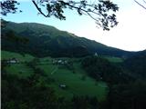 2
2 3
3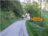 4
4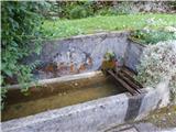 5
5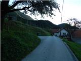 6
6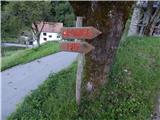 7
7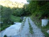 8
8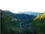 9
9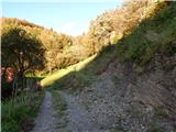 10
10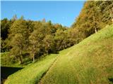 11
11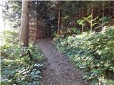 12
12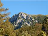 13
13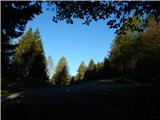 14
14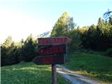 15
15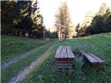 16
16 17
17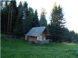 18
18 19
19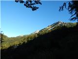 20
20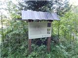 21
21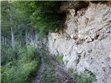 22
22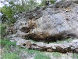 23
23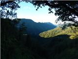 24
24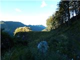 25
25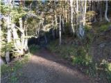 26
26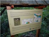 27
27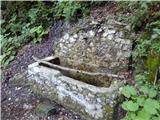 28
28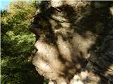 29
29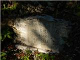 30
30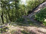 31
31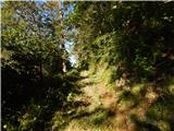 32
32 33
33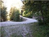 34
34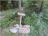 35
35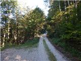 36
36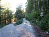 37
37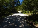 38
38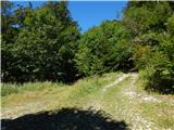 39
39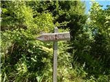 40
40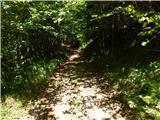 41
41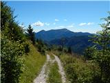 42
42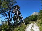 43
43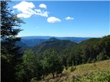 44
44 45
45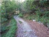 46
46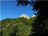 47
47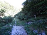 48
48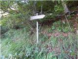 49
49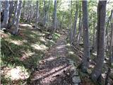 50
50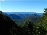 51
51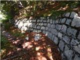 52
52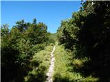 53
53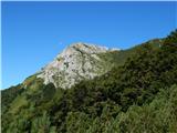 54
54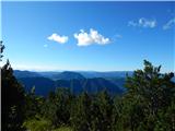 55
55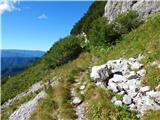 56
56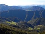 57
57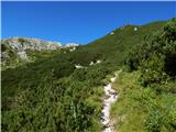 58
58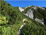 59
59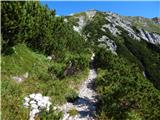 60
60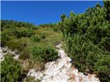 61
61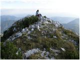 62
62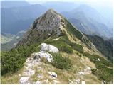 63
63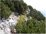 64
64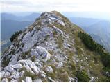 65
65 66
66
Discussion about the trip Stržišče - Jehlc (Špičasta kupa)
To post a comment you must log in:
If you do not yet have a username, you must first
register.