Suhadolnik - Bivouac in Kočna (via Grdi graben)
Starting point: Suhadolnik (901 m)
| Latitude/Longitude: | 46,33520°N 14,51020°E |
| |
Route name: via Grdi graben
Walking time: 3 h 30 min
Difficulty: very difficult marked way
Elevation gain: 1051 m
Elevation difference along the route: 1051 m
Map: Kamniške in Savinjske Alpe 1:50.000
Recommended equipment (summer): helmet
Recommended equipment (winter): helmet, ice axe, crampons
Views: 13.075
 | 1 person like this post |
Access to starting point:
From the highway Ljubljana - Jesenice we go to the exit Kranj - east and follow the road ahead in the direction of Jezersko, but only to the village Kokra. In the mentioned village, we will only a few meters before the road crosses a bridge over the river Kokra, notice a road which runs towards Suhadolnik. The turn-off of the road is located when we are on the right side of the river (left bank), the road sign is approximately 7 km. We follow this road to a parking lot, which is located approximately 200 m before the farm Suhadolnik.
Route description:
At the beginning of the parking lot, we notice hiking signposts, which point us onto a road, on which in less than 5 minutes of walking we arrive at a smaller crossroad at the farm Suhadolnik. Here we continue on the right road, which we follow for approximately 5 minutes, or to the spot where the blazes lead us onto an ascending cart track. Further, for a short time we ascend on the cart track, then the blazes direct us right onto a footpath which moderately ascends through the forest. Higher, we return to the cart track, which only a few meters ahead brings us to a forest road, which we then follow to its end (to here we need approximately half an hour).
At the end of the road the marked path splits into two parts. We continue on the left path (right somewhat easier "Old path"), which further ascends on a gentle cart track. A little further the blazes direct us slightly right onto torrent deposits of sand, and the path on the other side continues through the forest, where it starts to ascend steeper and steeper. Higher, we come to a smaller cavity, and the path behind it becomes technically demanding. With the help of a steel cable we ascend one level higher, and the path then continues on a steep slope, where occasionally some peg helps us. Higher, the path turns to the right, ascends transversely over steep and especially in wet slippery-dangerous slopes and then brings us to an excellently secured passage. With the help of wooden steps or ladder and help of a steel cable, we ascend the steep slope, which without the mentioned protections would be very dangerous. Higher some pegs help us, the path then flattens and crosses a short exposed slope, where an emergency fence helps us. Only a little further we come to the next ladder, by which there is no steel cable, but the passage is not particularly demanding. Follows a short descent into a smaller gully and then we cross it too. On the other side of the gully we steeply ascend (some pegs help us), after which the path slowly flattens and in a few 10 steps of further walking brings us to the spot where the somewhat easier "Old path" joins.
Follows a short transverse ascent and the path brings us to a larger plain, where once stood the "old hut". Through high grasses we walk to the other side of the plain, where we arrive at a marked junction. At the junction we go left following the signs Dolci, Kokrška Kočna. The path then starts steeply ascending on a poorly trodden path over a grassy slope. Soon we turn slightly to the left and cross steep exposed slopes. The path then starts slightly descending and crosses Grdi graben. We start ascending again on a steep slope and then the path brings us to gentle grassy slopes (Srednji Dolci). From the right the path from Kokrsko sedlo joins us, a few meters later we are again at a junction. We go left towards the bivouac and Kokrska Kočna, right leads the path towards Dolška škrbina and then further towards Jezerska Kočna or Grintovec. The path then crosses scree to the left and ascends over a short gully.
A little above the gully an unmarked path towards Bivak pod Kočno branches off to the left, which we can already see and which is only a few minutes' walk from the marked path.

Photos:
 1
1 2
2 3
3 4
4 5
5 6
6 7
7 8
8 9
9 10
10 11
11 12
12 13
13 14
14 15
15 16
16 17
17 18
18 19
19 20
20 21
21 22
22 23
23 24
24 25
25 26
26 27
27 28
28 29
29 30
30 31
31 32
32 33
33 34
34 35
35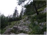 36
36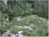 37
37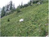 38
38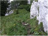 39
39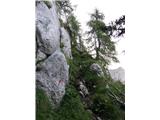 40
40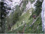 41
41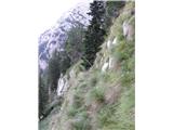 42
42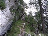 43
43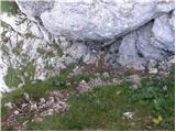 44
44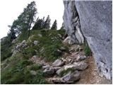 45
45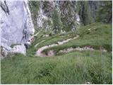 46
46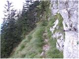 47
47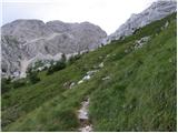 48
48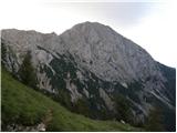 49
49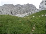 50
50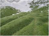 51
51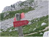 52
52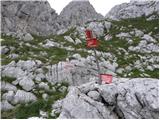 53
53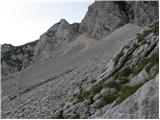 54
54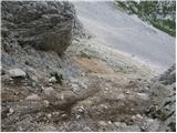 55
55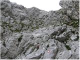 56
56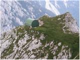 57
57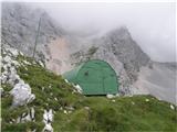 58
58
Discussion about the trip Suhadolnik - Bivouac in Kočna (via Grdi graben)
|
| velkavrh1. 08. 2010 |
Before today I've done this trail many times. Passed by two years ago en route to both Kočni and Grintavec. Years ago passed here to saddle then Grintavec. Today demanding due to overgrowing grass and wet ground from rain. Reaching Spodne Dolce like green fairytale. Saw chamois herd before. Today one at bivouac. My favorite bivouac in Kamniško-Savinja. Friendly hut for night. Up via Taško. Fix last ladder, dangerous. Helmet nearly needed, loose rocks, preceding hiker may trigger. Continued via Ovnov čer to Cojzova koča. Actually Grintavec flank traverse. Used for tours from Cojzova koča to both Kočni and Grintavec from saddle. Nice full-day tour. Bivouac has logbook. Great!
|
|
|
|
| kolpa9. 07. 2011 |
On the way to K.Kočna, J.Kočna, Grintovec I stopped at the bivouac in Kočni. The bivouac is without the sheet metal protective roof, which was probably carried away by the last snow. The roof inside already leaks in some places, as it's probably cardboard under the wooden sheathing that has rotted in some spots. For the good of us hikers, the roof should be restored to its original state. The bivouac in weather conditions like on 7th (evening) and 8th (morning) July 2011 was very useful and provides safe shelter.
|
|
|
|
| metod6. 07. 2013 |
Today I went a bit differently to the bivouac. On this website I found a description of the "path" almost directly from Suhadolnik through the eastern slope of Kočna to the bivouac. I got a bit confused in the lower part, but it went. I entered chamois paradise, as they were rushing everywhere. Really nice tour for those seeking peace. I continued under Streha to Cojzova. I returned to the valley via the old path that leads above Pasja glava. Really interesting! I almost got lost, as there are plenty of chamois paths and they mislead you quickly. Especially important not to descend too early down the gully to the valley bottom. The path leads right to the last, real gully that extends into the scree towards Suhadolnik. Great, I'll go again!
|
|
|
To post a comment you must log in:
If you do not yet have a username, you must first
register.