Suhadolnik - Jezerska Kočna (via Grdi graben and Kokrska Kočna)
Starting point: Suhadolnik (901 m)
| Latitude/Longitude: | 46,33520°N 14,51020°E |
| |
Route name: via Grdi graben and Kokrska Kočna
Walking time: 5 h 15 min
Difficulty: very difficult marked way
Elevation gain: 1639 m
Elevation difference along the route: 1775 m
Map: Kamniške in Savinjske Alpe 1:50.000
Recommended equipment (summer): helmet, self belay set
Recommended equipment (winter): helmet, self belay set, ice axe, crampons
Views: 19.782
 | 1 person like this post |
Access to starting point:
From the Ljubljana - Jesenice highway, take the Kranj - east exit and follow the road ahead in the direction of Jezersko, but only to the village of Kokra. In the mentioned village, we will notice, a few meters before the road crosses the bridge over the river Kokra, a road which leads towards Suhadolnik. The turn-off of the road is located when we are on the right side of the river (left bank); the road sign is approximately 7 km. We then follow this road to a parking lot, which is located approximately 300 meters before the farm Suhadolnik.
Route description:
At the beginning of the parking lot, we notice hiking signposts, which direct us onto a road, along which in less than 5 minutes of walking we arrive at a smaller crossroad by the farm Suhadolnik. Here we continue on the right road, which we follow for approximately another 5 minutes, or to the place where the blazes lead us onto an ascending cart track. Further on, we ascend briefly along the cart track, then the blazes direct us right onto a footpath that moderately ascends through the forest. Higher up, we return to the cart track, which a few meters further brings us to a forest road, which we then follow to its end (to here we need approximately half an hour).
At the end of the road, the marked path splits into two parts. We continue on the left path (right somewhat easier "Old path"), which further ascends along a gentle cart track. A little further ahead, the blazes direct us slightly right onto torrent sand deposits, and the path on the other side continues through the forest, where it begins to ascend ever steeper. Higher, we come to a smaller cavity, and the path behind it becomes technically demanding. With the help of a steel cable, we ascend one level higher, and the path then continues along a steep slope, where some pegs occasionally assist us. Higher, the path turns right, ascends transversely over steep and especially slippery when wet slopes, and then brings us to an excellently secured passage. With the help of wooden steps or ladder and assistance of a steel cable, we ascend the steep slope, which without the mentioned protections would be very dangerous. Higher, a few more pegs assist us, the path then levels out and crosses a short exposed slope, where an emergency fence assists us. Just a little further, we come to the next ladder, next to which there is no steel cable, but the passage is not particularly demanding. A short descent into a smaller gully follows, and we then cross it as well. On the other side of the gully, we ascend steeply (some staples assist us), then the path gradually levels out and brings us in a few dozen steps of further walking to the place where the somewhat easier "Old path" joins.
A short transverse ascent follows, and the path brings us to a larger plain, where the "stara koča" once stood. Through tall grass, we walk to the other side of the plain, where we arrive at a marked junction. At the junction, we turn left following the signs Dolci, Kokrška Kočna. The path then begins to ascend steeply along a poorly trodden trail over the grassy slope. Soon we turn slightly left and cross steep exposed slopes. The path then begins to descend slightly and crosses Grdi graben. We begin ascending again along the steep slope, and then the path brings us to level grassy slopes (Srednji Dolci). From the right, the path from Kokrsko sedlo joins us, a few meters later we are again at a junction. We turn left towards the bivouac and Kokrska Kočna, right leads the path towards Dolška škrbina and then further towards Jezerska Kočna or Grintovec. The path then crosses scree to the left and ascends over a short gully.
A little above the gully, an unmarked path branches left towards Bivak pod Kočno, which we can already see and is only a few minutes' walk from the marked path. We continue on the marked path right upwards, and soon we begin ascending over scree. In the upper part of the scree, the path turns left and brings us to a somewhat more demanding rocky section of the path. Here we turn slightly right again and ascend the slope with easier climbing. The path in this section is not secured, but there are sufficient holds in the rock, so the ascent does not cause major difficulties. In the last section towards the summit, the path becomes somewhat steeper, and some steel cables assist us.
From Kokrska Kočna, we continue on the marked path in the direction of Jezerska Kočna. The well-protected path first descends into the gully between both Kočnas, then begins ascending towards the summit of Jezerska Kočna. Just a little before the summit, we come to a marked junction, where we continue left (right Jezersko and (Z)Dolška škrbina). Only a few steps of walking remain, and the very panoramic path brings us to the somewhat spacious summit of Jezerska Kočna.

Photos:
 1
1 2
2 3
3 4
4 5
5 6
6 7
7 8
8 9
9 10
10 11
11 12
12 13
13 14
14 15
15 16
16 17
17 18
18 19
19 20
20 21
21 22
22 23
23 24
24 25
25 26
26 27
27 28
28 29
29 30
30 31
31 32
32 33
33 34
34 35
35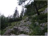 36
36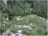 37
37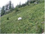 38
38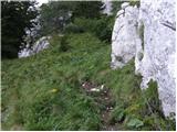 39
39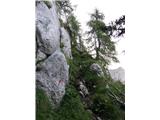 40
40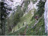 41
41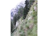 42
42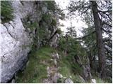 43
43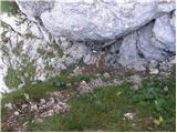 44
44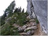 45
45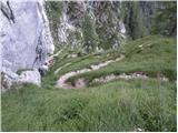 46
46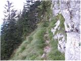 47
47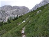 48
48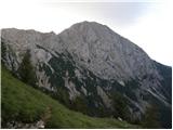 49
49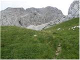 50
50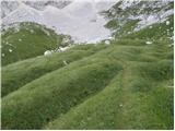 51
51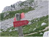 52
52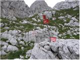 53
53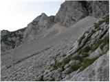 54
54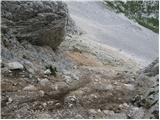 55
55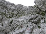 56
56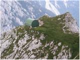 57
57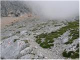 58
58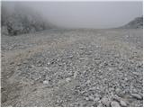 59
59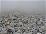 60
60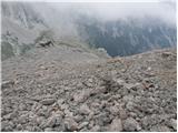 61
61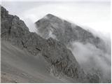 62
62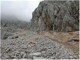 63
63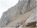 64
64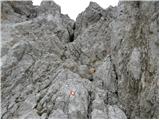 65
65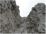 66
66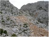 67
67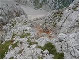 68
68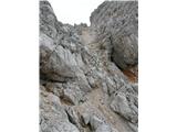 69
69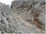 70
70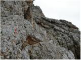 71
71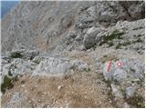 72
72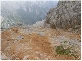 73
73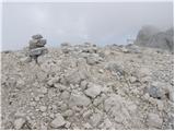 74
74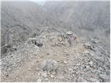 75
75 76
76 77
77 78
78 79
79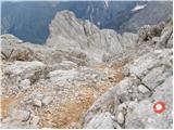 80
80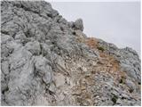 81
81 82
82 83
83
Discussion about the trip Suhadolnik - Jezerska Kočna (via Grdi graben and Kokrska Kočna)
|
| Damien_8326. 06. 2011 |
Was on this tour today, the only thing that bothered me a little were the endless scree fields. You walk and walk, but get nowhere. Well, on the way back it went much easier and faster  Today quite foggy, so no nicer views, but next time Today quite foggy, so no nicer views, but next time 
|
|
|
|
| ales2422. 08. 2012 |
Would anyone go on Saturday via this path to Jezerska Kočna??
|
|
|
|
| jax22. 08. 2012 |
Ah, I've already done that this season, so no repeat for me 
Otherwise it's a great tour, I really recommend it. Just watch out on the descent when you're already lower down from the belly (you'll probably descend there), when you think all difficulties are over, a 20-meter unprotected steep gully awaits. That's where I cursed a bit. And maybe on descent it's better than going through Grdi graben again (it's really a bit tricky) to detour to Kokrsko sedlo and treat yourself to another ričet. Just that from me, for consideration.
|
|
|
|
| Domch26. 10. 2012 |
Yesterday in fairy-tale weather - no clouds, warm and fantastic views, I did a super tour. Start from Suhadolnik, over Taško, Grdi Graben, Srednje Dolce, up through scree to Kokrsko Kočna, then to Jezerska Kočna, descent towards Dovška Škrbina and Zgonje Dolce and through scree back to Dolce and over Grdi Graben, and along the old path back to Suhadolnik. Beautiful circular tour. Physically demanding, adrenaline-packed and full of exciting moments. The path over Grdi Graben is beautiful and scenic. Up through the last scree is a slide and very strenuous, even went on all fours . In the wall there are good holds, but it drags on to Kokrska Koča. Snack up top shirtless and then towards Jezerska Kočna. The path is quite demanding but not too exposed. The last part has some frozen snow patches - caution needed. The same applies to the descent towards the bulging wall and the part towards Dovška Škrbina. The Terbušasta stena thrilled me, really interesting and unique part of the path. Descent otherwise unremarkable. Saw two herds of chamois and smelled ptarmigans.
|
|
|
|
| mukica26. 10. 2012 |
I have a photo of two who were walking through the fine scree, taken from the path to Grintovec
|
|
|
|
| Domch26. 10. 2012 |
That was surely us two, then later also a fellow from the opposite direction who cursed the scree even more than us, but for consolation we saw two herds of chamois grazing on both sides of the scree.
|
|
|
|
| Potohodnik12. 08. 2013 |
how much time do you need from Jezerska Kočna to Grintovec? Then I plan descent to Kokrsko sedlo and back to Suhadolnik.
|
|
|
|
| megla12. 08. 2013 |
I think somewhere from 1.5 to 2 hours, depending on fitness.
|
|
|
|
| Potohodnik12. 08. 2013 |
Thanks, is a via ferrata kit necessary?
|
|
|
|
| jax12. 08. 2013 |
No, there are very few fixed ropes on the path, so it's not much help. But you need some feel for easier climbing on not always good rock.
|
|
|
|
| Jure872. 09. 2013 |
On Saturday I went to Kočna via this path and down via Dolce and past Cojzova koča. Nice loop. Up there a cold wind was already blowing, announcing winter. Regarding the ascent path itself, from the scree onwards need to be very careful not to trigger rocks on people behind us or to be hit by rocks that someone above might trigger. Helmet is mandatory.
|
|
|
|
| smatjaz2. 09. 2013 |
I also went up on Saturday with my son from Kokrško sedlo. Probably won't repeat this!!! Sample steel cables a bit below the summit, otherwise incredibly crumbly. Almost impossible to climb up without triggering rocks. Extremely tiring to watch out for those above and below!!! Can't imagine descending this path??? It's only for sufficiently psychophysically prepared. Better option to continue to Jezerska Kočna and descend towards Češka koča - better protection. Without helmet it's Russian roulette. 
|
|
|
|
| panda3. 09. 2013 |
You should have checked the tour before, now you wouldn't complain. It's not that bad after all, otherwise no one would climb up from that direction. I agree that the upper scree before entering the wall of K. Kočna is deadly boring, that it's better to continue to J. Kočna and down through Preduh circularly to Dolc via the scree down. But you didn't criticize the Grdi graben, which is also not friendly. This is a tour full of superlatives, at least in my opinion.
|
|
|
|
| Becar3. 09. 2013 |
I agree with Jure87 and smatjaz. Very crumbly, practically unprotected path and at least one level harder than via Dolc to Jezerska Kočna.
|
|
|
|
| ms_primoz3. 09. 2013 |
the mentioned scree comes into play in the heat... horror, I thought it would kill me
|
|
|
|
| ms_primoz3. 09. 2013 |
smatjaz - you're exaggerating a bit....Grdi graben not recommended when wet...otherwise super tour...
|
|
|
|
| smatjaz3. 09. 2013 |
ms primož, I'm not saying it's not a beautiful and unique tour, but have you tried the ascent in Grdi graben when there are 6 hikers above you and 8 below? If I were there alone with my son, I would scream even more, while the scree didn't seem anything special to me. Maybe I should have gone via Dolc when there was such a crowd in the wall. Panda, all the charm of mountaineering is lost when from the entrance to the wall to the top you keep your eyes peeled for what might fly from above and what you'll kindly send to those below, and not everyone is so considerate to those below them, and they don't even warn about falling rocks.
|
|
|
|
| sirt14. 09. 2013 |
I'll just comment on the path, it's very varied and beautiful. By far the most annoying part is Grdi graben which lives up to its name.
As for dislodging stones, it's a matter of knowledge and culture of mountaineers. There can be 20 above you and everything will be fine, or just 1 and ruin your day.
|
|
|
|
| panda4. 09. 2013 |
smatjaz: I've been on this path twice, last time last year. I agree with "sirt1"'s observation, but even if you watch carefully, something can slip from under your feet (similar to Hanzova pot on Mala Mojstrovka). Unfortunately, the mountaineer must be aware of this and take it into account. It's not ideal even when you're alone in the wall, as you're exposed only to yourself. The only advantage is that you don't throw a stone on your own head.
|
|
|
|
| Tajka677. 09. 2022 07:16:15 |
Yesterday we did the ascent in this direction to both Kočne. The markers are renewed, but those on the ground we hikers cover with crumbling rocks when walking, so some are hidden. Perhaps some protection on the exposed and narrow paths along the rock would really come in handy, even if the rock crumbles and it's probably impossible to place more pegs because of that. Long, stamina-demanding path, but all rewarded with magnificent views.
|
|
|
To post a comment you must log in:
If you do not yet have a username, you must first
register.