Suhi Dol - Guard tower below Kovček
Starting point: Suhi Dol (681 m)
| Latitude/Longitude: | 46,05020°N 14,20130°E |
| |
Walking time: 20 min
Difficulty: easy marked way
Elevation gain: 89 m
Elevation difference along the route: 89 m
Map: Škofjeloško in Cerkljansko hribovje 1:50.000
Recommended equipment (summer):
Recommended equipment (winter):
Views: 962
 | 1 person like this post |
Access to starting point:
A) First, we drive to Horjul (from Dobrova near Ljubljana or Vrhnika to here), then we continue driving towards Vrzdenc, Šentjošt and Gorenja vas. At Vrzdenc the road starts to ascend more steeply, then a little further it brings us to a hairpin bend, in the middle of which a road branches off to the left towards Šentjošt and Smrečje. We continue right on the main road, which soon brings us to a small saddle, at the end of which a road branches off to the right towards the village Samotorica. We continue straight, the road starts to descend more steeply and after a short descent it brings us to the hamlet Ljubljanica (lower part of Butajnova), where we come to the next crossroads. We continue left in the direction of Gorenja vas and follow the road to Suhi Dol, where we park in a suitable place.
B) We drive to Polhov Gradec, then we continue driving towards Gorenja vas. We follow the road towards Gorenja vas to the settlement Suhi Dol, where on the pass we park in a suitable place.
C) We drive into Poljanska dolina, more precisely to the roundabout in Gorenja vas, from where we continue towards Lučine and Vrhnika. On the ascending asphalt road at the crossroads we follow in the direction of Horjul and Vrhnika, soon after the settlements Lučine and Dolge Njive we arrive at the settlement Suhi Dol, where on the pass we park in a suitable place.
Route description:
From the pass at Suhi Dol we head onto the asphalt road towards Smrečje and Goli Vrh, where we first pass a few more houses, then along the edge of the pasture we ascend into the forest. A few minutes of ascent on the road follow, then at the information board the signs for the foundations of the guard tower direct us left onto a path that ascends through the forest. On the nearby clearing the path flattens and temporarily disappears, on the other side of the clearing we continue on a beaten and marked path, which ascends transversely to the right and soon turns left. At the small junction we go left again, as indicated by the arrow too, after some 10 steps of further walking then right towards the foundations of the guard tower, which we reach in one minute of further walking.
Description and pictures refer to the condition in June 2020.
Photos:
 1
1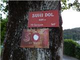 2
2 3
3 4
4 5
5 6
6 7
7 8
8 9
9 10
10 11
11 12
12 13
13 14
14 15
15 16
16
Discussion about the trip Suhi Dol - Guard tower below Kovček
To post a comment you must log in:
If you do not yet have a username, you must first
register.