Suhi Dol - Sivka (by road)
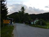
Starting point: Suhi Dol (681 m)
| Latitude/Longitude: | 46,05020°N 14,20130°E |
| |
Route name: by road
Walking time: 1 h 40 min
Difficulty: easy marked way
Elevation gain: 253 m
Elevation difference along the route: 280 m
Map: Škofjeloško in Cerkljansko hribovje 1:50.000
Recommended equipment (summer):
Recommended equipment (winter):
Views: 1.070
 | 1 person like this post |
Access to starting point:
A) First, we drive to Horjul (to here from Dobrova near Ljubljana or Vrhnika), and then we continue driving towards Vrzdenc, Šentjošt and Gorenja vas. At Vrzdenc the road starts ascending steeper, and then a little further it brings us to a hairpin turn, in the middle of which a road branches off to the left towards Šentjošt and Smrečje. We continue right on the main road, and it soon brings us to a small saddle, at the end of which a road branches off to the right towards the village Samotorica. We continue straight, and the road starts steeply descending and after a short descent it brings us to the hamlet Ljubljanica (bottom part of Butajnova), where we come to the next crossroad. We continue left in the direction of Gorenja vas and we follow the road to Suhi Dol, where we park in an appropriate spot.
B) We drive to Polhov Gradec, and then we continue driving towards Gorenja vas. We follow the road towards Gorenja vas to the settlement Suhi Dol, where on the mountain pass we park in an appropriate spot.
C) We drive into Poljanska dolina, more precisely to the roundabout in Gorenja vas, from where we continue towards Lučine and Vrhnika. At the crossroads we follow the ascending asphalt road in the direction of Horjul and Vrhnika, soon after the settlements Lučine and Dolge Njive we get to the settlement Suhi Dol, where on the mountain pass we park in an appropriate spot.
Route description:
From the mountain pass on Suhi Dol we go on an asphalt road in the direction of Planina nad Horjulom, and soon the asphalt road splits. We continue on a slightly right road which leads us among houses and where we are accompanied by blazes. Higher both roads join, and we continue right and further we ascend diagonally. A few minutes higher from the road a parallel path which leads partly through the forest branches off slightly to the left, and we continue on the road, by which we are also accompanied by blazes. A little further we leave the forest, and the road brings us to a crossroad below the church of St. Andrej, where we go left in the direction of hamlet Zameja. After 100 meters of additional walking we get to the chapel, where a short path branches off sharply to the right to the church of St. Andrej, which is situated on a panoramic hill.
From the chapel we continue straight and in a few minutes we get to hamlet Zameja, where blazes point us to the left on a side road which after the last farm changes into a cart track, and in a gentle ascent it leads us through the pasture. On the second part of the pasture the cart track starts vanishing, and we continue slightly left to the edge of the forest, where we join the path through the forest.
We continue straight or before the forest slightly right, where a wide footpath appears. The path ahead leads through the forest, where we walk on and by the ridge of Zlatni vrh, and hill Gabrovc with a quarry we bypass on the right side. Next follows a little more of a light descent and past a bigger chapel we reach an asphalt road, where the paths split again.
Straight across the road which we reach at the crossroad continues the steep path towards Sivka, and we continue right and continue walking on the road. At a few houses we choose the slightly left upper road, on which we ascend to a smaller saddle by the chapel, where we go left in the direction of Sivka. The path ahead first leads through the forest, and higher along the edge of ample hay meadows. At the last trees we get to the logbook box, and the peak is situated a few dozen strides further.
Suhi Dol - sv. Andrej 0:25, sv. Andrej - Sivka 1:15.
Description and pictures refer to the situation in June 2020.

Along the route: Sveti Andrej (Planina nad Horjulom) (798m)
Photos:
 1
1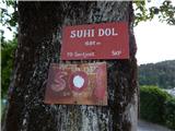 2
2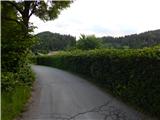 3
3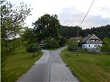 4
4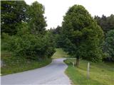 5
5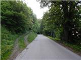 6
6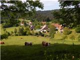 7
7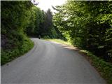 8
8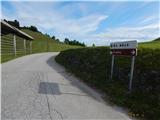 9
9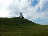 10
10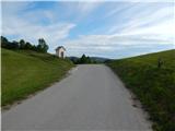 11
11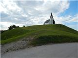 12
12 13
13 14
14 15
15 16
16 17
17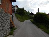 18
18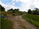 19
19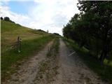 20
20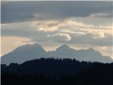 21
21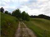 22
22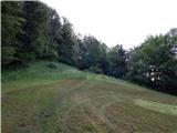 23
23 24
24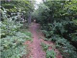 25
25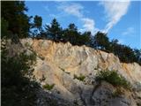 26
26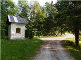 27
27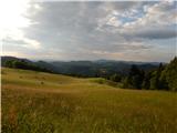 28
28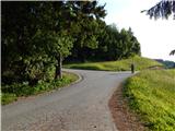 29
29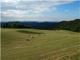 30
30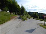 31
31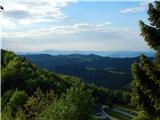 32
32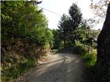 33
33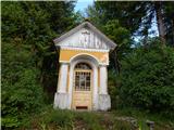 34
34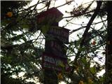 35
35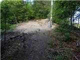 36
36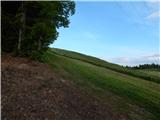 37
37 38
38 39
39 40
40
Discussion about the trip Suhi Dol - Sivka (by road)
To post a comment you must log in:
If you do not yet have a username, you must first
register.