Suhi Dol - Sivka (through forest)
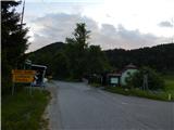
Starting point: Suhi Dol (681 m)
| Latitude/Longitude: | 46,05020°N 14,20130°E |
| |
Route name: through forest
Walking time: 1 h 30 min
Difficulty: easy marked way
Elevation gain: 253 m
Elevation difference along the route: 300 m
Map: Škofjeloško in Cerkljansko hribovje 1:50.000
Recommended equipment (summer):
Recommended equipment (winter):
Views: 4.851
 | 2 people like this post |
Access to starting point:
A) First, we drive to Horjul (to here from Dobrova pri Ljubljani or Vrhnika), then we continue driving towards Vrzdencu, Šentjošt and Gorenja vas. At Vrzdencu the road starts ascending more steeply, then a little further it brings us to a serpentine, in the middle of which a road branches off to the left towards Šentjošt and Smrečje. We continue right on the main road, which soon brings us to a small pass, at the end of which a road branches off to the right towards the village Samotorica. We continue straight, the road starts descending more steeply and after a short descent it brings us to the hamlet Ljubljanica (lower part of Butajnova), where we come to the next crossroad. We continue left in the direction of Gorenja vas and follow the road to Suhi Dol, where we park in a suitable place.
B) We drive to Polhov Gradec, then we continue driving towards Gorenja vas. We follow the road towards Gorenja vas to the settlement Suhi Dol, where on the pass we park in a suitable place.
C) We drive into Poljanska dolina, more precisely to the roundabout in Gorenja vas, from where we continue towards Lučine and Vrhnika. On the ascending asphalt road at crossroad we follow in the direction of Horjul and Vrhnika, soon after the settlements Lučine and Dolge Njive we arrive at the settlement Suhi Dol, where on the pass we park in a suitable place.
Route description:
From the pass at Suhi Dol we head onto the asphalt road in the direction of Planina nad Horjulom, soon the asphalt road splits. We continue on the slightly right road, which leads us among houses and where we are accompanied by blazes. Higher both roads join, we continue right and further ascend transversely. A few minutes higher we leave the road and continue slightly left onto a cart track, which ascends parallel to the road, through the forest at junctions we follow the blazes. The path ahead leads us along the right side of a meadow, where it turns left, then through a shorter strip of forest we ascend to a larger hay meadow, where we continue along its upper edge. On the other side of the meadow the blazes direct us again into a strip of forest, when we leave the forest the path on the meadow starts to disappear. We continue in approximately the same direction, only now moderately descending, soon the path reappears. Lower we reach an indistinct ridge, where the path leads past a marker, we continue further towards north to northeast. At the marker we return into a strip of forest, then quickly leave it and continue along the upper edge of the meadow, where the path leading past Planina nad Horjulom joins us.
We continue straight or slightly right before the forest, where a wide path appears. The path ahead leads through the forest, where we walk on and along the ridge of Zlatnega vrha, the hill Gabrovc with the quarry we bypass on the right side. There follows some slight descent and past a larger chapel we reach an asphalt road, which at the intersection we only cross and continue on the path in the direction of the hiking trail (left downward Lučine, left upward some farms slightly right Lomovec and Sivka by road - the road does not lead to the summit), along which higher we notice some signs with the inscription Prijatelji Sivke. After a few minutes of ascent the forest ends and to the summit only a little walking remains on the panoramic summit slope of the mountain.
Right of the summit there is a mountaineering summit logbox, left of the summit the summit logbox of Prijatelji Sivke.
Description and pictures refer to the condition in June 2020.

Photos:
 1
1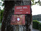 2
2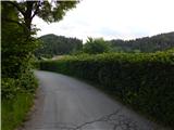 3
3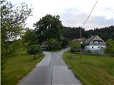 4
4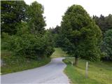 5
5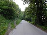 6
6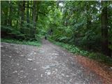 7
7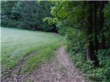 8
8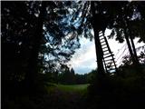 9
9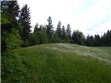 10
10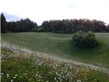 11
11 12
12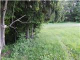 13
13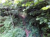 14
14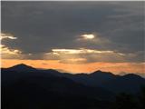 15
15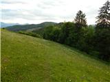 16
16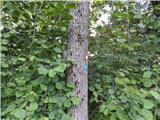 17
17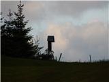 18
18 19
19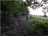 20
20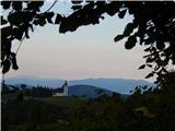 21
21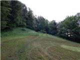 22
22 23
23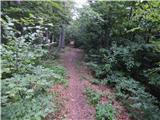 24
24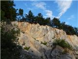 25
25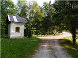 26
26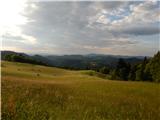 27
27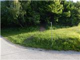 28
28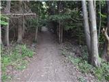 29
29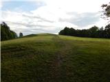 30
30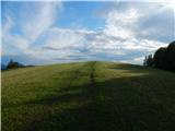 31
31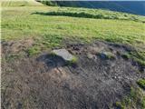 32
32 33
33
Discussion about the trip Suhi Dol - Sivka (through forest)
|
| J.P.28. 02. 2021 |
This little summit has the best view in the Polhograjsko hribovje, correct me if I'm wrong... Super choice for a quick jump into nature, the path is also nicely traceable. Best regards
|
|
|
|
| motorist19859. 03. 2026 08:42:08 |
The previous comment is not mistaken! I was very surprised how beautiful the path is too, was there yesterday for the first time. Detoured to the little church and offroad back to the car  
|
|
|
To post a comment you must log in:
If you do not yet have a username, you must first
register.