Suhi Dol - Sveti Andrej (Planina above Horjul)
Starting point: Suhi Dol (681 m)
| Latitude/Longitude: | 46,05020°N 14,20130°E |
| |
Walking time: 25 min
Difficulty: easy marked way
Elevation gain: 117 m
Elevation difference along the route: 117 m
Map: Škofjeloško in Cerkljansko hribovje 1:50.000
Recommended equipment (summer):
Recommended equipment (winter):
Views: 5.686
 | 1 person like this post |
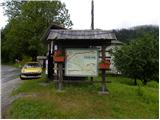
Access to starting point:
First, we drive to Horjul (from Dobrova pri Ljubljana or Vrhnika), then we continue driving towards Vrzdenec, Šentjošt and Gorenja vas. At Vrzdenec the road starts to ascend more steeply, then a little further it brings us to a serpentine, in the middle of which a road branches off to the left towards Šentjošt and Smrečje. We continue right on the main road, which soon brings us to a small saddle, at the end of which a road branches off to the right towards the village Samotorica. We continue straight, the road starts to descend more steeply and after a short descent it brings us to the hamlet Ljubljanica (lower part of Butajnova), where we come to the next crossroad. We continue left in the direction of Gorenje vas and follow the road to Suhi Dol, where we park in a suitable place.
We can also reach the starting point from the direction of Polhov Gradec and Gorenje vas.
Route description:
At the bus stop in Suhi Dol, we will notice signs for Planina, which direct us right onto the road, which soon splits into two parts. We continue on the right marked road (both roads join higher up), which leads us along a somewhat steeper road among the houses in the village. Above the village, both roads join, and we follow it to the right, where we quickly enter the forest. Further on, we ascend for some time through the forest, then we pass onto panoramic grassy meadows. A short ascent follows and the road brings us to a small crossroad, where we have two options for continuing.
We can continue on the left road, where after 50 m we reach the chapel, opposite which we notice a poorly visible and relatively steep grassy cart track, along which we quickly ascend to the church of St. Andrej, or we continue straight past the houses and then in the middle of the village look for a marked cart track, which directs us sharply left. Along the mentioned cart track, which first ascends steeply, we quickly arrive at the church of St. Andrej.

Photos:
 1
1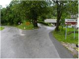 2
2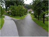 3
3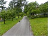 4
4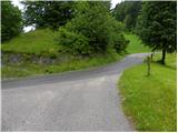 5
5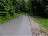 6
6 7
7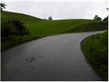 8
8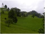 9
9 10
10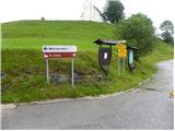 11
11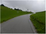 12
12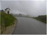 13
13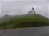 14
14 15
15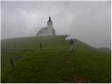 16
16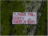 17
17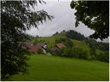 18
18
Discussion about the trip Suhi Dol - Sveti Andrej (Planina above Horjul)
To post a comment you must log in:
If you do not yet have a username, you must first
register.