Sv. Pankracij (Legat) / St. Pongratzen (Legat) - Kapunar / Kapunerkogel (via Sveti Urban)
Starting point: Sv. Pankracij (Legat) / St. Pongratzen (Legat) (800 m)
Starting point Lat/Lon: 46.6554°N 15.2991°E 
Path name: via Sveti Urban
Time of walking: 2 h 10 min
Difficulty: easy marked way
Difficulty of skiing: no data
Altitude difference: 251 m
Altitude difference (by path): 310 m
Map: Pohorje - izletniška karta 1:50.000
Access to starting point:
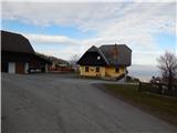
A) From Dravograd we drive towards Maribor, but only to the village Vas, where we continue left towards Remšnik. Next follows an ascent to the mentioned settlement, where a little before the parish church of St. Jurij we continue sharply left. Further, we drive past homesteads Kajzar and Helbel, at the latter we continue on the right road, and then we go also past homesteads Prelank where we go left, and Korenk which we bypass on the left side. Next follows some more of crossing, where at the crossroads we continue straight. When we get to the national border, from the crossroad we continue on the far the left road in the direction of Sveti Pankracij or inn Legat / st. Pongratzen (Gh. Legat). We park few 10 meters ahead from the inn, on a parking lot behind the chapel.
B) From Maribor, we drive towards Dravograd, but only to the settlement Brezno, where we turn right in the direction of the settlement Brezni Vrh and Remšnik. Higher, we leave the road towards Remšnik and we continue straight towards Brezni Vrh. Only few meters ahead we continue slightly right, and then we drive past homesteads Hager, Podržavnik, Kompar, Breznik, where we go left towards Austria, and then follows some more of crossing and we get to the border crossing with Austria. Here we go left and we drive for approximately 500 meters to the next crossroad, where we continue slightly right in the direction of Sveti Pankracij or inn Legat / st. Pongratzen (Gh. Legat). We park few 10 meters ahead from the inn, on a parking lot behind the chapel.
C) Over the border crossing Jurij we drive to Austria, and then we drive through settlements Pesnica / Pößnitz, Gradišče / Schlossberg to the settlement Lučane / Leutschach, where we go left towards the settlement Arnež / Arnfels. From Arnež we continue towards Ivnik / Eibiswald, and we drive on the main road only to the settlement Zgornji Osek / Oberhaag, where we go left towards the settlement Sveti Pankracij / St. Pongratzen. Further, we follow the signs for the mentioned settlement and signs for guesthouse Legat / Gh. Legat. We park few meters further from the inn, on a parking lot by the chapel.
Path description:
By the chapel we notice signposts for Sveti Pankracij / St. Pongratzen and mountain hut Kapunerhütte, which point us on a quite steep path which starts ascending through the forest. Higher, we twice cross a cart track, and blazes lead us out of the forest on a panoramic meadow, on which we walk to the nearby church of St. Pankracij.
From the church, we continue right or towards the west, and then past the chapel we quickly get to a marked crossing, from which we continue left towards Sveti Urban and settlement Remšnik (right mountain hut Kapunerhütte and Austrian path on Kapunar).
The path ahead leads us on the Slovenian side of the border and crosses slopes towards the left. After few minutes of crossing, we get to the farm Mravljak, where we continue straight, and after the farm we continue left downwards and with nice views on the path that runs on a cart track, we descend to a macadam road which we follow to the right. A short descent follows, and then from a marked crossing we continue straight in the direction towards Kapunar and Remšnik (left downwards Remšnik). Next follows a diagonal ascent to a crossroad at the farm Zgornji Murn, where we continue sharply right. The road then gradually turns back towards the left and in few minutes brings us to the farm Slanik, where for some time flattens. From the farm we short time continue with nice views on part of Drau valley and Pohorje, and then the road returns into the forest and it brings us to the church of St. Urban.
From the church, we continue on the road, and then before the farm Buzenik we continue right on a cart track which past the chapel brings us into the forest. On the cart track, we in few minutes ascend to the national border, where we get very close to Austrian path.
We continue on the Slovenian side of the national border, where at the wooden cross Austrian path turns a little more to the right. After few minutes of the ascent paths again get closer and then they run parallel to the hunting cross, where our path turns a little to the left. Next follows few minutes of walking, and then we get to the hut of amateur radio operators on Kapunar, where there is an inscription box and from where a nice view opens up on the Slovenian side.
From the hut, we continue slightly right in the direction of the mountain hut Kapunerhütte, and then on an appropriate place we leave the marked path and to the summit of Kapunar we ascend on one of several worse footpaths, which lead to the top.
The starting point - Sveti Pankracij 0:15, Sveti Pankracij - Sveti Urban 0:50, Sveti Urban - Kapunar 1:05.
Description and pictures refer to a condition in the year 2018 (December).
Pictures:
 1
1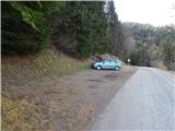 2
2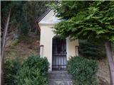 3
3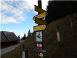 4
4 5
5 6
6 7
7 8
8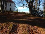 9
9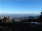 10
10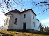 11
11 12
12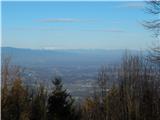 13
13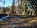 14
14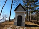 15
15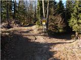 16
16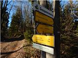 17
17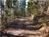 18
18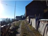 19
19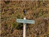 20
20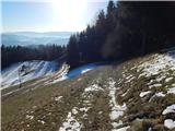 21
21 22
22 23
23 24
24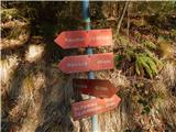 25
25 26
26 27
27 28
28 29
29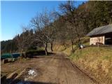 30
30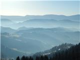 31
31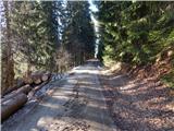 32
32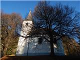 33
33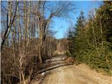 34
34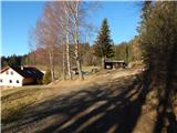 35
35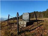 36
36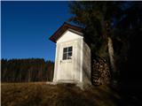 37
37 38
38 39
39 40
40 41
41 42
42 43
43 44
44 45
45 46
46 47
47 48
48 49
49 50
50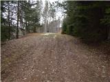 51
51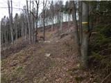 52
52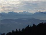 53
53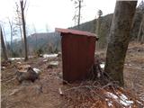 54
54 55
55 56
56 57
57