Sveta Barbara (Logar) - Tošč (via farm Vodnik)
Starting point: Sveta Barbara (Logar) (466 m)
| Latitude/Longitude: | 46,11510°N 14,31360°E |
| |
Route name: via farm Vodnik
Walking time: 1 h 40 min
Difficulty: easy unmarked way, easy marked way
Elevation gain: 555 m
Elevation difference along the route: 555 m
Map: Ljubljana - okolica 1:50.000
Recommended equipment (summer):
Recommended equipment (winter): ice axe, crampons
Views: 2.340
 | 1 person like this post |
Access to starting point:
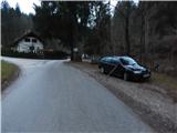
A) From the road Medvode–Škofja Loka, at the beginning of Škofja Loka we drive in the direction of Poljanska Valley, then after the Sten Tunnel we turn right towards Puštal. A little further, we turn right again, then we drive through Puštal and Hrastnica Valley. We then follow the asphalt road, which leads us along the bottom of the valley, to the recycling spot at the Logar homestead, where we park in a suitable place.
B) From Poljanska Valley we drive towards Škofja Loka, then before the Sten Tunnel we turn left towards Puštal, and at the next intersection we go right. We continue driving through Puštal and Hrastnica Valley. We then follow the asphalt road, which leads us along the bottom of the valley, to the recycling spot at the Logar homestead, where we park in a suitable place.
Route description:
From the starting point, we continue on the left road in the direction of farms Hribernik, Kogovšek, Bernik... (right Selo, Polhov Gradec and St. Ožbolt), where we first go past a few more houses, then ascend along the stream Kozjekov graben. A little further, the path towards Guzelj (sale of agricultural machinery) branches off to the right, and a few minutes higher, also to the right, the road towards the farm Vodnik.
We continue right towards the farm Vodnik (straight to farm Kozjek), arriving there on an ascending asphalt road. We continue through the yard of the farm Vodnik, then before the hayrack continue left onto the cart track, which crosses meadows towards the left. The cart track quickly splits, and we choose the right one, which begins to ascend. After a short ascent, the cart track turns right, then brings us with nice views to the nearby transmitters, where the cart track splits once again. We choose the left cart track, which enters the forest and ascends diagonally to the left; after a few minutes, it joins a somewhat wider cart track, which we follow to the right. A diagonal ascent to the right follows; before reaching the indistinct ridge, we choose the right, dead-end branch of the cart track (continuation on the cart track is also possible). When the cart track ends after a few steps, we ascend on a poorer footpath to the ridge, where the path becomes more distinct and regular blazes appear. For a few minutes we ascend along the forested ridge, then the path turns right and after a short traverse joins a much better-trodden path that leads past the church of St. Jedrt.
A little further, the marked path approaches the cart track closely, then distances itself from it and leads us on and along the northwestern ridge of Tošč. Higher up, the path leads through a few shorter panoramic sections, and in a moderate ascent we reach the highest peak of Polhograjsko hribovje.
Description and pictures refer to the condition in 2018 (December).

Photos:
 1
1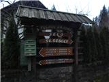 2
2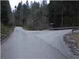 3
3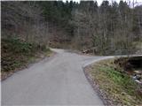 4
4 5
5 6
6 7
7 8
8 9
9 10
10 11
11 12
12 13
13 14
14 15
15 16
16 17
17 18
18 19
19 20
20 21
21 22
22 23
23 24
24 25
25 26
26 27
27 28
28 29
29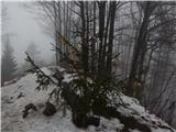 30
30
Discussion about the trip Sveta Barbara (Logar) - Tošč (via farm Vodnik)
To post a comment you must log in:
If you do not yet have a username, you must first
register.