Sveta Barbara (Nova Hrastnica) - Osolnik
Starting point: Sveta Barbara (Nova Hrastnica) (395 m)
| Latitude/Longitude: | 46,13580°N 14,30950°E |
| |
Walking time: 1 h 50 min
Difficulty: easy unmarked way
Elevation gain: 463 m
Elevation difference along the route: 500 m
Map: Škofjeloško in Cerkljansko hribovje 1:50.000
Recommended equipment (summer):
Recommended equipment (winter): ice axe, crampons
Views: 4.208
 | 2 people like this post |
Access to starting point:
A) From the road Medvode - Škofja Loka, at the beginning of Škofja Loka we drive in the direction of Poljanska Valley, then after the Sten Tunnel we turn right towards Puštal. A little further, we go right again, then we drive through Puštal and Hrastnica Valley. We then follow the asphalt road that leads us along the bottom of the valley to the crossroads before the Nova Hrastnica bus stop, where the road branches off to the right towards Sv. Andrej. At the crossroads, where there are no designated parking spaces, the described path begins.
B) From Poljanska Valley we drive towards Škofja Loka, then before the Sten Tunnel we turn left towards Puštal, at the next crossroads we go right. Further on, we drive through Puštal and Hrastnica Valley. We then follow the asphalt road that leads us along the bottom of the valley to the crossroads before the Nova Hrastnica bus stop, where the road branches off to the right towards Sv. Andrej. At the crossroads, where there are no designated parking spaces, the described path begins.
Route description:
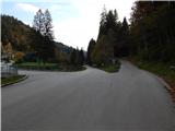
From the starting point, we head left, where we first cross the bridge over the Hrastnica stream, then keep slightly right. At the end of the settlement the road becomes macadam and starts to ascend through the forest. Higher we arrive at a junction from which we continue straight, only a little further the road brings us to the Kamnar homestead, where the drivable road ends.
We bypass the house on the left side, behind the hayrack we continue on a grassy cart track which quickly takes us into the forest. A few minutes of traversing through the forest follow, then we arrive at the church of St. Barbara, from which a beautiful view opens up.
From the church we continue sharply left and ascend the asphalt road to the Kožuh homestead. At the homestead we continue left, where we follow the cart track which continues towards the west, on it continuing in a gentle diagonal ascent to the hay meadow, where it ends. Here we continue right and ascend along the left edge of the hay meadow, ascending along an indistinct ridge. When a little higher we enter the forest, a track appears which is easy to follow and initially very steep, leading us to the right of smaller cliffs. Higher the track levels out and temporarily comes very close to an older cart track, then continues through the forest to the indistinct Kožuhov vrh.
Here the ridge turns slightly more to the right, the track which continues on and beside the ridge first descends lightly, then mostly ascends gently to moderately. A little further the track widens into a cart track, when the cart track turns slightly right we leave it and continue left on a trodden but further quite overgrown path. The path ahead leads us along and on the ridge of Mavrovec (841 m), then the track levels out again for a few minutes. A little further we leave the forest, behind the NOB memorial the path steeply ascends the increasingly panoramic summit slope of Osolnik. When the track levels out we reach the summit, the church and logbook box are located a few dozen steps further ahead.
Starting point - St. Barbara 0:45, St. Barbara - Osolnik 1:10.
The description refers to the condition in November 2019, the pictures are from October and November of the same year.

Along the route: Sveta Barbara (nad Hrastnico) (629m)
Photos:
 1
1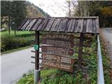 2
2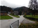 3
3 4
4 5
5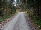 6
6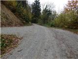 7
7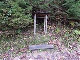 8
8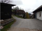 9
9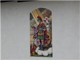 10
10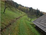 11
11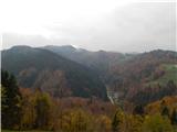 12
12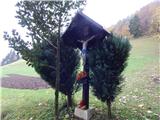 13
13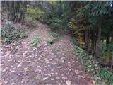 14
14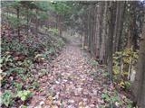 15
15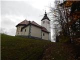 16
16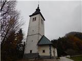 17
17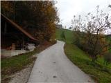 18
18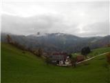 19
19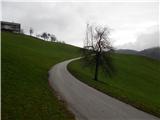 20
20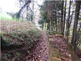 21
21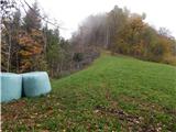 22
22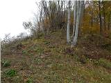 23
23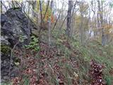 24
24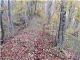 25
25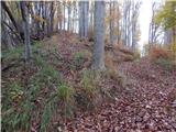 26
26 27
27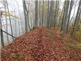 28
28 29
29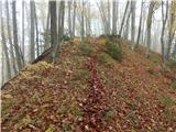 30
30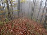 31
31 32
32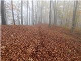 33
33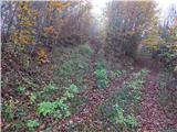 34
34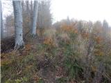 35
35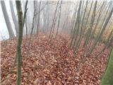 36
36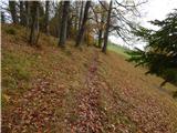 37
37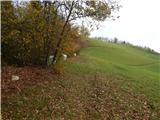 38
38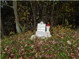 39
39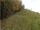 40
40 41
41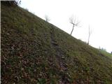 42
42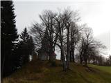 43
43 44
44
Discussion about the trip Sveta Barbara (Nova Hrastnica) - Osolnik
|
| ločanka21. 04. 2020 |
This sounds good. I'll go check tomorrow if everything holds true
|
|
|
|
| ločanka23. 04. 2020 |
A wonderful approach for me, nicer than I imagined from these pictures. Well, the weather was nicer too. Everything is completely accurate, just when looking for the path into the forest, we missed it a bit. So, already at the homestead immediately left (picture 21). And it says so . And you cross two more peaks, Kožuhov vrh and Mavrovec. What more could you want? Thanks for this description! . And you cross two more peaks, Kožuhov vrh and Mavrovec. What more could you want? Thanks for this description!
|
|
|
To post a comment you must log in:
If you do not yet have a username, you must first
register.