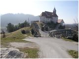
Sveti Jurij - Donačka gora (eastern peak) (western path)
Starting point: Sveti Jurij (320 m)
| Latitude/Longitude: | 46,25370°N 15,73840°E |
| |
Route name: western path
Walking time: 1 h 55 min
Difficulty: partly demanding marked way
Elevation gain: 563 m
Elevation difference along the route: 605 m
Map: Rogaška Slatina z Bočem in Donačko goro 1:25.000
Recommended equipment (summer):
Recommended equipment (winter): ice axe, crampons
Views: 432
 | 1 person like this post |
Access to starting point:
From the highway Ljubljana - Maribor we go to the exit Dramlje and follow the road ahead in the direction of Šentjur, Rogaška Slatina and Rogatec. In Rogatec signs for Donačka gora point us to the left. A little further, we come to the next crossroads, where we continue right, again in the direction of Donačka gora. Further, we drive towards the village Sveti Jurij (do not follow the signs for Donačka gora any further). In the village Sveti Jurij we turn left upwards towards the church of St. Jurij, by which we park. We can park already a little lower on the parking lot by the road.
Route description:
From the church of St. Jurij we continue on the road upwards. After 100 meters of walking we arrive at a crossroads, where we continue left. After a further few dozen steps we arrive at a farm, where the marked footpath turns right upwards and first ascends through a meadow, then turns right, crosses a belt of shrubs and brings us, at the cross, to the next farm.
Here we continue upwards on a marked cart track, which soon brings us across a panoramic slope to a marked junction.
We continue straight in the direction of Rudijev dom and St. Donat, and after a few minutes of further walking the steepness eases and the path turns left. This is followed by a shorter traverse of the slopes towards the west to the church of St. Donat.
From the church we continue in the direction of Rudijev dom, on the path that goes into the forest. The path first crosses the western slopes of Donačka gora, then ascends briefly on a steep slope that is mainly dangerous for slipping when wet. Further the path brings us to a farm, after which we step onto the road, where we continue right. The road on which we continue the ascent brings us after a good 5 minutes of further walking to Rudijev dom.
From Rudijev dom we continue in the direction of the summit of Donačka gora and first walk on a macadam road, from which we soon go right in the direction of the easier path to Donačka gora (straight: demanding path to Donačka gora and Žetale).
The path ahead first ascends moderately through the forest, after a few minutes it passes onto steep slopes and becomes steeper. We then ascend on a well-maintained mountain path that climbs in numerous switchbacks. Higher we pass a memorial plaque in memory of Ernst Froelich, who in 1853 blazed the path to Donačka gora, which was the first marked path in Slovenia. After the memorial plaque there follow a few minutes of ascent on the northwestern slope of Donačka gora, then we reach the ridge, where we go left. This is followed by ascent on and along the forested ridge and in a few minutes we reach the higher, western summit of Donačka gora.
From the western summit we continue on the marked ridge path in the direction towards Žetale. After a short descent the path pulls slightly away from the ridge to the right side, then continues with some shorter ascents and descents, occasionally the path runs on quite a steep slope, where mainly when wet there is greater danger of slipping. After approximately 20 minutes of walking on and along the ridge we arrive at a marked junction, where a demanding path branches off to the left towards Žetale and Kupčinji Vrh, we continue straight and after a further few dozen steps we arrive at the precipitous eastern summit of Donačka gora.
Starting point - Rudijev dom 0:50, Rudijev dom - western summit of Donačka gora 0:45, western summit of Donačka gora - eastern summit of Donačka gora 0:20.

Photos:
 1
1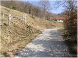 2
2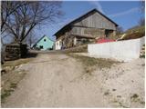 3
3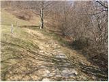 4
4 5
5 6
6 7
7 8
8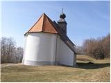 9
9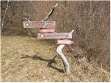 10
10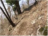 11
11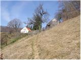 12
12 13
13 14
14 15
15 16
16 17
17 18
18 19
19 20
20 21
21 22
22 23
23 24
24 25
25 26
26 27
27 28
28 29
29 30
30 31
31 32
32 33
33 34
34 35
35 36
36 37
37 38
38 39
39 40
40 41
41
Discussion about the trip Sveti Jurij - Donačka gora (eastern peak) (western path)
To post a comment you must log in:
If you do not yet have a username, you must first
register.