Sveti Jurij - Donačka gora (old south path)
Starting point: Sveti Jurij (320 m)
| Latitude/Longitude: | 46,25370°N 15,73840°E |
| |
Route name: old south path
Walking time: 1 h 30 min
Difficulty: difficult marked way
Elevation gain: 564 m
Elevation difference along the route: 564 m
Map:
Recommended equipment (summer): crampons
Recommended equipment (winter): crampons
Views: 22.007
 | 3 people like this post |
Access to starting point:
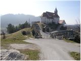
From the Ljubljana–Maribor highway, take the Dramlje exit and follow the road ahead in the direction of Šentjur, Rogaška Slatina and Rogatec. In Rogatec, the signs for Donačka gora direct us to the left. A little further on, we come to the next intersection, where we continue right again in the direction of Donačka gora. Further on, we drive towards the village of Sveti Jurij (do not follow the signs for Donačka gora ahead). In the village of Sveti Jurij, we turn left uphill towards the church of St. Jurij, beside which we park. We can park a little lower on the parking lot beside the road.
Route description:
From the church of St. Jurij we continue on the road upwards. After 100 m of walking, we come to an intersection, where we continue left. After a further few dozen steps, we come to a farm, where the marked footpath turns right upwards. The path first ascends across a meadow, then turns right, where it crosses a strip of bushes and then brings us via a cross to the next farm. Here we continue upwards on a marked cart track, which across a panoramic slope soon brings us to a path junction. We continue straight in the direction of Rudijev dom and St. Donat. After a few minutes of further walking, the steepness eases and the path turns left. A short traverse of the slopes towards the west to the church of St. Donat follows.
By the little church, the marked path towards Rudijev dom continues to the left (west direction), but we continue straight ahead (north direction) into the nearby forest. At first we have the impression that there is no path here, but when we reach the forest we notice a well-trodden path and unofficial blazes on a tree. Just one minute further, the forest ends and the path brings us among ferns, from where a nice view opens onto the neighbouring Macelj. The path soon returns to the forest, through which it begins to ascend more steeply. During the ascent, besides the unofficial blazes for orientation, individual cairns also help us. Further on, the path leads past several fallen trees, then we arrive at a kind of gully down which logs are dragged into the valley. Here the trail temporarily ends and the path becomes somewhat more demanding further on.
We continue upwards, where we notice an unofficial blaze (greyish-white circle) on one of the trees. We ascend more rocky terrain, where the next cairn helps us, though we can easily overlook it. From here the path is level for about a minute, then it begins to ascend a very steep slope (especially when wet, great risk of slipping). We continue along a barely visible trail that climbs in a few zigzags, helped by a few old, almost completely faded blazes. Higher up we reach vertical rocky cliffs, where the path turns left and brings us to the most difficult part of the trail. Using our hands, we climb through a narrow passage between rocks, above which the path levels out. Further on, a view opens onto Macelj and Strahinjščica, and the path ascends gently for a while. The path soon becomes steeper and climbs in a few hairpins, where the unofficial blazes end. Here it seems logical that the path goes upwards, but it does not, so we continue straight. When we spot white lines on a tree a little further on, we finally go right. From here, the path climbs in a few more hairpins and then brings us to the paragliding take-off site.
From here we continue for about one more minute and the path brings us to the ridge, where we join Frolichova pot (the path leading from Rudijev dom towards Donačka gora). Here we continue right and soon reach the panoramic summit of Donačka gora (a view opens onto Medvednica, Kamniške Alpe, Peca, Uršlja gora, Pohorje...)
The path is no longer officially marked and has been abandoned for several years.
We can descend via the path past Rudijev dom, or via the demanding path past the eastern summit.

Photos:
 1
1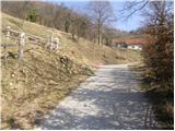 2
2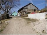 3
3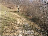 4
4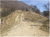 5
5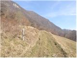 6
6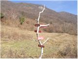 7
7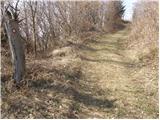 8
8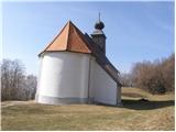 9
9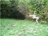 10
10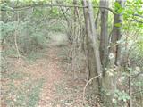 11
11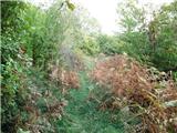 12
12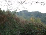 13
13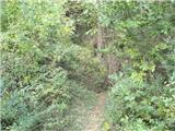 14
14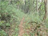 15
15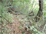 16
16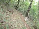 17
17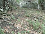 18
18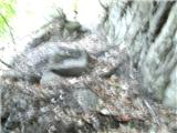 19
19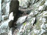 20
20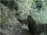 21
21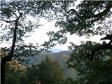 22
22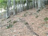 23
23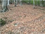 24
24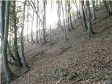 25
25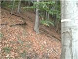 26
26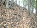 27
27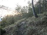 28
28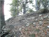 29
29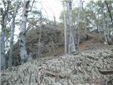 30
30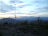 31
31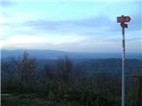 32
32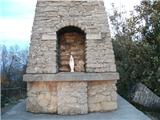 33
33 34
34
Discussion about the trip Sveti Jurij - Donačka gora (old south path)
|
| Marx20. 09. 2013 |
Today (20.09.) I went along this path to Donačka gora. Someone drew a lot of unofficial markers (white stripes and circles) and now it's impossible to miss. Unfortunately, there are many fallen trees on the path, one exactly before the most difficult part through the rock...
|
|
|
|
| edelweiss961. 01. 2019 |
We took this path on 29.12.2018, and due to wrong information we missed the marked demanding path to the eastern peak. Nevertheless, this path proved to be very interesting and worth visiting. The beginning of the path is a bit harder to find, then the path is well marked with cairns and blazes.
|
|
|
|
| monika899518. 05. 2020 |
Hiked the trail on 16.5.2020. Some fallen trees along the trail, in a couple of places need to climb over. Due to mild winter and rain the day before the hike, many ticks in the forest, so be careful. Otherwise the trail is suitable for active hikers, definitely not for elderly or children (risk of slipping).
|
|
|
|
| lepenatka11. 11. 2022 08:44:55 |
This path doesn't get much traffic .Walked on 8.11. .Walked on 8.11.
Interesting, steep, full of leaves and ticks.
|
|
|
To post a comment you must log in:
If you do not yet have a username, you must first
register.