Sveti Jurij - Grad Castle in Goričko
Starting point: Sveti Jurij (251 m)
| Latitude/Longitude: | 46,80142°N 16,03700°E |
| |
Walking time: 2 h 20 min
Difficulty: easy marked way
Elevation gain: 119 m
Elevation difference along the route: 320 m
Map: Pomurje 1:40.000
Recommended equipment (summer):
Recommended equipment (winter):
Views: 453
 | 1 person like this post |
Access to starting point:
We drive to Gederovci (from Radenci or Murska Sobota to here) and continue driving in the direction of Kuzma. When we arrive in the settlement Sveti Jurij, just a little after the church we turn right and park on the parking lot near the church of St. Jurij and the primary school Sveti Jurij.
Route description:
From the parking lot, we continue towards the north and walk parallel with the main road; after the police office, we go right and descend on a marked road to the sports field, and on the other side of the field we arrive at a marked junction.
At the junction, a path branches off to the left leading towards the Planinska koča Rak mountain hut; we continue straight and ascend slightly on a macadam road. The road quickly turns right, but at the bend we continue straight and proceed along the ascending marked path, which after a few minutes brings us to an asphalt road. Along the road, we ascend first gently, then somewhat more steeply. Soon after leaving the municipality of Rogašovci, the road flattens and leads us out of the forest to an unmarked junction.
Slightly to the left is the cemetery on Somovski Breg. We choose the slightly right road and begin to descend moderately. We continue the path with nice views of the Goričko landscape; the road further leads past individual houses, and at junctions we continue along the main path or follow the blazes, which are not very frequent. The descent ends on the flat section, where from the marked junction we continue straight towards Grad (left Planinska koča Rak).
A little further ahead, we cross the Lukaj stream over the bridge; from the junction where we reach the wider road, we go left. The path ahead leads past the bus stop; we leave the wider road after just a few dozen steps and continue right in the direction of the Pomurska planinska pot. Further on, we ascend again along the asphalt road, from which beautiful views open onto the surroundings; higher up, looking back, also onto Stradner Kogel in Austria.
When the road flattens, we arrive at a smaller hamlet where the asphalt ends and the road turns right into the forest. A little further, the blazes direct us slightly right onto a footpath that continues along a gentle cart track; at junctions, we follow the blazes. For some time, we continue without major changes in elevation; after the junction with several cart tracks, we gradually begin to descend. Lower down, we descend along the forest mountain path; when we leave the forest, we arrive at Kačova mlaka.
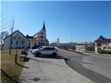
After the pond, which we bypass on the right side, we reach an asphalt road along which we continue to the nearby main road, which we follow to the right. We carefully cross the main road and then walk through the settlement of Grad to the parish church along the left edge.
Before the church, we go left, and then behind the church we notice the continuation of the marked path leading towards the Grad castle on Goričko. The path ahead first continues beside the nearby house, then turns left and gradually enters a dense forest, where it continues along the fence. Higher up, the path flattens and turns left, where we soon reach Grad castle.
Starting point - Kačova mlaka 2:00, Kačova mlaka - castle 0:20.

Along the route: Somovski Breg (341m), Dolnji Slaveči (240m), Kranjčev Breg (341m),
Kačova mlaka (265m), Grad (267m)
Photos:
 1
1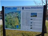 2
2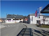 3
3 4
4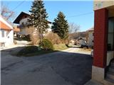 5
5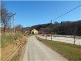 6
6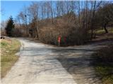 7
7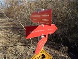 8
8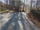 9
9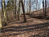 10
10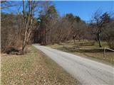 11
11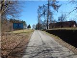 12
12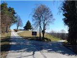 13
13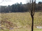 14
14 15
15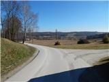 16
16 17
17 18
18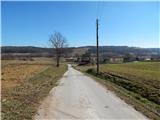 19
19 20
20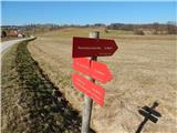 21
21 22
22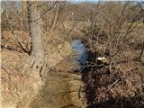 23
23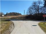 24
24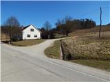 25
25 26
26 27
27 28
28 29
29 30
30 31
31 32
32 33
33 34
34 35
35 36
36 37
37 38
38 39
39 40
40 41
41 42
42 43
43 44
44 45
45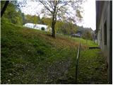 46
46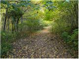 47
47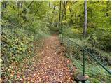 48
48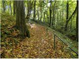 49
49 50
50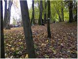 51
51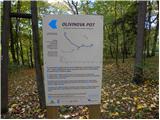 52
52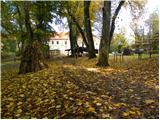 53
53 54
54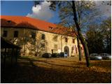 55
55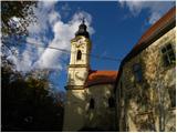 56
56 57
57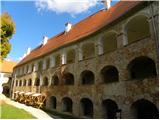 58
58
Discussion about the trip Sveti Jurij - Grad Castle in Goričko
To post a comment you must log in:
If you do not yet have a username, you must first
register.