Starting point: Sveti Jurij (320 m)
| Latitude/Longitude: | 46,25370°N 15,73840°E |
| |
Walking time: 1 h 5 min
Difficulty: easy unmarked way
Elevation gain: 275 m
Elevation difference along the route: 300 m
Map: Rogaška Slatina z Bočem in Donačko goro 1:25.000
Recommended equipment (summer):
Recommended equipment (winter):
Views: 171
 | 1 person like this post |
Access to starting point:
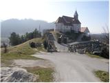
From the Ljubljana–Maribor motorway, take the Dramlje exit and follow the road ahead in the direction of Šentjur, Rogaška Slatina and Rogatec. In Rogatec, signs for Donačka gora direct us to the left. A little further on, we come to the next junction, where we continue right, again in the direction of Donačka gora. Further ahead, we drive towards the village of Sveti Jurij (do not follow the signs for Donačka gora further). In the village of Sveti Jurij, we turn left uphill towards the church of St. Jurij, next to which we park. We can park a little lower on the parking lot by the road.
Route description:
From the church of St. Jurij we continue on the road upwards. After 100 m of walking we arrive at a junction, where we continue left. After a further few dozen steps we arrive at a farm, where the marked footpath turns right upwards and initially ascends across a meadow, then turns right, crosses a belt of scrub and then, at the cross, brings us to the next farm.
Here we continue upwards on the marked cart track, which across a panoramic slope soon brings us to a marked junction.
We continue straight in the direction of Rudijev dom and St. Donat, and after a few minutes of further walking the steepness eases and the path turns left. There follows a short traverse of the slopes to the west to the church of St. Donat.
From the church we continue in the direction of Rudijev dom on the path that enters the forest. The path first crosses the western slopes of Donačka gora, then ascends briefly on a steep slope that is especially slippery when wet. Further on the path brings us to a farm, beyond which we step onto the road, where we continue right. The road up which we continue the ascent brings us, after a good 5 minutes of further walking, to Rudijev dom.
From Rudijev dom we continue in the direction of the summit of Donačka gora and initially walk along a macadam road. From the road, an easier path to Donačka gora branches off to the right first, while we continue along the road to the left-hand hairpin, where we leave the road and continue straight ahead on the path, subsequently walking on a cart track that crosses the northern slopes of Donačka gora. There follows a short traversing ascent and we climb to an indistinct saddle beside Joški vrh, where we leave the marked path. Here we go left and in two minutes arrive at the indistinct Joški vrh.
Starting point - Rudijev dom 0:50, Rudijev dom - Joški vrh 0:15.

Photos:
 1
1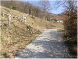 2
2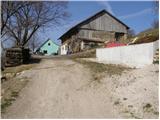 3
3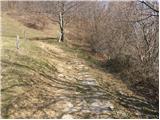 4
4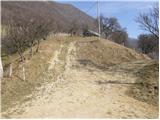 5
5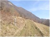 6
6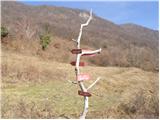 7
7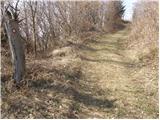 8
8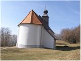 9
9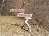 10
10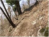 11
11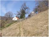 12
12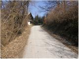 13
13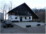 14
14 15
15 16
16 17
17 18
18 19
19 20
20 21
21 22
22 23
23 24
24 25
25 26
26
Discussion about the trip Sveti Jurij - Joški vrh
To post a comment you must log in:
If you do not yet have a username, you must first
register.