Sveti Trije kralji - Dom na Osankarici (via Črno jezero)
Starting point: Sveti Trije kralji (1181 m)
| Latitude/Longitude: | 46,43788°N 15,46004°E |
| |
Route name: via Črno jezero
Walking time: 1 h 5 min
Difficulty: easy marked way
Elevation gain: 12 m
Elevation difference along the route: 150 m
Map: Pohorje 1:50.000
Recommended equipment (summer):
Recommended equipment (winter): ice axe, crampons
Views: 3.390
 | 1 person like this post |
Access to starting point:
We drive to the center of Slovenska Bistrica, where from the traffic-light-controlled intersection we turn in the direction of the health home and continue driving along Partizanska cesta. This is followed by a drive through the town, where we continue straight ahead; on the outskirts of the town, at the industrial zone, we head onto the road towards Tinje, Holy Three Kings and Black Lake. This is followed by an ascent along a somewhat narrower asphalt road, which begins to climb and initially leads us past the Hunters' hut pizzeria Gams, higher up we also pass through the settlement Visole, and a few kilometers higher we arrive at Zgornje Tinje, from where we follow the signs for the ski area Jakec - Three Kings. We park at the parking lot at the foot of the ski area, or near the church of St. Three Kings.
Route description:
From the starting point, we walk to the church of the Holy Three Kings and continue in the direction of Black Lake and Urškina pot, quickly arriving at the nearby ski slope, along which we continue for a short time, then cross it (during ski slope operation, we cross the ski run and lift higher - above the cableway and ski slope). The path ahead leads past the ARSO weather station, and we continue following the blazes along the connecting ski slope, arriving in a few minutes at another ski slope, which we also cross (upwards by the ski slope - Veliki vrh). This is followed by crossing a lift and another ski slope, then the path enters the forest, where after a few minutes of further walking we arrive at a cross, by which stands an information board for Urškina pot. The path ahead slowly descends, bringing us to a marked junction, where we take the left path (straight ahead Šumik and Ruška koča), continuing in the direction of Osankarica and Black Lake. We also continue gently to moderately descending and follow the blazes. When the descent ends, we arrive at a junction near Black Lake.
We continue straight (left Oplotnica - path past Kos) and in a few steps arrive at the lake.
We follow the path ahead in the direction of Osankarica, bypassing the lake on the right side; after crossing the stream, the path enters the forest and continues along a log-paved path. The path initially continues without major elevation changes, but after some time begins to descend noticeably. We follow the paved path, which is slippery when wet, all the way to the parking lot near Dom na Osankarici. From the parking lot, we cross the road and ascend to Dom na Osankarici, which burned down in 2021.
Holy Three Kings - Black Lake 0:50, Black Lake - Osankarica 0:15.
Description and pictures refer to the condition in April 2022.

Photos:
 1
1 2
2 3
3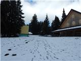 4
4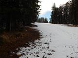 5
5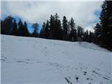 6
6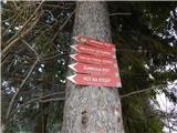 7
7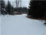 8
8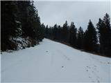 9
9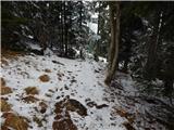 10
10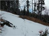 11
11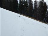 12
12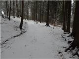 13
13 14
14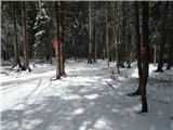 15
15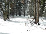 16
16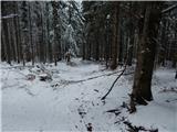 17
17 18
18 19
19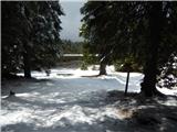 20
20 21
21 22
22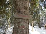 23
23 24
24 25
25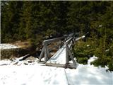 26
26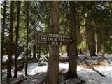 27
27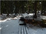 28
28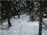 29
29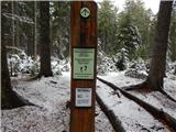 30
30 31
31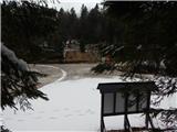 32
32 33
33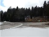 34
34 35
35
Discussion about the trip Sveti Trije kralji - Dom na Osankarici (via Črno jezero)
To post a comment you must log in:
If you do not yet have a username, you must first
register.