Starting point: Sveti Urh (420 m)
| Latitude/Longitude: | 46,02730°N 14,32070°E |
| |
Walking time: 1 h
Difficulty: easy marked way
Elevation gain: 203 m
Elevation difference along the route: 245 m
Map: Ljubljana - okolica 1:50.000
Recommended equipment (summer):
Recommended equipment (winter):
Views: 5.297
 | 1 person like this post |
Access to starting point:
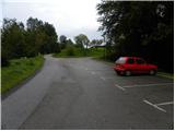
A) From the highway Ljubljana - Koper, we take the exit Brezovica, then we continue driving in the direction of Dobrova pri Ljubljani. From Dobrova, we continue in the direction of Horjul, we drive on the regional road to the settlement Podolnica. Here we turn right into the village, then in the upper part of the village we continue left towards the church of St. Urh. We park on the asphalt parking lot a few 10 meters below the church.
B) From the highway Koper - Ljubljana, we take the exit Vrhnika, then we continue driving in the direction of Horjul. When we arrive in Horjul, at the intersection we turn right in the direction of Dobrova, we drive on the main road to the settlement Podolnica. Here we turn left into the village, then in the upper part of the village we continue left towards the church of St. Urh. We park on the asphalt parking lot a few 10 meters below the church.
Route description:
From the parking lot, we return a few meters back, and then we head onto the cart track that continues past the water tank. For a short time we continue on the wider cart track, then we continue right into the forest. We continue in the direction of Ključ (straight saddle Prosca and Koreno) and further we ascend on the occasionally steeper tractor track. Higher, another path from the saddle Prosca joins us from the left, and we continue straight on the marked path, which then only gently to moderately ascends. Higher, the path flattens even more, then it slowly starts to descend lightly. The path, which all the time runs through the forest, a little lower also joins the path from Podolnica.
From the junction we continue in the direction of Ključ, and we follow the somewhat steeper path again in the direction of Ključ. Because the path further has a few smaller junctions, we carefully follow the blazes so as not to stray onto any of the numerous unmarked cart tracks. There follows a shorter somewhat steeper ascent and the path brings us to the forest-covered summit of Ključ.

Along the route: Kovnik (536m)
Photos:
 1
1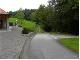 2
2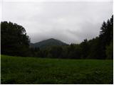 3
3 4
4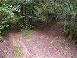 5
5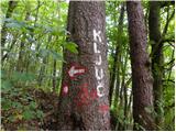 6
6 7
7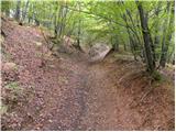 8
8 9
9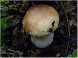 10
10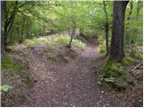 11
11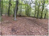 12
12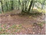 13
13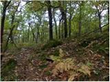 14
14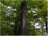 15
15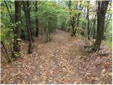 16
16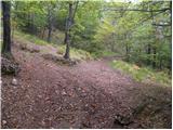 17
17 18
18 19
19 20
20
Discussion about the trip Sveti Urh - Ključ
|
| matjaz-pr28. 06. 2025 15:37:24 |
Very nice trip. Incredible peace, beautiful forests, pleasant path. You can pick wild dandelion, Lapuh, trpotec.
|
|
|
To post a comment you must log in:
If you do not yet have a username, you must first
register.