Tacen - Grmada (Mazijeva steza)
Starting point: Tacen (303 m)
| Latitude/Longitude: | 46,11830°N 14,46150°E |
| |
Route name: Mazijeva steza
Walking time: 1 h 10 min
Difficulty: easy marked way
Elevation gain: 373 m
Elevation difference along the route: 385 m
Map: Ljubljana - okolica 1:50.000
Recommended equipment (summer):
Recommended equipment (winter): ice axe, crampons
Views: 14.268
 | 1 person like this post |
Access to starting point:
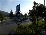
A) From the highway Ljubljana - Jesenice, we take the exit Ljubljana - Šmartno, and then continue driving towards Tacen. When we get to the bridge over the Sava River, at the crossroads we turn right in the direction of Vikrče and Pirniče. Immediately after the crossroads, we again turn right onto the larger marked parking lot.
B) From Celovška cesta in Ljubljana, only a little after the turn-off for the Gorenjska highway, the road towards Vižmarje and Tacen branches off to the right (if we come from the Medvode side, only a little before the turn-off for the highway, we continue left). We continue driving towards Tacen, immediately after we have crossed the bridge over the Sava River, we park on the large parking lot.
Route description:
At the beginning of the parking lot, we notice signposts for Šmarna gora, which first lead us along the sidewalk, then direct us to the right onto Thumova ulica. After a few minutes of easy walking, we come to the intersection of Thumova ulica and Ulica Janeza Rožiča, and we continue straight on the narrower mountain path. After a short gentle ascent, we step onto the road, we only cross it, and continue the ascent on the increasingly steep mountain path. The path, which continues through the forest, levels out higher and brings us to the plain Spodnja Kuhinja.
On Spodnja Kuhinja there is a marked junction, and we continue left in the direction of Mazijeva steza to Grmada (straight Sedlo, right Partizanska steza). The path ahead gently ascends towards the left for some time, and at the junctions we follow the path in the direction of Mazijeva steza. A short gentle descent follows, and the path brings us to a junction where the path from Vikrče joins us, and we continue slightly right in the direction of Grmada along Mazijeva steza.
The path ahead begins to ascend steeply through the forest, and occasional views towards the valley and part of the Polhograjski Dolomiti start to open up. Higher, the path brings us to the ridge of Grmada, where we join Pogačnikova and Westrova poti.
At the junction, we continue right, and we follow the ridge path, which continues through the forest, all the way to the summit of Grmada.

The trip can be extended to the following destinations: Šmarna gora
Photos:
 1
1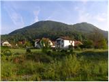 2
2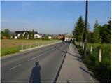 3
3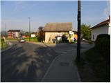 4
4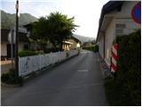 5
5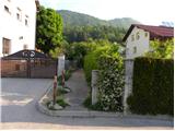 6
6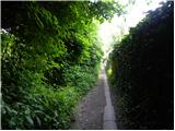 7
7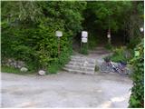 8
8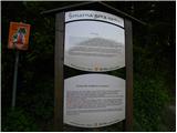 9
9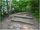 10
10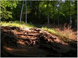 11
11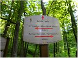 12
12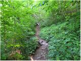 13
13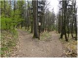 14
14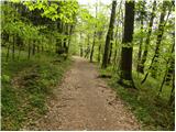 15
15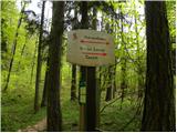 16
16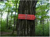 17
17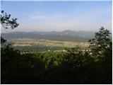 18
18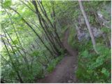 19
19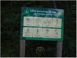 20
20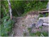 21
21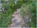 22
22 23
23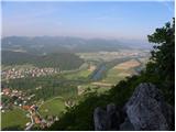 24
24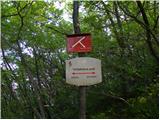 25
25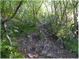 26
26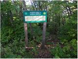 27
27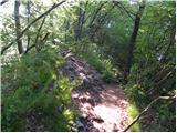 28
28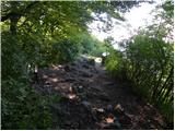 29
29 30
30
Discussion about the trip Tacen - Grmada (Mazijeva steza)
|
| Pohodnica5617. 05. 2012 |
On Saturday there was a procession on the path through the roots, as we like to call it. This Mazijeva comes in very handy, no crowds, no dodging sprinting youths. If time doesn't allow some slightly more distant "stroll", this is real relaxation.
|
|
|
|
| Kozorog18. 05. 2012 |
anya - no worry, it's too steep for most!
|
|
|
|
| Pohodnica5618. 05. 2012 |
Exactly what Kozorog says. We'll still be able to pant a bit more peacefully
|
|
|
|
| POLJANC19. 05. 2012 |
If you want to pant in peace, I recommend Westrovo. Nice regards to all lovers of Šmarna gora.
|
|
|
|
| VanSims19. 05. 2012 |
@POLJANC: Presumably, no imbecile with two loose boxers will be walking on it (sadly experienced).
|
|
|
|
| Vassago21. 09. 2018 |
Easy to moderately difficult (for beginners) hike that soon turns into daily recreation. Mazijeva steza is much less crowded compared to paths to Šmarno goro, so the feeling of being in nature and on the hill is much more authentic.
|
|
|
To post a comment you must log in:
If you do not yet have a username, you must first
register.