Tacen - Grmada (via Spodnja Kuhinja)
Starting point: Tacen (303 m)
| Latitude/Longitude: | 46,11830°N 14,46150°E |
| |
Route name: via Spodnja Kuhinja
Walking time: 1 h
Difficulty: easy marked way
Elevation gain: 373 m
Elevation difference along the route: 373 m
Map: Ljubljana - okolica 1:50.000
Recommended equipment (summer):
Recommended equipment (winter): crampons
Views: 13.679
 | 1 person like this post |
Access to starting point:
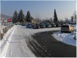
From Celovška cesta in Ljubljana, only a little after the turn-off onto the Gorenjska motorway, the road towards Vižmarje and Tacen branches off to the right (if we come from the Medvode side, only a little before the turn-off onto the motorway, we continue left). We continue driving towards Tacen, and immediately after we have crossed the bridge over the Sava River, we park on a large parking lot.
From the Gorenjska motorway we go to the exit Šmartno, and then we follow the road in the direction of Šmartno pod Šmarno goro and later Tacen, where we then also park on a large parking lot.
Route description:
At the beginning of the parking lot, we notice signposts for Šmarna gora, which at first lead us along the sidewalk, then direct us to the right onto Thumova ulica. After a few minutes of easy walking we come to the intersection of Thumova ulica and Ulica Janeza Rožiča, and we continue straight on a narrower mountain path. After a short gentle ascent we step onto the road, we only cross it and continue the ascent on a steeper and steeper mountain path. The path, which ahead runs through the forest, flattens higher up and brings us onto the plain Spodnja Kuhinja.
We continue straight (left Mazijeva steza, right Romarska pot) on the so-called path "čez korenine". The path ahead again starts to ascend steeply and flattens slightly only when we join the path from Šmartno. We continue in the direction of Šmarna gora on a wider path, which soon makes a sharp right turn and brings us to the chapel only a few steps further. Only a few meters above the chapel, signs for Grmada direct us sharply to the left (straight Šmarna gora) onto a narrower and occasionally quite steep footpath. Higher up, the path brings us onto the summit and forest-covered ridge, along which we then ascend to the summit of Grmada in a few minutes, from which some views open up, mainly towards the south and southwest.

Along the route: Spodnja Kuhinja (450m), Sedlo (599m)
The trip can be extended to the following destinations: Šmarna gora
Photos:
 1
1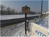 2
2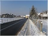 3
3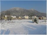 4
4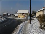 5
5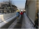 6
6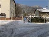 7
7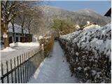 8
8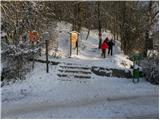 9
9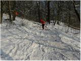 10
10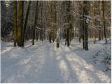 11
11 12
12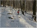 13
13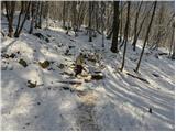 14
14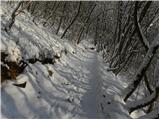 15
15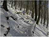 16
16 17
17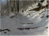 18
18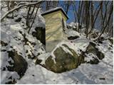 19
19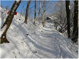 20
20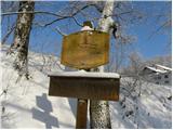 21
21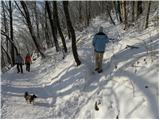 22
22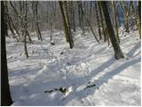 23
23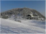 24
24 25
25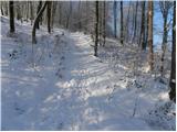 26
26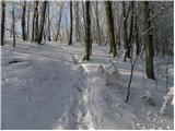 27
27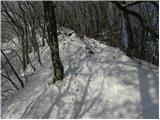 28
28 29
29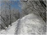 30
30 31
31 32
32
Discussion about the trip Tacen - Grmada (via Spodnja Kuhinja)
|
| viharnik21. 12. 2009 |
Nicer ascent variant to Grmada goes from sp. Kuhinja left to Pot svobode and after less than 20 min right to Mazijeva pot, which crosses the entire southern slope of the mountain. Higher up on the ridge it joins Westrova pot and the climbing path from Vikrč(gostilna Kovač). The path then follows the ridge all the way to the top. Due to distance from crowded paths, well-laid trail and fewer roots, this path is for me the nicest approach to Grmada aka Šmarna gora. In snow Mazijeva pot is slightly exposed to slipping (some 10m in the summit section).
|
|
|
To post a comment you must log in:
If you do not yet have a username, you must first
register.