Tacen - Šmarna gora (Partizanska steza)
Starting point: Tacen (303 m)
| Latitude/Longitude: | 46,11830°N 14,46150°E |
| |
Route name: Partizanska steza
Walking time: 1 h
Difficulty: easy marked way
Elevation gain: 366 m
Elevation difference along the route: 366 m
Map: Ljubljana - okolica 1:50.000
Recommended equipment (summer):
Recommended equipment (winter): ice axe, crampons
Views: 21.992
 | 1 person like this post |
Access to starting point:
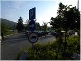
A) From the Ljubljana-Jesenice highway, take the Ljubljana-Šmartno exit, then continue driving towards Tacen. When you arrive at the bridge over the Sava River, turn right at the intersection towards Vikrč and Pirnič. Immediately after the intersection, turn right again onto the larger marked parking lot.
B) From Celovška cesta in Ljubljana, just after the turn-off for the Gorenjska highway, the road towards Vižmarje and Tacen branches off to the right (if coming from the Medvode side, just before the turn-off for the highway, continue left). Continue driving towards Tacen, then immediately after crossing the bridge over the Sava River, park on the large parking lot.
Route description:
At the beginning of the parking lot, we notice the mountain signposts for Šmarna gora, which first lead us along the sidewalk, then direct us right onto Thumova ulica. After a few minutes of easy walking, we reach the intersection of Thumova ulica and Ulica Janeza Rožiča, and we continue straight on the narrower mountain path. After a short gentle ascent, we step onto the road, cross it, and continue the ascent on an increasingly steep mountain path. The path, which continues through the forest, levels out higher up and brings us to the plain of Spodnja Kuhinja.
At Spodnja Kuhinja there is a marked junction, and we continue right in the direction of Romarska pot and Partizanska steza (left Mazijeva steza to Grmada, straight to Sedlo). The path ahead ascends diagonally to the right, then joins the path from Šmartno. Here we continue slightly left and ascend to the nearby chapel. At the chapel, we continue right, and the path quickly brings us to the next junction, where we continue left uphill in the direction of Partizanska steza to Šmarna gora.
From the junction onwards, the path becomes steeper and leads onto much steeper slopes, which are particularly dangerous for slipping in snow and ice. Further on, we ascend in switchbacks up the steep slope; the well-made and maintained path brings us after some time to a bench, from which a nice view opens towards the valley. Above the bench, the path goes onto the ridge, along which we ascend right below the summit of Šmarna gora. Here the path leaves the ridge for the slope, over which in a few dozen steps of further walking we ascend to the summit of Šmarna gora.

Photos:
 1
1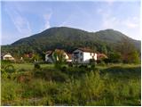 2
2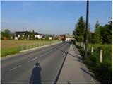 3
3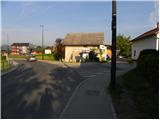 4
4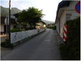 5
5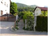 6
6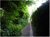 7
7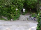 8
8 9
9 10
10 11
11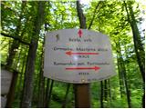 12
12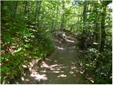 13
13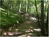 14
14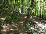 15
15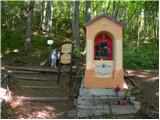 16
16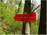 17
17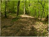 18
18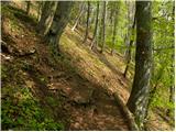 19
19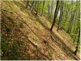 20
20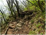 21
21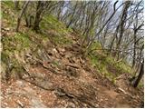 22
22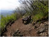 23
23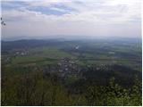 24
24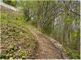 25
25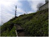 26
26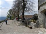 27
27 28
28
Discussion about the trip Tacen - Šmarna gora (Partizanska steza)
|
| sla23. 05. 2012 |
I already saw a helicopter on December 25th that took the injured woman to Lj. (the person in question would otherwise need crampons or at least the much-praised chains for the shoe...).
|
|
|
To post a comment you must log in:
If you do not yet have a username, you must first
register.