Tátikahidegkút - Tátika vár (modra pot)
Starting point: Tátikahidegkút (205 m)
Route name: modra pot
Walking time: 40 min
Difficulty: easy marked way
Elevation gain: 208 m
Elevation difference along the route: 208 m
Map:
Recommended equipment (summer):
Recommended equipment (winter):
Views: 120
 | 1 person like this post |
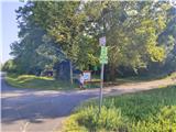
Access to starting point:
From the Nagykanizsa - Budapest motorway, take the exit for Keszthely. The motorway ends before the town (status 2024), but we continue on the bypass. At one of the numerous roundabouts, we will notice signs for Sümeg and Héviz. Continue along Hévizi ut street to the junction, where Napfényi Sor street is to the right and we go slightly right (the main road continues straight to Héviz, the junction is poorly marked).
Now drive another two kilometres, or until we reach the next junction with signs for Sümeg. Turn right and drive another five kilometres to the settlement Zalaszántó. Three kilometres past the village, we will spot the parking lot on the right where our trail begins.
We can also reach Keszthely by entering Hungary via the Dolga Vas / Redics border crossing, then through the town Zalaegerszeg to Héviz where we again follow signs for the direction Sümeg, but this route is even more demanding in terms of orientation.
Route description:
From the parking lot, head east where the trail initially leads across two short clearings, passing under the high-voltage power line at the second. The first markings then appear, in the shape of a square with a blue line.
The trail ahead begins to ascend, first more gently then steeper. In the forest, after a sharp right-hand bend, we reach the summit plateau where the slope eases for a while, and from the right the trail from the settlements Zalaszántó and Várvölgy joins us.
The final ascent follows on a wider path that once led to the castle. The trail climbs further to the ruins of the former castle.
The surface on this trail is occasionally rocky and quite slippery when wet.
The summit is in the ruins offering views in all directions except east where forest encroaches. To see north, reach the eastern part of the fortification.
Photos:
 1
1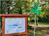 2
2 3
3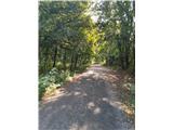 4
4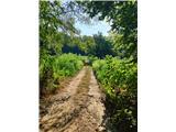 5
5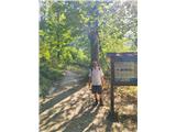 6
6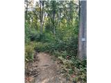 7
7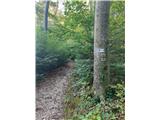 8
8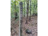 9
9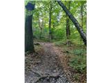 10
10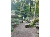 11
11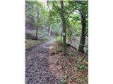 12
12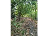 13
13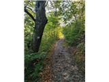 14
14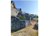 15
15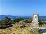 16
16
Discussion about the trip Tátikahidegkút - Tátika vár (modra pot)
To post a comment you must log in:
If you do not yet have a username, you must first
register.