Teharje - Babni vrh (Pot I. Celjske čete)
Starting point: Teharje (241 m)
| Latitude/Longitude: | 46,22960°N 15,29761°E |
| |
Route name: Pot I. Celjske čete
Walking time: 2 h 15 min
Difficulty: easy marked way, easy unmarked way
Elevation gain: 512 m
Elevation difference along the route: 577 m
Map: Celjska kotlina, 1:50000
Recommended equipment (summer):
Recommended equipment (winter):
Views: 325
 | 1 person like this post |
Access to starting point:
Teharje have a rich history. They are first indirectly mentioned in written sources as early as the 12th century. Local history is closely connected with the Counts of Celje, because people from Teharje gained ennoblement. Today Teharje is the seat of the eponymous local community, in which about a thousand inhabitants live. The settlement is located on the right side of the river Voglajna, east of Celje, therefore the access is easiest by road from Celje. The starting point of our path is located at the bridge over Voglajna, and we can park on the nearby large parking lot by the former inn, just before the secured railway crossing and the mentioned bridge, near the large industrial halls, in the area of the former Ironworks Štore.
Route description:
The larger part of our trip at first leads from the starting point on the marked hiking path Pot I. Celjske čete, which is managed by PD Grmada Celje. At the starting point, there is a signpost which points us along the asphalt road which runs by the left bank of the river Voglajna. After approximately 700 meters of walking on the asphalt at the crossing we go to the right on a macadam road into the forest. At the memorial plaque higher, we leave the road and we continue on a forest path uphill. After getting out of the forest, we get to the settlement Osenica, where a view opens up on Bavč and Grmada. We soon get to a crossing, from where from the right the Celje mountain trail (CPP) joins, which leads from the direction of the castle Stari grad. We circumvent the meadow and we continue on the asphalt road which leads higher into Pečovje. After approximately 900 meters of walking on asphalt, at a well-marked hayrack we leave it and we continue to the right on the forest road. After 500 meters of pleasant views on the nearby hills, where there is also our destination, we step into the forest, where from the right joins the path which leads from the starting point in Zvodnem. To here from the parking lot there is 1 hour of walking, 3.36 km distance, 167 meters of ascent and 18 meters of descent.
We continue straight on the forest road. Already after about 100 meters we get to another crossing, where we leave the forest road and we continue to the left downwards on a cart track in the direction of Štore or Bojanski graben. When we descend all the way to the ditch, at the crossing we continue sharply to the right along the stream Bojanski potok. We follow the marked path in a narrow gorge by the stream, but only to the next crossing, where the path branches off to the left. We follow the blazes, we leave the gorge of the stream Bojanski potok and we continue in a steeper ascent. Soon after we get out of the forest, we join to the left on the forest road which on a gentle slope leads to Zaroviše. After a few steps, we reach the saddle on the south side of Veliki and Mali Bojanski vrh, where from the left joins the path from Žlajfa. Here the path Pot I. Celjske čete ends.
We continue on the marked path Štore - Dom na Svetini, which is managed by PD Železar Štore, sharply to the right on asphalt, through a short section in the forest and through a yard of a homestead between the tower silo, house and stable. Next follows continuation straight upwards towards the south in the pasture-meadow area, after approx. 140 meters at the turn-off we turn left on a cart track, we leave the marked path towards Svetina, and we go towards the distant forest on the east. As an orientation point of the turn-off we notice a concrete well, which is situated left by the path. We soon leave the meadow and we come into the forest. The path alternately runs for some time through the forest, and for some time also through a meadow by the edge of the forest. When we come among houses, soon after a short section on macadam we get to a signpost of the XIV. division trail. Here we continue left, but only a few steps to the edge of the forest, where we continue right just by the edge of the forest on a pleasant clearing, where nice views open up on surrounding peaks. At the end of the clearing, we turn slightly left on a footpath into the forest, which soon joins the cart track which is coming from the right side. We continue on the cart track, where soon a view opens up towards the eastern hills, right here a little before the forest we leave the cart track and we go on a narrow footpath which leads slightly right upwards towards the summit. A few more strides on a moderately gentle ridge and we are on the top of Babni vrh.

Photos:
 1
1 2
2 3
3 4
4 5
5 6
6 7
7 8
8 9
9 10
10 11
11 12
12 13
13 14
14 15
15 16
16 17
17 18
18 19
19 20
20 21
21 22
22 23
23 24
24 25
25 26
26 27
27 28
28 29
29 30
30 31
31 32
32 33
33 34
34 35
35 36
36 37
37 38
38 39
39 40
40 41
41 42
42 43
43 44
44 45
45 46
46 47
47 48
48 49
49 50
50 51
51 52
52 53
53 54
54 55
55 56
56 57
57 58
58 59
59 60
60 61
61 62
62 63
63 64
64 65
65 66
66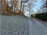 67
67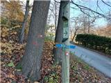 68
68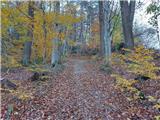 69
69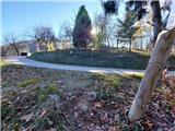 70
70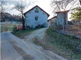 71
71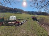 72
72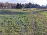 73
73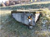 74
74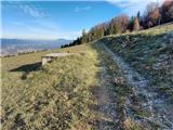 75
75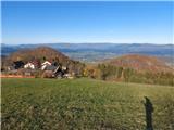 76
76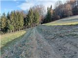 77
77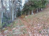 78
78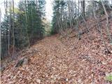 79
79 80
80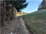 81
81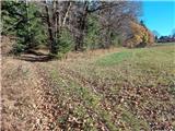 82
82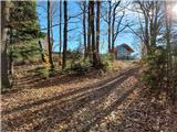 83
83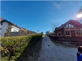 84
84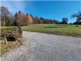 85
85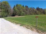 86
86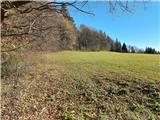 87
87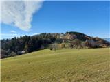 88
88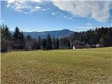 89
89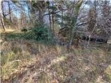 90
90 91
91 92
92 93
93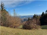 94
94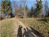 95
95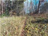 96
96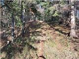 97
97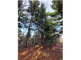 98
98 99
99
Discussion about the trip Teharje - Babni vrh (Pot I. Celjske čete)
To post a comment you must log in:
If you do not yet have a username, you must first
register.