Teharje - Bavč (via Marija)
Starting point: Teharje (241 m)
| Latitude/Longitude: | 46,22960°N 15,29761°E |
| |
Route name: via Marija
Walking time: 2 h 30 min
Difficulty: easy marked way, easy unmarked way
Elevation gain: 451 m
Elevation difference along the route: 481 m
Map: Celjska kotlina, 1:50000
Recommended equipment (summer):
Recommended equipment (winter):
Views: 238
 | 1 person like this post |
Access to starting point:
Teharje have a rich history. They are first indirectly mentioned in written sources as early as the 12th century. Local history is closely connected with the Counts of Celje, because people from Teharje gained ennoblement. Today Teharje is the seat of the eponymous local community, in which about a thousand inhabitants live. The settlement is located on the right side of the river Voglajna, east of Celje, therefore the access is easiest by road from Celje. The starting point of our trail is located at the bridge over Voglajna, and we can park on the nearby large parking lot by the former inn, just before the secured railway crossing and the aforementioned bridge, near the large industrial halls, in the area of the former Ironworks Štore.
Route description:
The first part of our trip leads from the starting point along the marked mountain trail Pot I. Celjske čete, which is maintained by PD Grmada Celje. At the starting point, there is a signpost that directs us along the asphalt road that runs along the left bank of the river Voglajna. After approximately 700 meters of walking on the asphalt, at the junction we turn right onto the macadam road into the forest. At the memorial plaque higher up, we leave the road and continue on the forest path uphill. After exiting the forest higher up, we arrive at the settlement Osenica, where a view opens up on Bavč and Grmada. We soon arrive at a junction, from which the Celje Mountain Trail (CPP) joins us from the right, leading from the direction of Stari grad. We bypass the meadow and continue along the asphalt road, which leads higher into Pečovje. After approximately 900 meters of walking on asphalt, we leave it at a neatly marked hayrack and continue right on the forest road. After 500 meters of pleasant views of the nearby hills, we enter the forest, from which the path leading from the starting point in Zvodno joins us from the right. To here from the parking lot: 1 hour of walking, 3.36 km distance, 167 meters of ascent and 18 meters of descent.
We continue straight along the forest road. Soon, Barbarina pot also joins us from the left from the direction of Štore. From here onward, we follow the signposts for Barbarina pot for some time, while simultaneously leaving Pot I. Celjske čete. A little higher, after passing two isolated homesteads, a narrower forest path branches off to the left, which soon begins to ascend more steeply. Before the junction below Marija, we are aided by some wire cables, more in the function of a fence than a handhold. At the junction, the CPP (Celje Mountain Trail) signs direct us straight uphill to Srebotnik, but we continue left, first slightly downhill past the chapel with the image of Mary carved into the wall of Srebotnik, then slightly uphill along a wide forest path, partly a logging trail. We soon reach a new junction, where we continue right onto the hardened forest road slightly uphill and stop following the signposts for Barbarina pot. We follow the forest road for a few hundred meters to the next junction on the saddle below the southern access to Srebotnik.
To the left, we can ascend to Tolsti vrh, to the right to Srebotnik, but we continue along the forest road slightly left downhill along the CPP, which in this section connects Srebotnik with Tolsti vrh. We follow the forest road for a few hundred meters to the first path junction or Hudičev potok, where the CPP path branches off to the left uphill toward Tolsti vrh. We continue right across the stream, where the forest road transitions into an unmarked forest path. The undulating path leads us about a kilometer through the forest until we arrive at a larger path junction on the saddle on the south side of Bavč, where a marked path from Hudičev graben toward Grmada joins from the right. Here we head north and continue along the ridge, along which we soon arrive at our goal via an unmarked trail.

Photos:
 1
1 2
2 3
3 4
4 5
5 6
6 7
7 8
8 9
9 10
10 11
11 12
12 13
13 14
14 15
15 16
16 17
17 18
18 19
19 20
20 21
21 22
22 23
23 24
24 25
25 26
26 27
27 28
28 29
29 30
30 31
31 32
32 33
33 34
34 35
35 36
36 37
37 38
38 39
39 40
40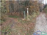 41
41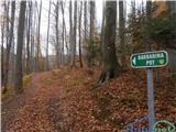 42
42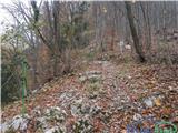 43
43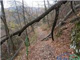 44
44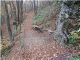 45
45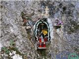 46
46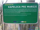 47
47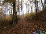 48
48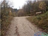 49
49 50
50 51
51 52
52 53
53 54
54 55
55 56
56 57
57 58
58 59
59 60
60 61
61 62
62 63
63 64
64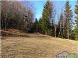 65
65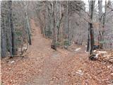 66
66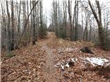 67
67 68
68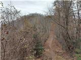 69
69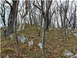 70
70 71
71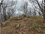 72
72
Discussion about the trip Teharje - Bavč (via Marija)
To post a comment you must log in:
If you do not yet have a username, you must first
register.